र.
(← selected work) (research question)

can a post-industrial waterfront treat the city's waste and its floods with the same landscape?

Thirty hectares of Mumbai's eastern waterfront redesigned as a machine that lets the sea in and cleans what the city sends out.

Mumbai mismanages 93 per cent of its waste; a great deal of it goes into the drains, and the drains go into the sea. The same drains carry 2,142 mm of rain a year through a storm-water system sized for 25 mm a day, and by 2050 sea-level rise puts two-fifths of the city under regular flooding. Both problems meet at the eastern waterfront: 966 hectares of docks, sixteen kilometres of post-industrial edge. This studio took thirty hectares of it and asked one question: what is the inclusionary script, and how do we re-think the relationship between land and sea while addressing toxicity and flooding?

(role)
research · systems design · urban design
(period)
2020 · one semester
(context)
eastern waterfront · mumbai · cept L3 studio
(status)
studio
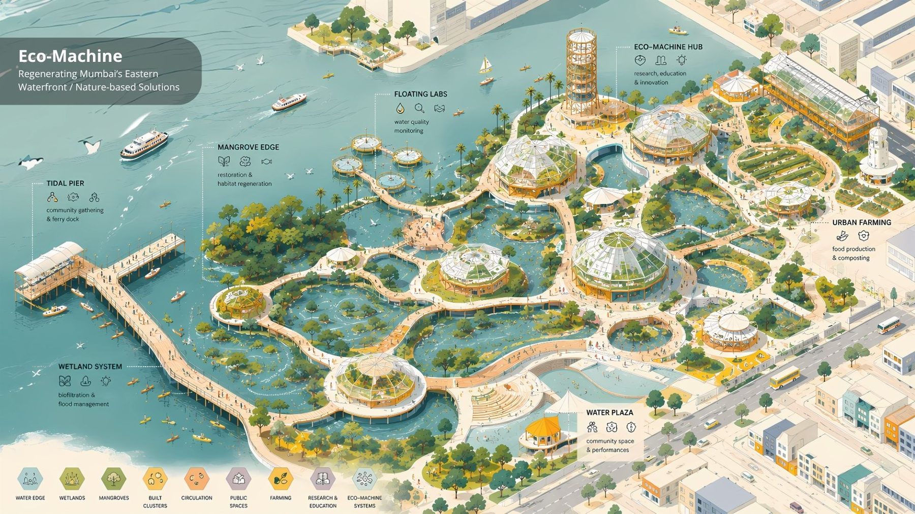
The eco-machine. The waterfront as one working landscape: tidal pier, mangrove edge, floating labs, wetland system, water plaza, urban farming, an eco-machine hub. The proposal, redrawn in 2026.
fig.01The eco-machine. The waterfront as one working landscape: tidal pier, mangrove edge, floating labs, wetland system, water plaza, urban farming, an eco-machine hub. The proposal, redrawn in 2026.
(00) the waterfront

Sixteen kilometres nobody can reach

Mumbai's eastern waterfront runs sixteen kilometres from Sassoon Dock to Sewri: 966 hectares of docks and bunders built between 1865 and 1915, most of it owned by the port trust, much of it dilapidated or unused, all of it closed to the city behind it. A koliwada, a fish market, oil and chemical factories, ship-breaking yards and metal scrapping share the edge with proposals for a coastal road and reclamation.

The studio took 300,000 square metres of it at Prince's and Victoria Docks, a post-industrial wasteland, and read it as the meeting of land and water: the one place where what the city sends out and what the sea sends back could be dealt with in the same ground.
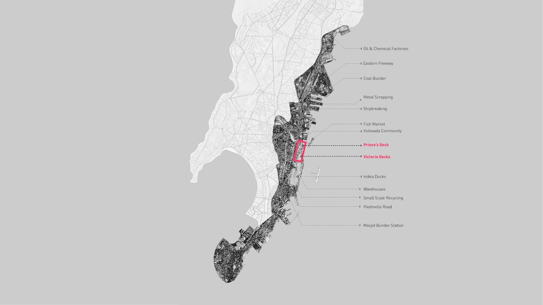
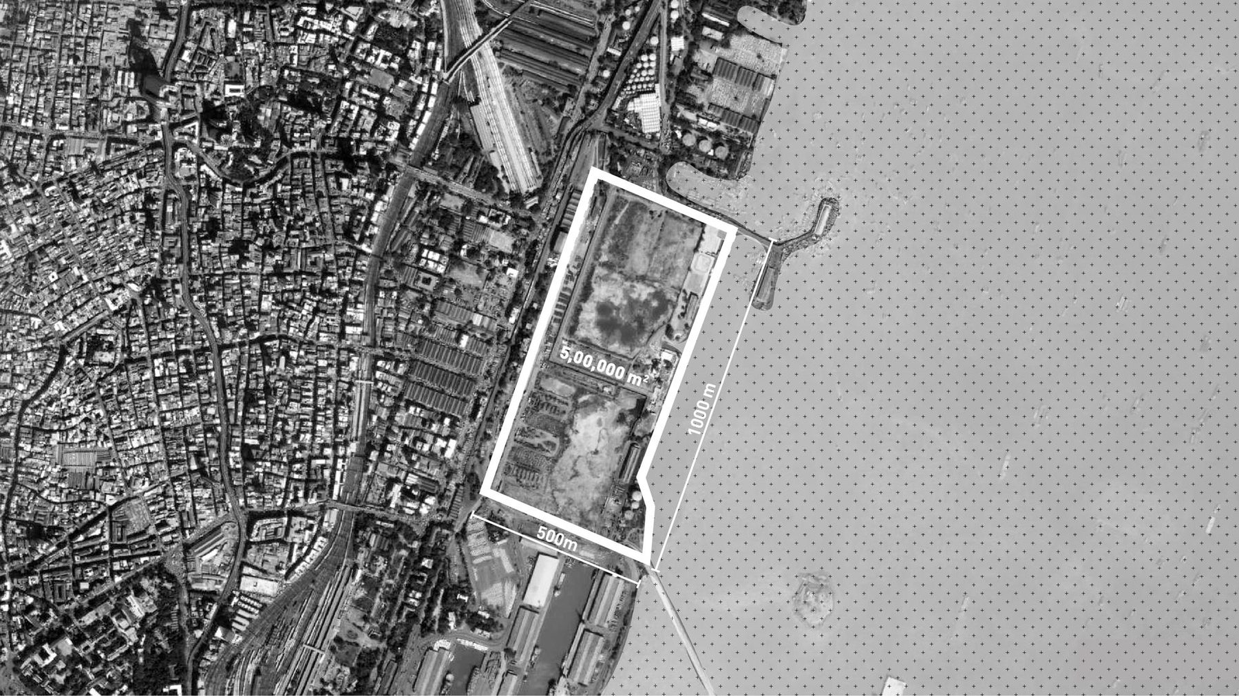
The eastern waterfront. Sassoon Dock to Sewri: docks, bunders, warehouses, a koliwada, a fish market, oil and chemical factories, ship-breaking and metal scrapping. The site is the red rectangle at Prince's and Victoria Docks.
fig.02The eastern waterfront. Sassoon Dock to Sewri: docks, bunders, warehouses, a koliwada, a fish market, oil and chemical factories, ship-breaking and metal scrapping. The site is the red rectangle at Prince's and Victoria Docks.
The site from above. 300,000 sq m of dock land, the city's grain stopping dead at the port wall.
fig.03The site. 300,000 sq m between the port railway and the harbour.
(01) waste

Where 93 per cent goes

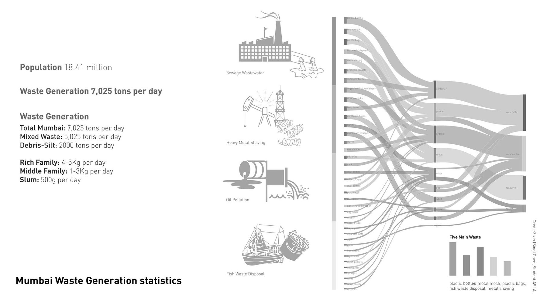
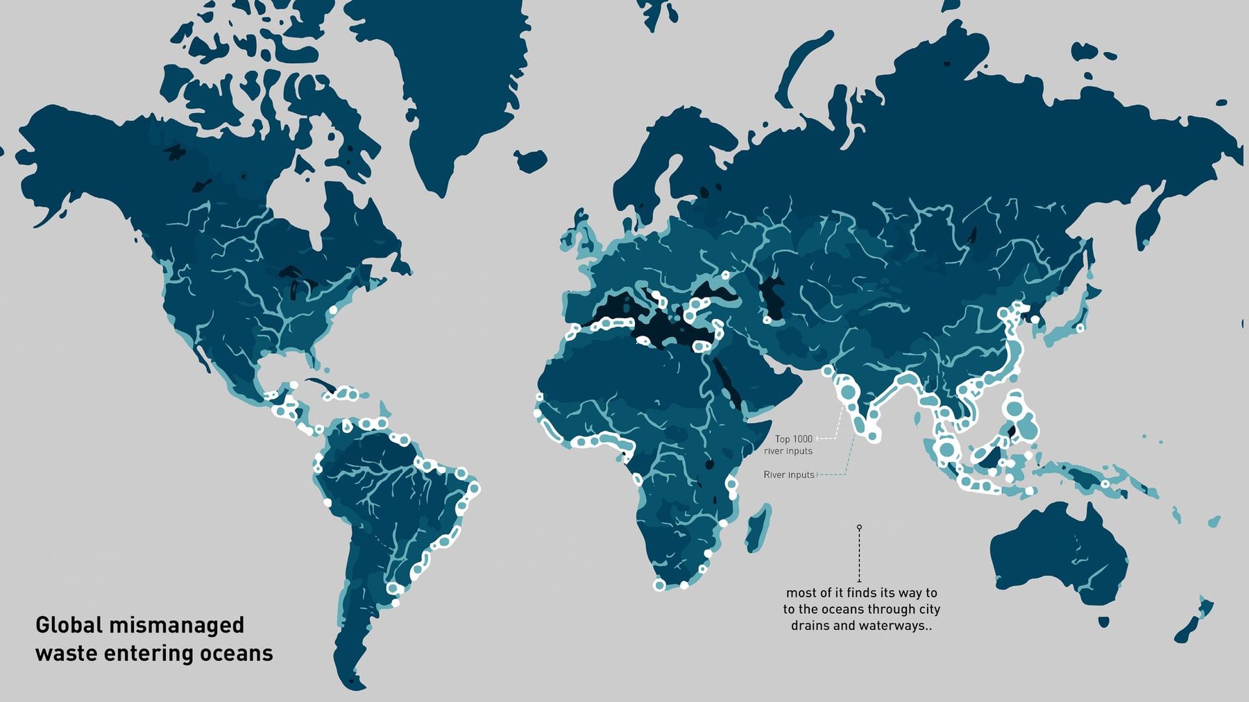
Mumbai produces 40,00,000 tonnes of waste a year, 7,025 tonnes a day; 93 per cent of it is mismanaged, and 37,000 tonnes a year end in rivers and drains. Globally, most of the plastic in the oceans arrives the same way: through city drains and waterways.

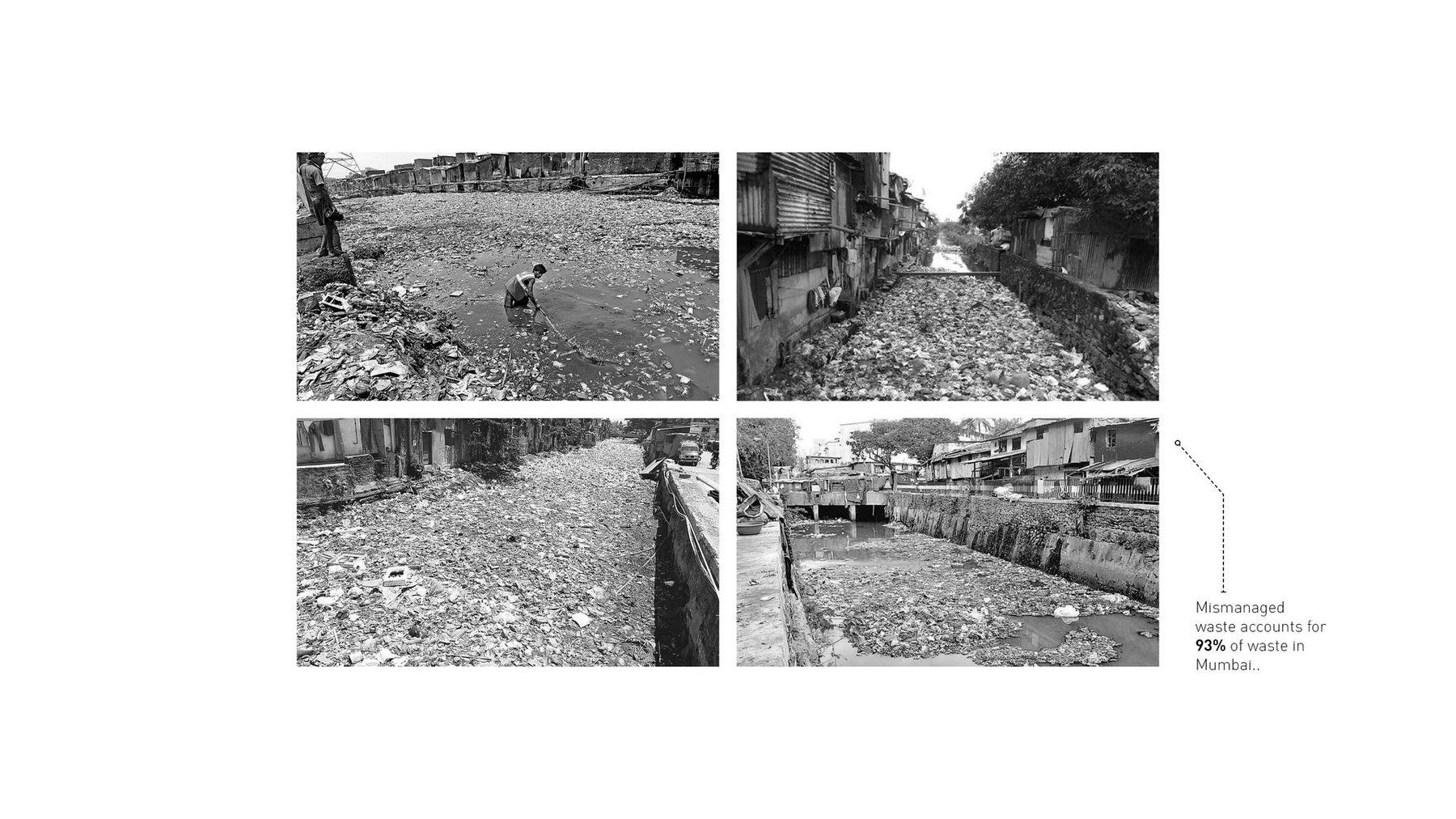
The nallahs are where it goes first: the open drains that stitch the city together and poison it at the same time, lined with the people who have nowhere else to live. A nallah shows a city everything it discards in one continuous section, and every one of them ends at a waterfront like this one.
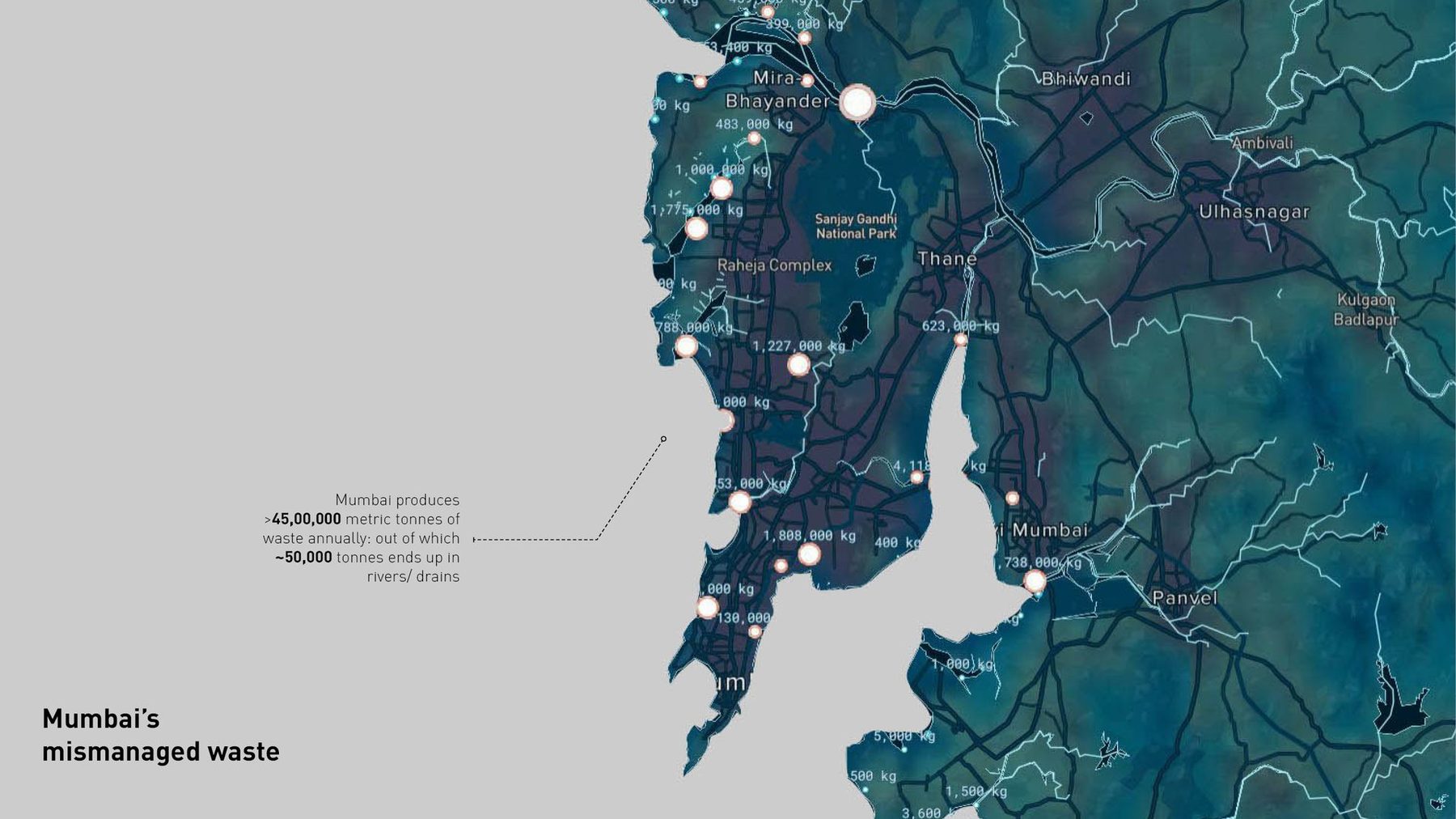
Mumbai's mismanaged waste. 40,00,000 tonnes a year, of which 37,000 tonnes end up in rivers and drains; the dots are the dumping grounds and the drains that feed the creeks.
fig.04Mumbai's mismanaged waste. 40,00,000 tonnes a year, of which 37,000 tonnes end up in rivers and drains; the dots are the dumping grounds and the drains that feed the creeks.
Global mismanaged waste entering the oceans. Most of it arrives through city drains and waterways.
Mumbai's waste, 7,025 tonnes a day. 5,025 of mixed waste, 2,000 of debris and silt; a rich family produces 4–5 kg a day, a slum household 500 g.
The nallahs. The open drains that carry the city's waste to the sea, and the people who live along them.
fig.05–07The scale of it. Global mismanaged waste entering the oceans through city drains; 7,025 tonnes a day in Mumbai, by household and by type; the nallahs, where it goes first.
(02) flooding

Two thousand millimetres through a twenty-five-millimetre pipe

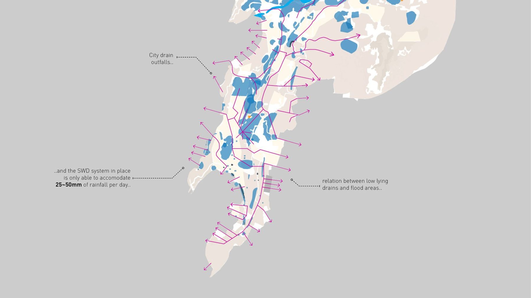
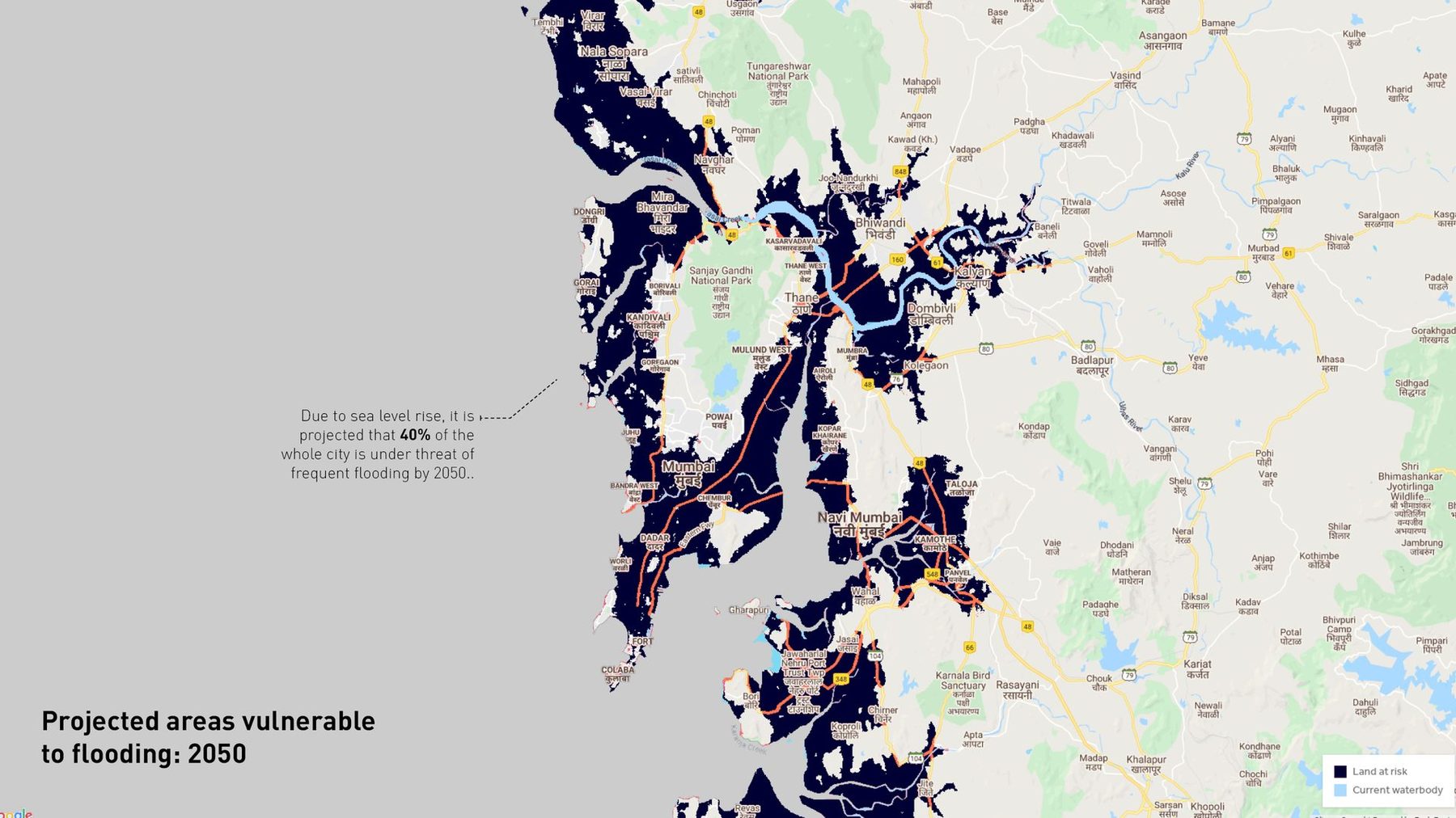
The same drains carry the monsoon. Average rainfall is 2,142 millimetres a year, 96 per cent of it in four months, into a storm-water system able to accommodate 25 millimetres a day. The map of the low-lying drains and the map of the areas that flood are the same map. By 2050, with sea-level rise, forty per cent of the city is projected to be under threat of regular flooding.

Toxicity and flooding are usually two departments. On this site they are one system, because the water that floods the city is the water that carries its waste, so the design treats them as one problem.
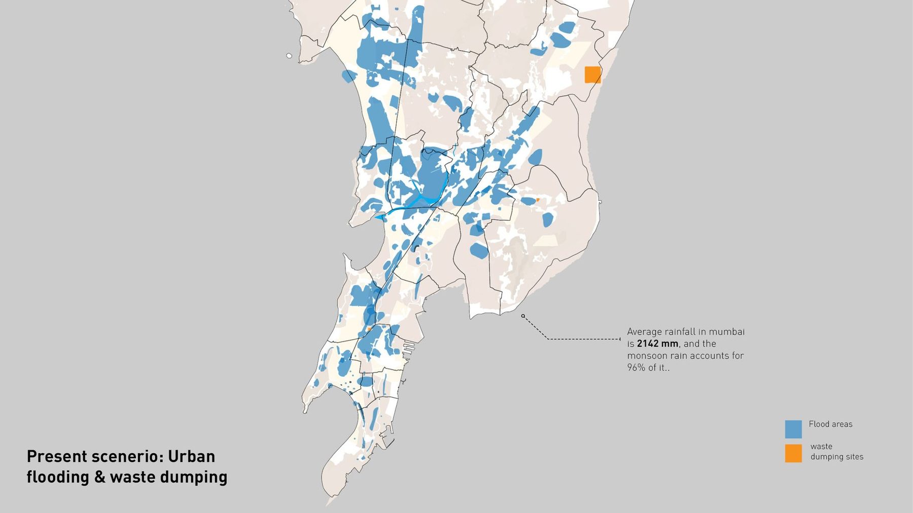
The present scenario. Flood areas in blue, dumping sites in orange. Average rainfall 2,142 mm, 96 per cent of it in the monsoon; the storm-water system holds 25 mm a day.
fig.08The present scenario. Flood areas in blue, dumping sites in orange. Average rainfall 2,142 mm, 96 per cent of it in the monsoon; the storm-water system holds 25 mm a day.
Projected areas vulnerable to flooding, 2050. Sea-level rise puts forty per cent of the city at risk of regular flooding.
The storm-water drains and their outfalls. A clear relation between the low-lying drains and the areas that flood.
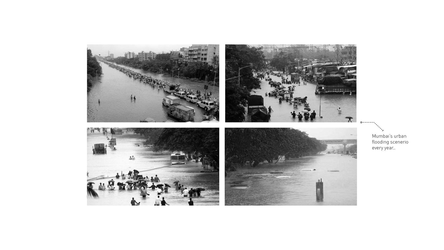
Mumbai's urban flooding, every year.
fig.09–11By 2050 forty per cent of the city is under threat of regular flooding; the relation between low-lying drains and flood areas; the city every monsoon.
(03) concept

Let the water in

The move is to let the water in. Mud dykes and wetlands as a natural buffer; drainage networks brought onto the site rather than piped past it; public functions above ground; waste-to-energy, recycling and water-treatment facilities underground; floating structures off the edge that collect the harbour's waste and hold public programs: recreation, culture, sport as crossing infrastructure.

Nothing in it is a single building. The site is a transition between land and sea and a starting point for a design that can be repeated across both ends and the edge: the interventions are modules, decentralised, connected underground through the treatment system and above ground through the programs, repeated wherever the sixteen kilometres allow.
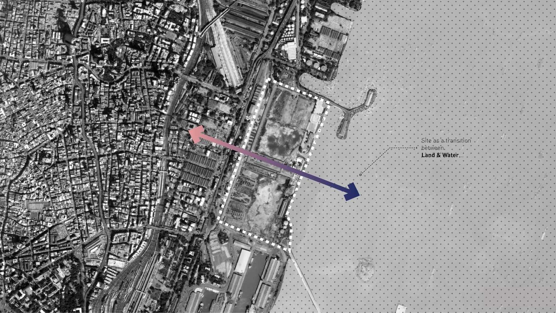
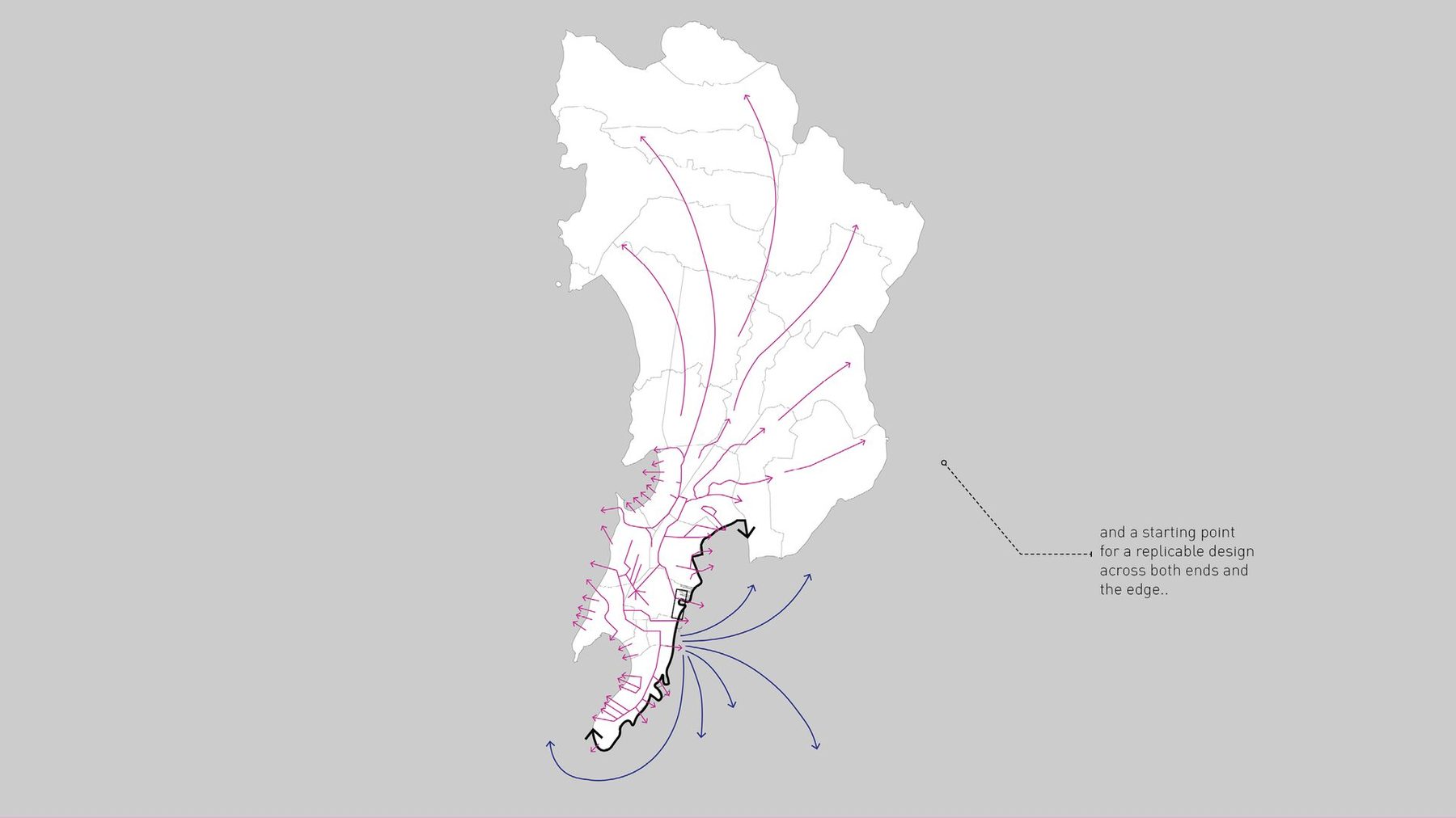
The site as a transition. A starting point for a replicable design across both ends and the edge, rather than a single project on one plot.
fig.12The site as a transition. A starting point for a replicable design across both ends and the edge, rather than a single project on one plot.
Replicable along the waterfront. The modules and their connections, repeated wherever the edge allows.
fig.13The concept. A series of interconnected interventions, decentralised, running the length of the edge.
(04) form

A landscape that treats

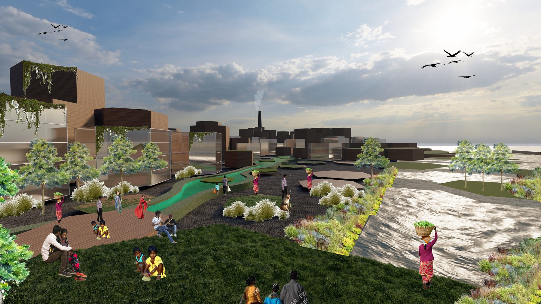
The name is borrowed from ecological engineering. An eco-machine is a sequence of living systems, wetland cells, root zones, settling pools, each one a treatment step. Strung along the edge, they turn a dock into a working landscape: the wetland is the flood buffer and the filter, the public terraces are the roof of the plant, the plaza sits on a treatment cell, and the people beside the water are its operators rather than its victims.
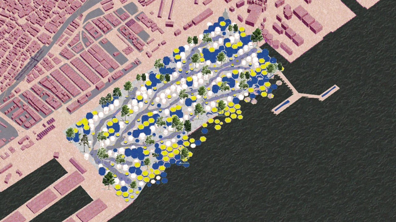
The site plan, 2020. Public wetlands as the buffer against the harbour, drainage networks on site, the treatment modules under the public ground, floating modules off the edge.
fig.14The site plan, 2020. Public wetlands as the buffer against the harbour, drainage networks on site, the treatment modules under the public ground, floating modules off the edge.
The terraced edge. Public ground stepping down to the wetland, the treatment modules beneath it.
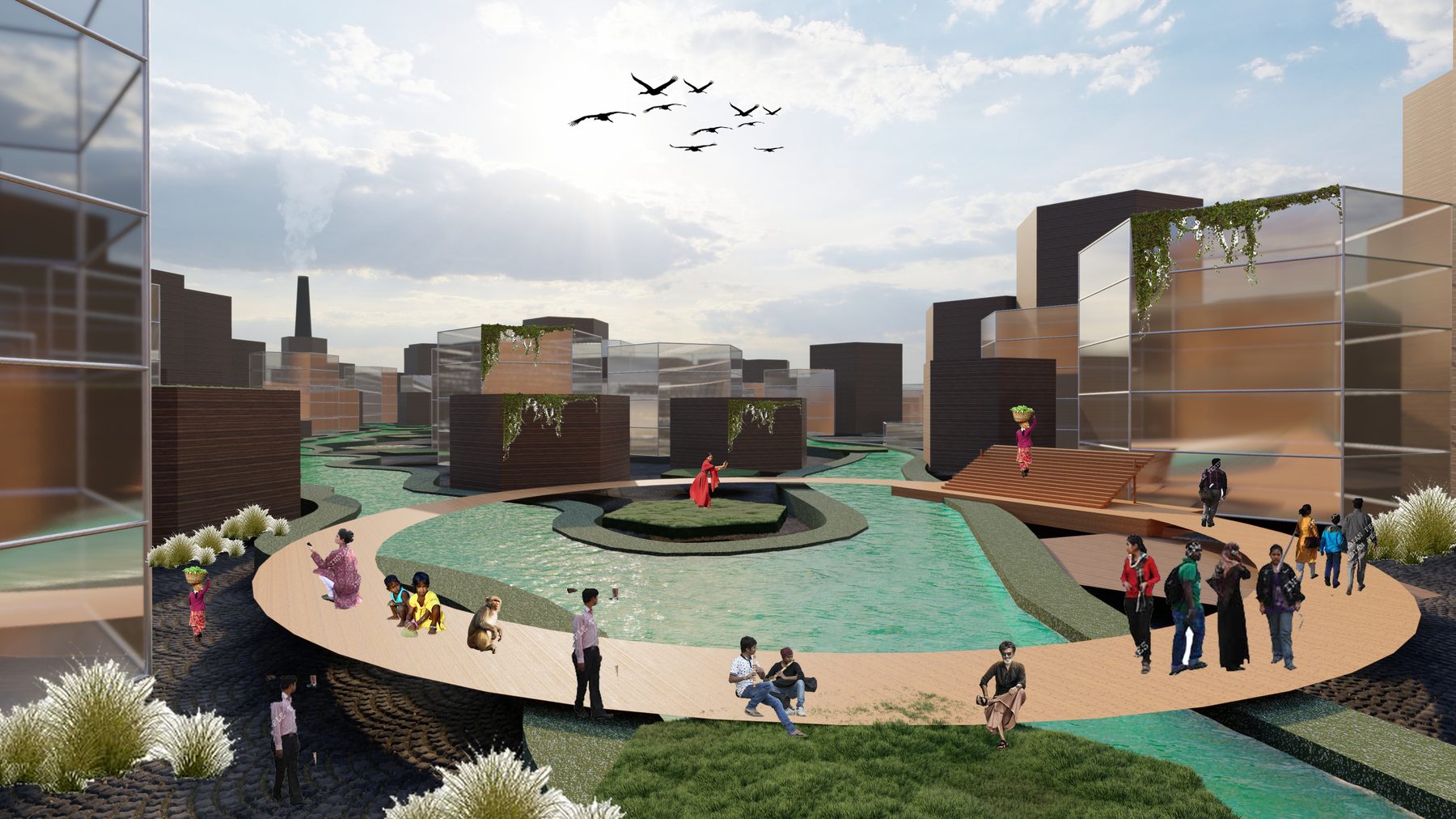
The water plaza. A ring over the wetland cell, the harbour beyond it.
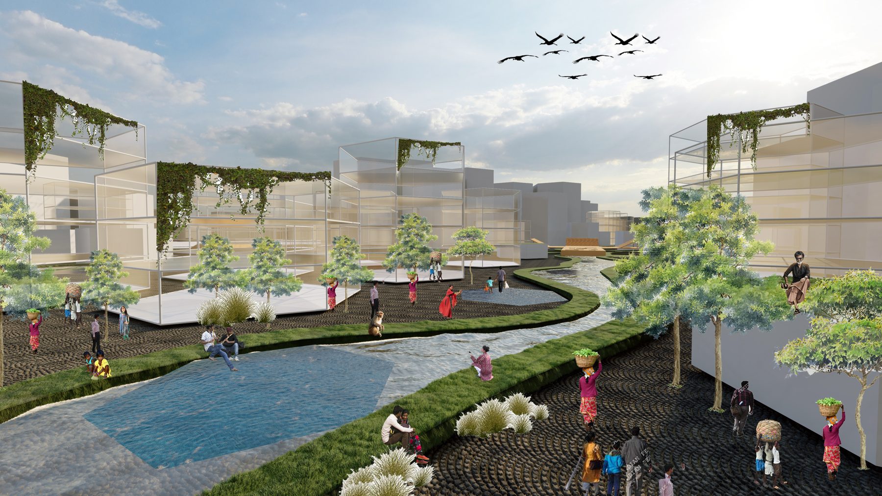
The canal. A drain rebuilt as a planted channel through the site.
fig.15–17At eye level. The terraced edge, the water plaza, the canal through the wetland.
(outcome)
Eco-Machine. Thirty hectares of Mumbai's eastern waterfront as a chain of living infrastructure: wetlands as flood buffer, treatment and waste-to-energy underground, public programs above, floating modules collecting the harbour's waste; designed as a module to repeat along the edge. L3 studio, Bachelor of Urban Design, CEPT University. November 2020.
(what I'd do next)
Size it. The proposal set out the loops but never closed the numbers: how much of 7,025 tonnes a day a wetland cell can take, how much of a 2,142 mm monsoon thirty hectares can hold. The climate inventories built three years later are the tool for that.
(next) Koliwadas · reverse effekt, twelve fishing villages →