can a neighbourhood be designed as rules rather than a plan?
A neighbourhood for 1,55,676 people in north Ahmedabad, designed as rules and searched by an evolutionary algorithm.
India will hold most of its population growth inside cities that already exist, and the usual answer, more floors on the same plan, gives up the ground. This studio took a 1.45 sq km site beside the Sabarmati, between Gandhi Ashram and a sewage treatment plant, and asked what densification would look like if the design were written as relationships instead of drawn as a masterplan: what should be dense, what should stay quiet, what must be kept open. Then it let an evolutionary algorithm search the plans those rules allow.
- (role)
- computational urban design · grasshopper · evolutionary search
- (period)
- 2020 · one semester
- (context)
- sabarmati · north ahmedabad · cept L2 studio
- (status)
- studio
What to keep before deciding what to build
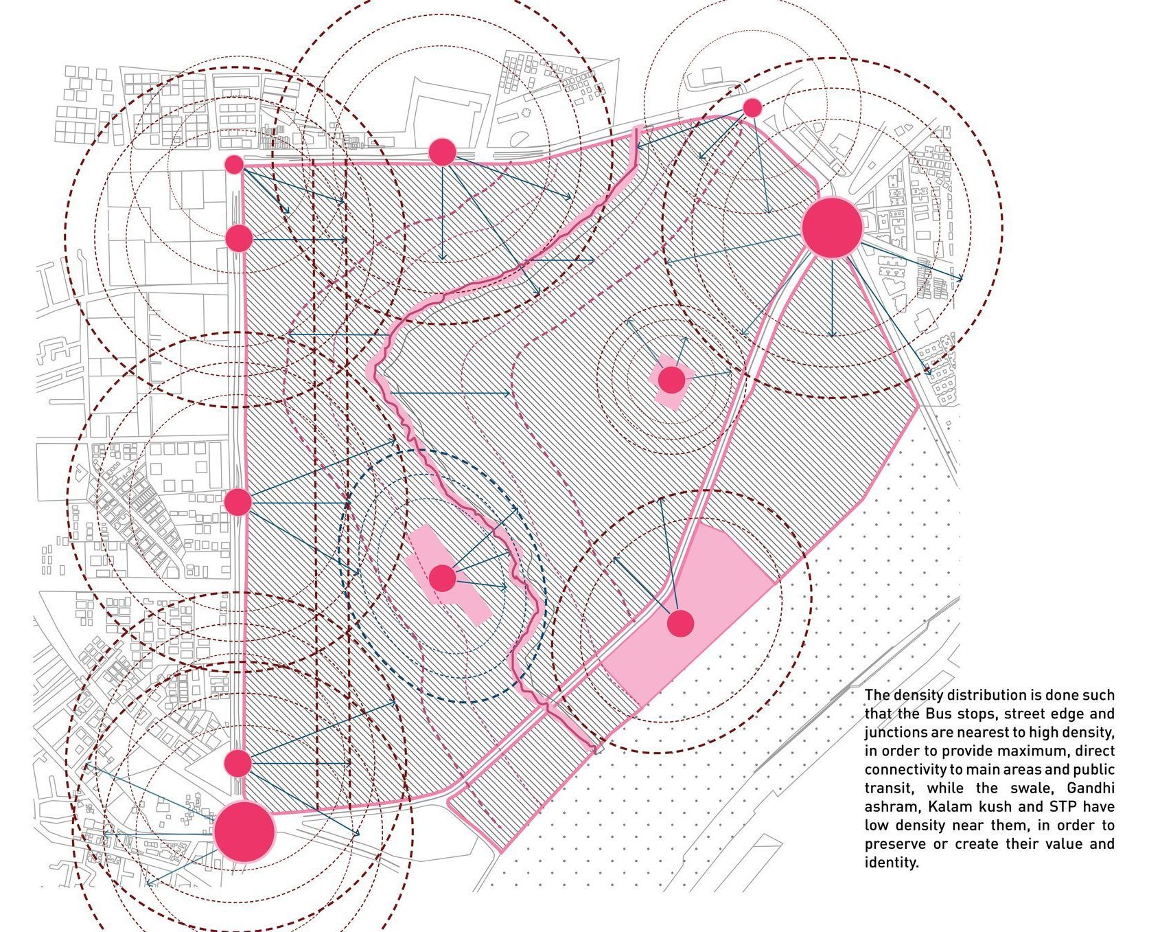
The site is in the central north of Ahmedabad, on the Sabarmati: 1.45 square kilometres with a green belt, a swale that once made it a retention basin, a sewage treatment plant, Kalam Kush and Gandhi Ashram on its edges, and bus and metro stops that tie it into the larger network. The studio brief was direct: urban growth will demand thousands of new cities, and the question is whether high density can be held without giving up spatial quality, climate, open space and a mix of uses.
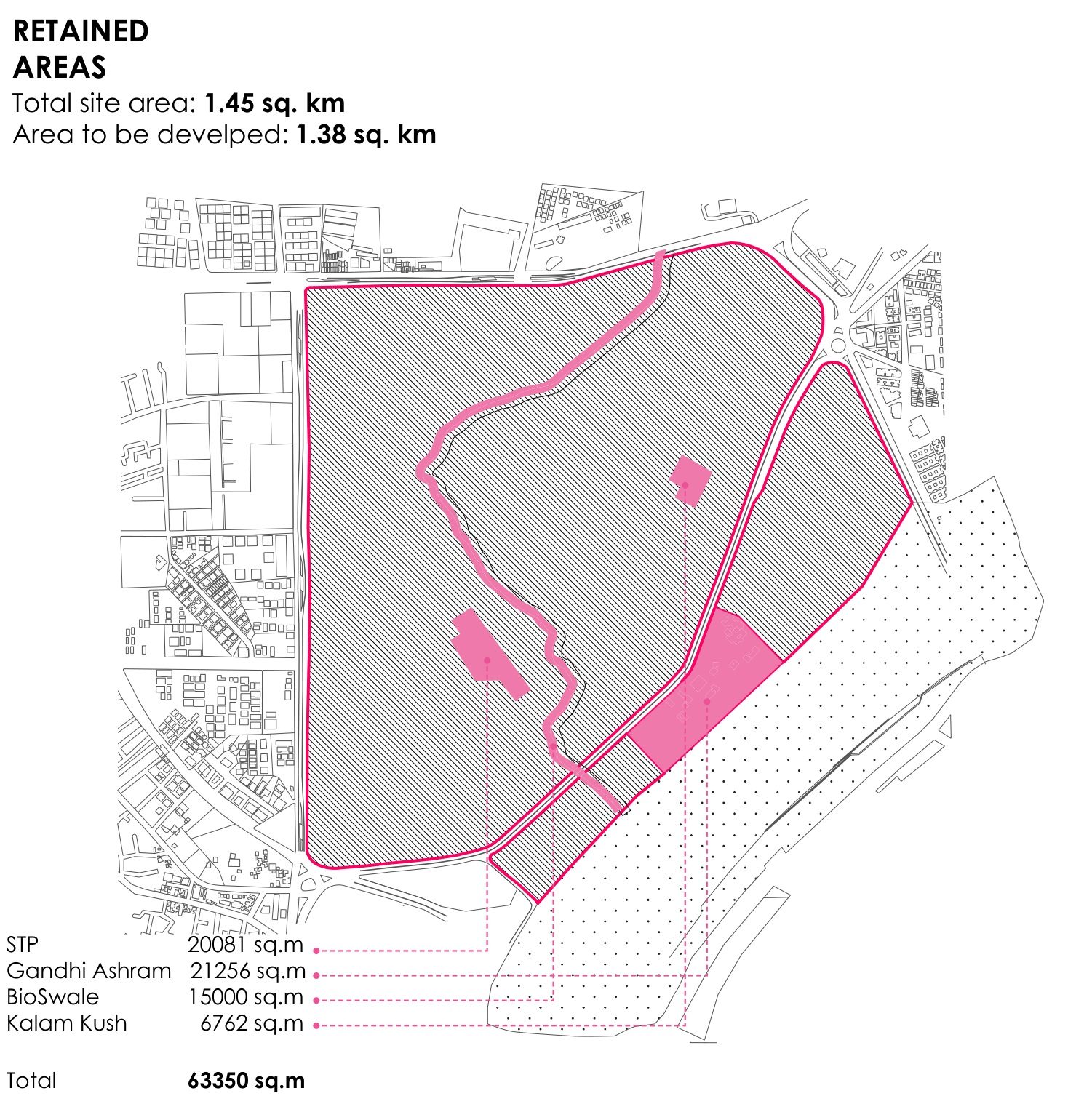
Before any rule was written, the site was read for what it should not lose. The retained entities set the low-density attractors; the transit stops and junctions set the high. The plan began as a list of what to preserve.
2025, 2035, 2050
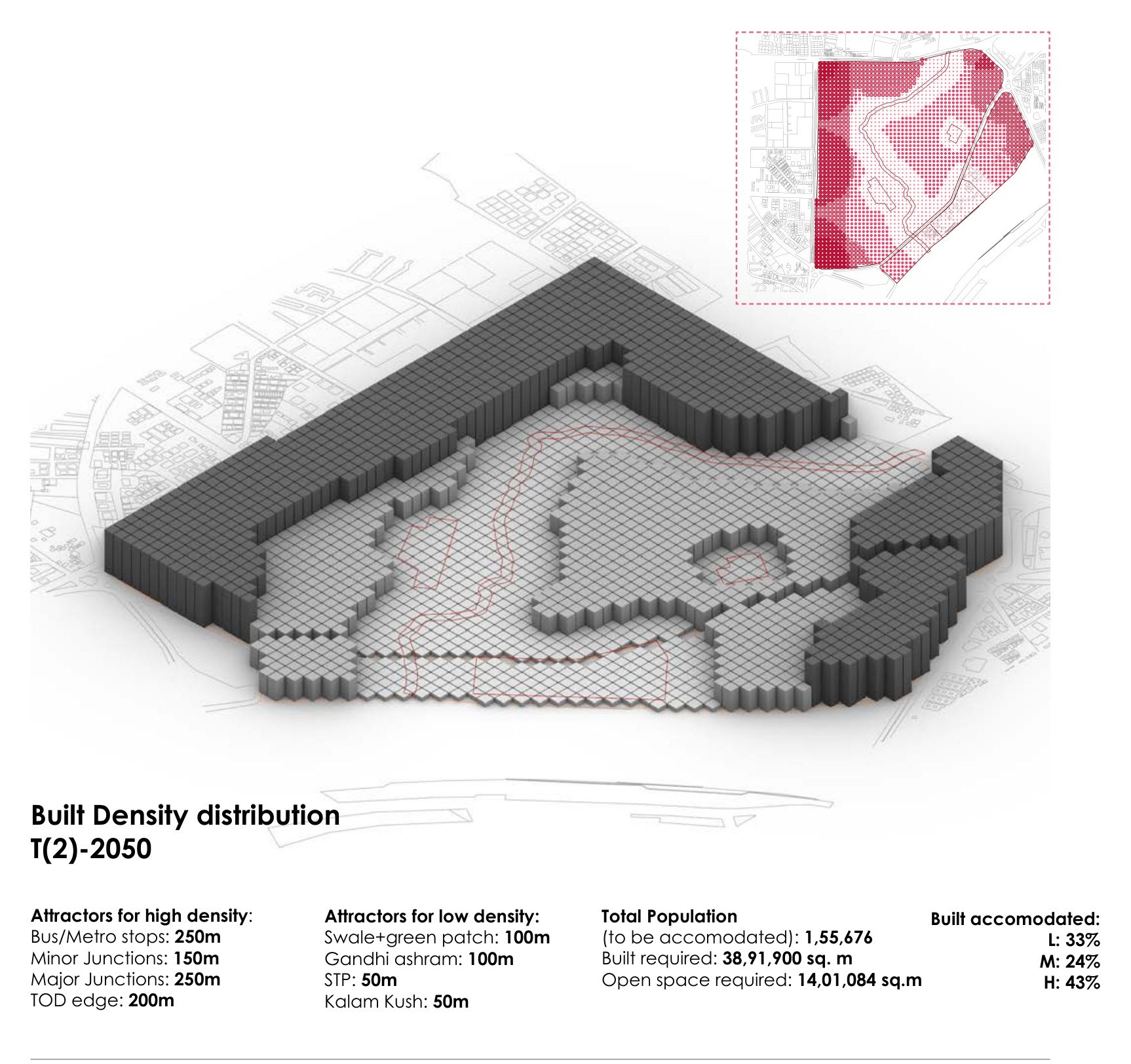
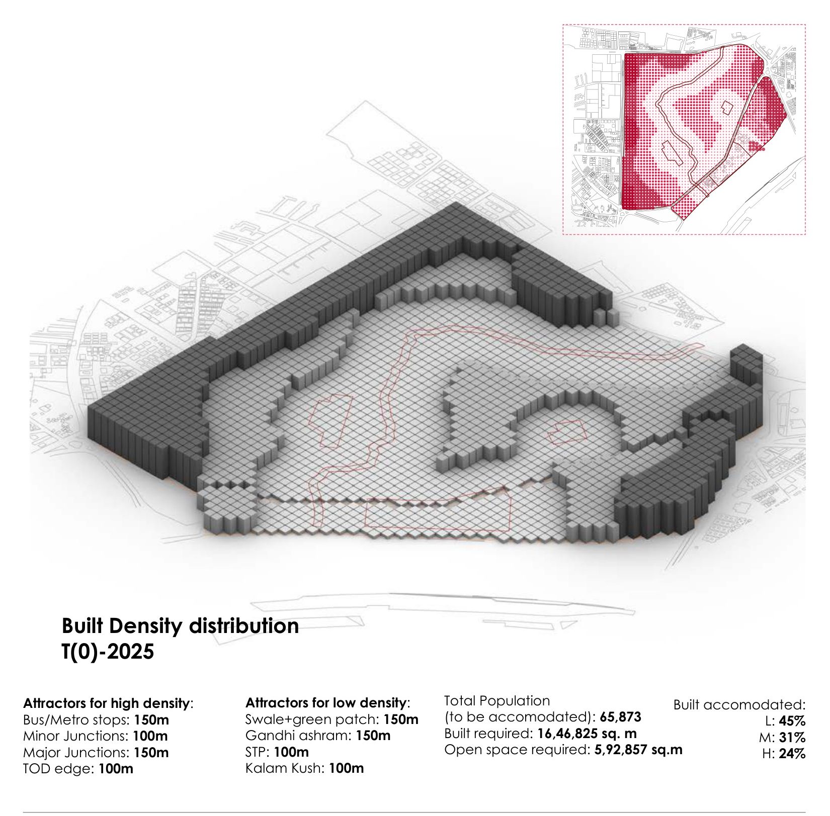
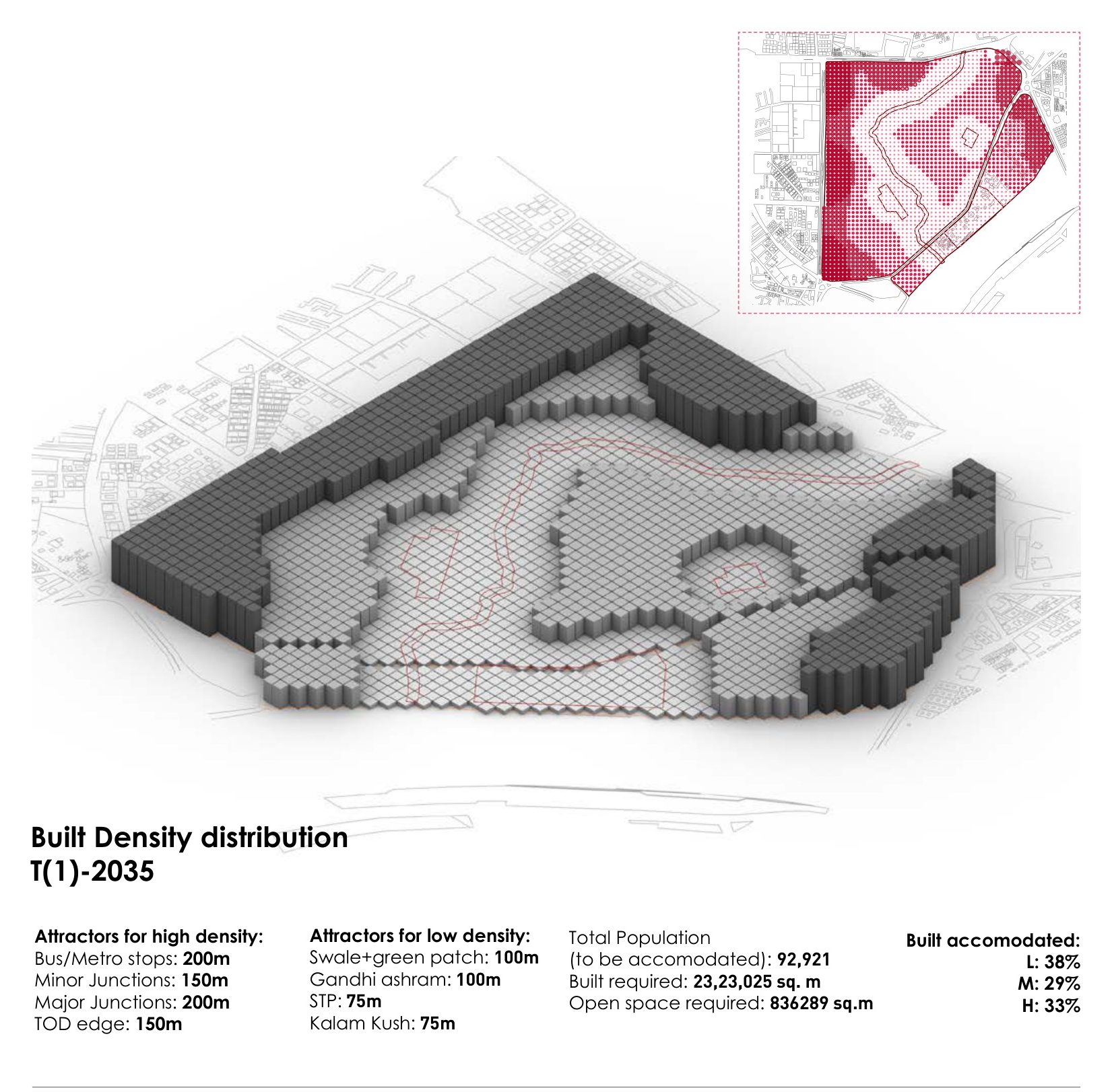
The arithmetic was done first. At 2050 the site has to hold 1,55,676 people: 38,91,900 square metres of built space and 14,01,084 of open space, which is more open space than there is site. Stacking floors alone reaches a hundred and fifty storeys. Put the required open space on rooftops as well as the ground, and it comes down to twelve.
So the density distribution is not one drawing but three. The same attractors are run at 2025, 2035 and 2050, their radii widening as the population grows; the share of high-density ground moves from a quarter to nearly half. The density map is a function of time rather than a fixed zoning.
A block, written as nine steps
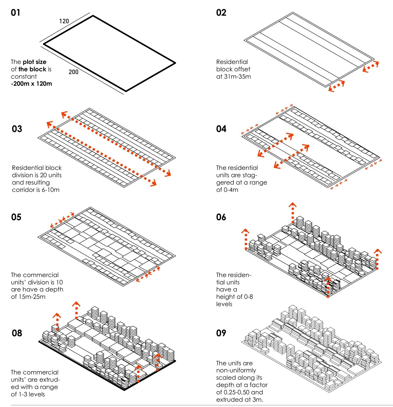
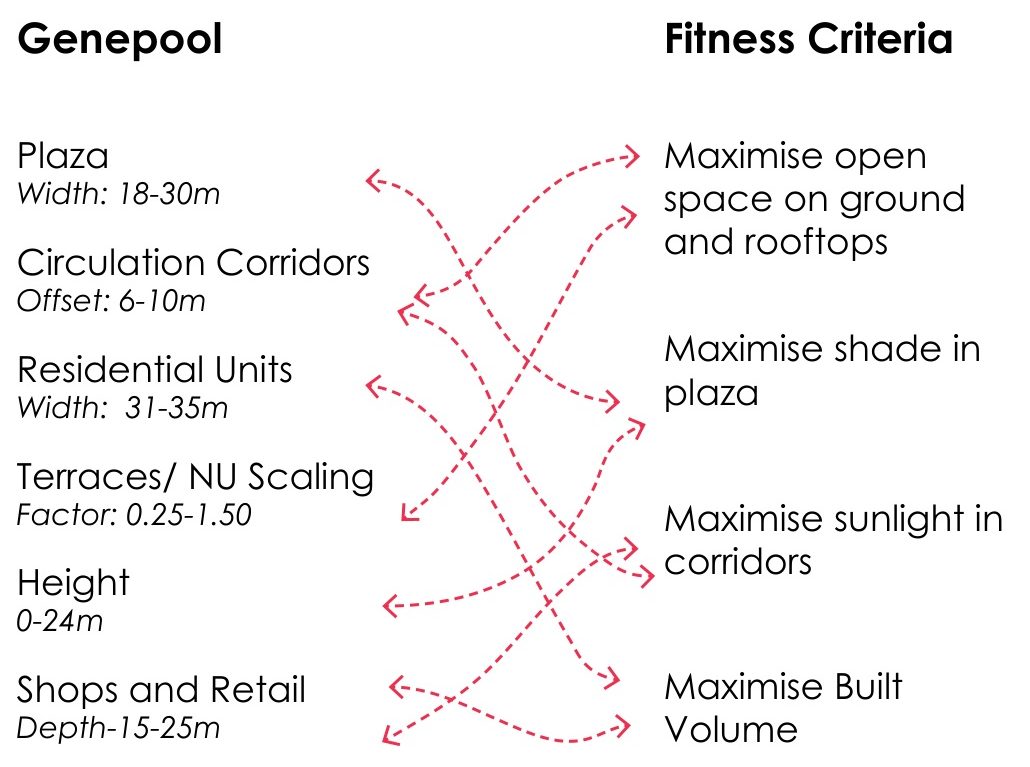
At the block scale, design intent is written as a procedure. The plot is constant, 200 by 120 metres. The residential block offset, the division into units, the staggering between them, the depth of the shops, the number of floors, the scaling of the terraces: each is given a range rather than a value. Those ranges are the genepool.
Against them sit the fitness criteria: maximise open space on ground and rooftops, maximise shade in the plaza, maximise sunlight in the circulation corridors, maximise built volume. The relationships between the two, which gene moves which criterion, are the design. Written this way the intent can be argued with: you can disagree with a rule precisely, in a way you cannot with a rendering.
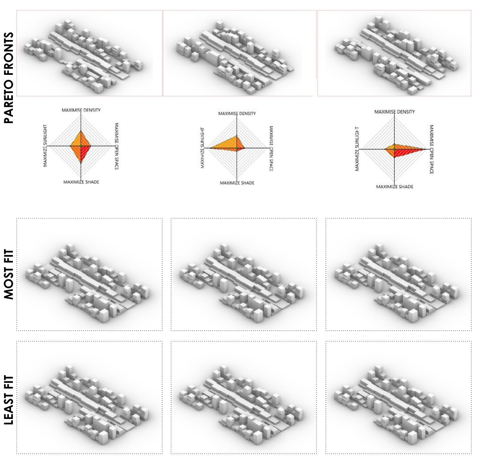
Most fit, least fit
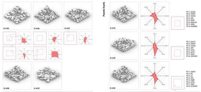
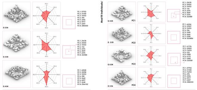
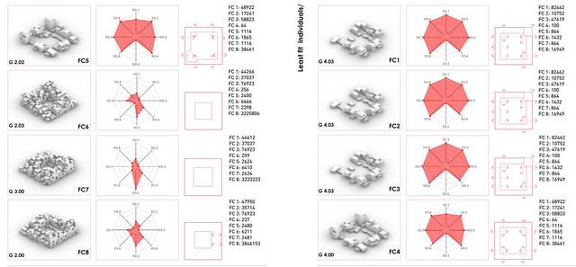
The evolutionary solver breeds populations of blocks, scores each against all criteria, and keeps the ones no other individual beats on every objective: the Pareto front. Below the front sit the most and least fit of each generation. The radar for each individual shows the trade-off directly: a block that wins on density loses on open space; one that wins on sunlight loses on shade. There is no single best answer, only a set of compromises, and the designer chooses among them with the reasons visible.
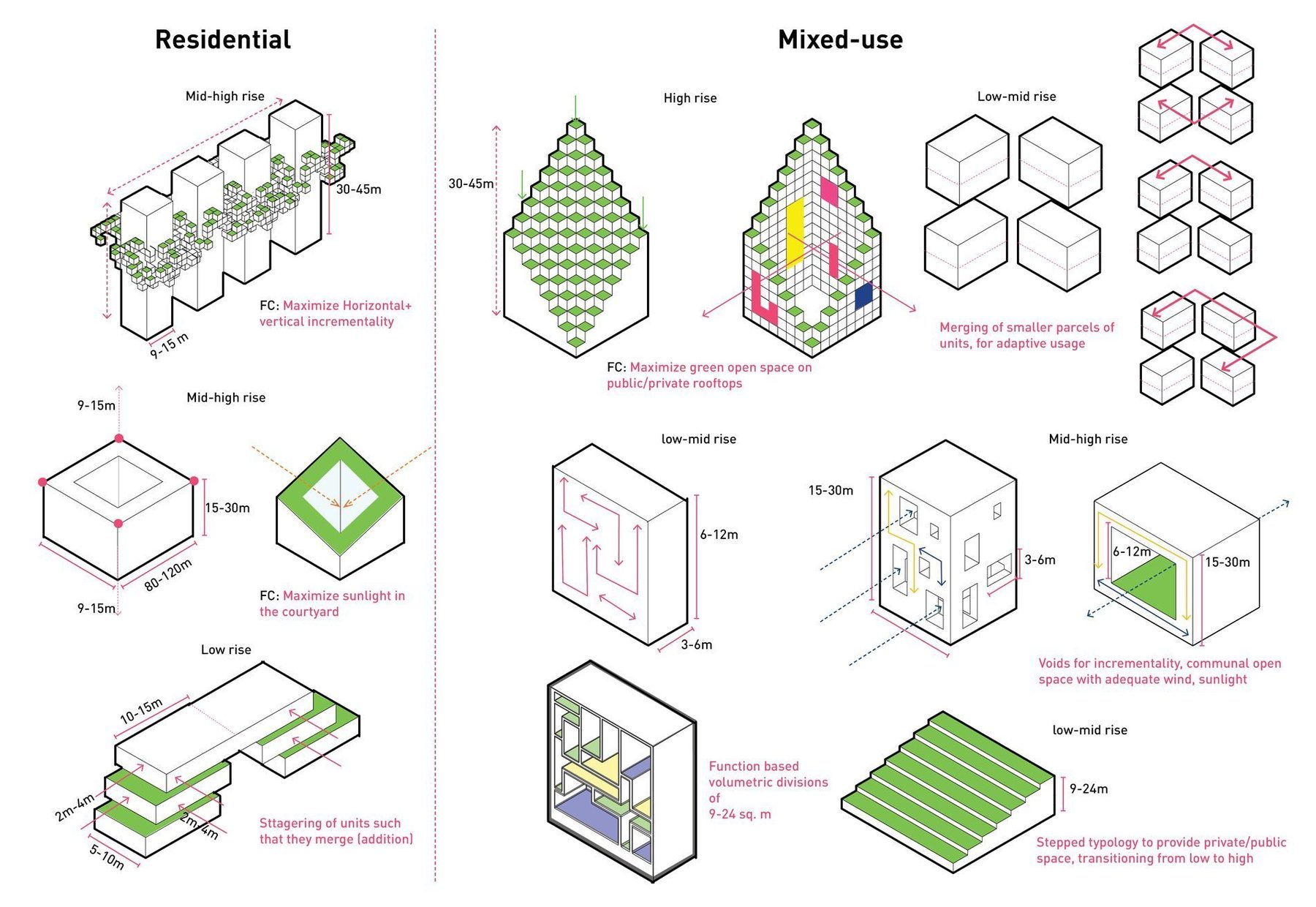
Eight neighbourhoods from one intention
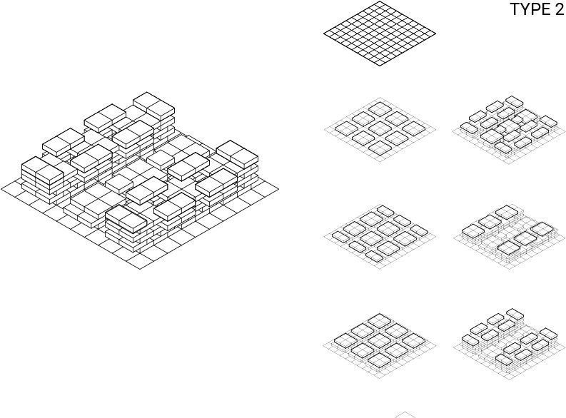
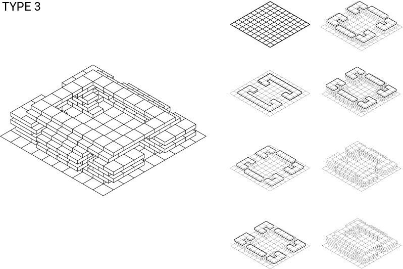
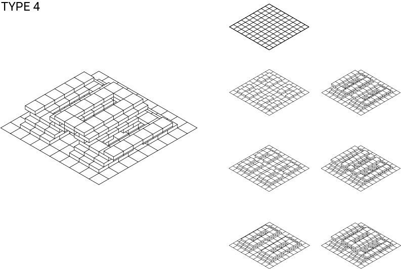
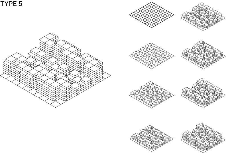
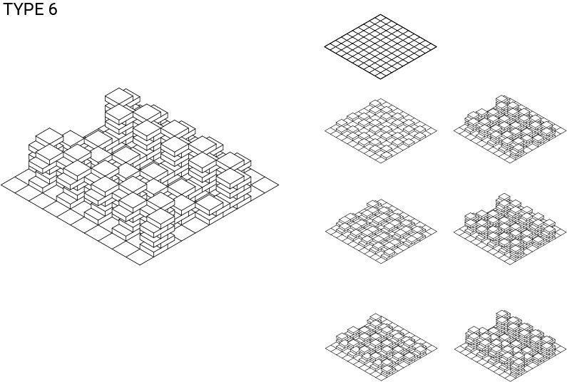
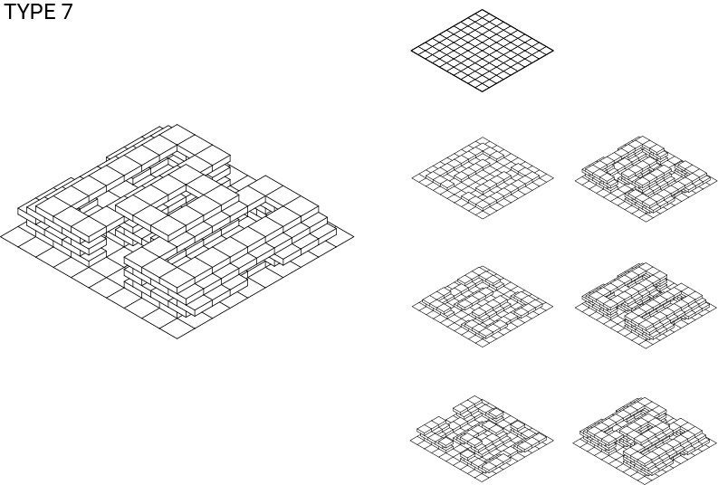
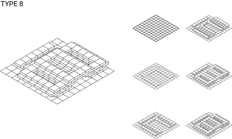
The same method produces the building types. Four primitives (single courtyard, L, U, tower) are given residential and commercial body plans: grid size 3 to 7.5 metres, depth 12 to 18, height 0 to 24, voids of 36 to 180 cubic metres, staggering at a factor of 1 to 1.5. Eight typologies come out of one rule set, from a coarse perimeter block to towers on a mat, each with the grid, plates and cells that generate it drawn beside it. What looks like eight designs is one intention, resolved eight ways.
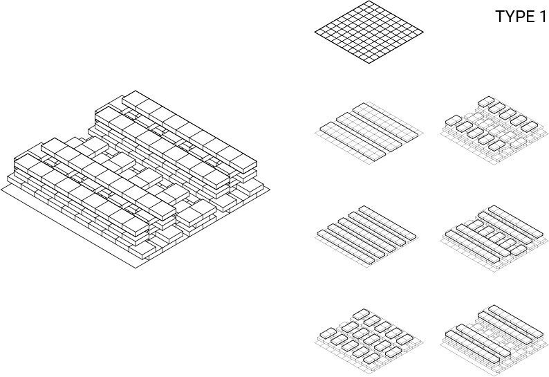
Four generations
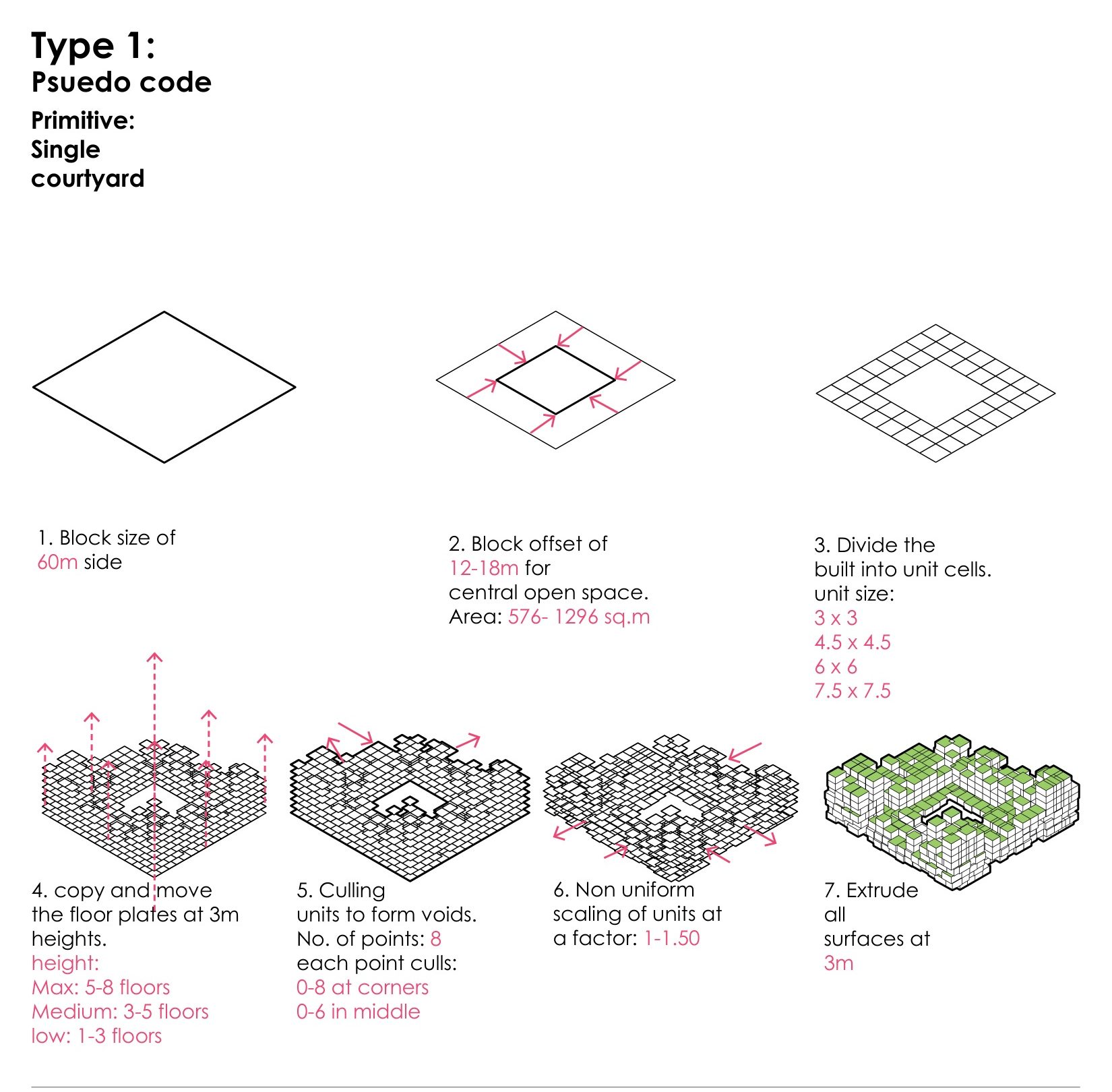
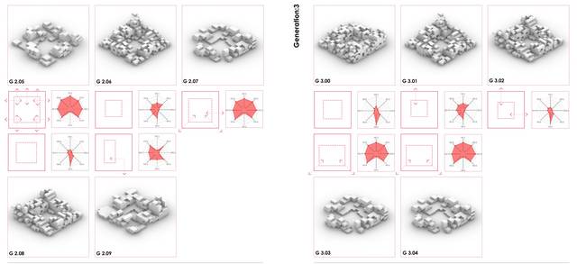
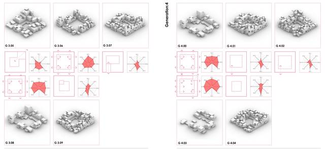
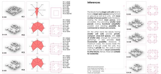
For Type 1 the procedure is written out as pseudo-code (a 60-metre block, an offset for the court, a division into cells, plates stacked at three metres, cells culled at eight points to make voids, non-uniform scaling, extrusion) and run for four generations. Every individual is scored on eight criteria and drawn beside its radar.
The inferences are the kind a masterplan cannot give. Blocks with larger unit cells produce larger open spaces and more access points, are more porous, and suit commerce and mixed use. Blocks with smaller cells produce private, close-knit voids the size of a community gathering, with access under the units, and suit housing. One individual, G 4.03, sits at the bottom of every criterion at once, which is its own kind of information.
What the rules feel like
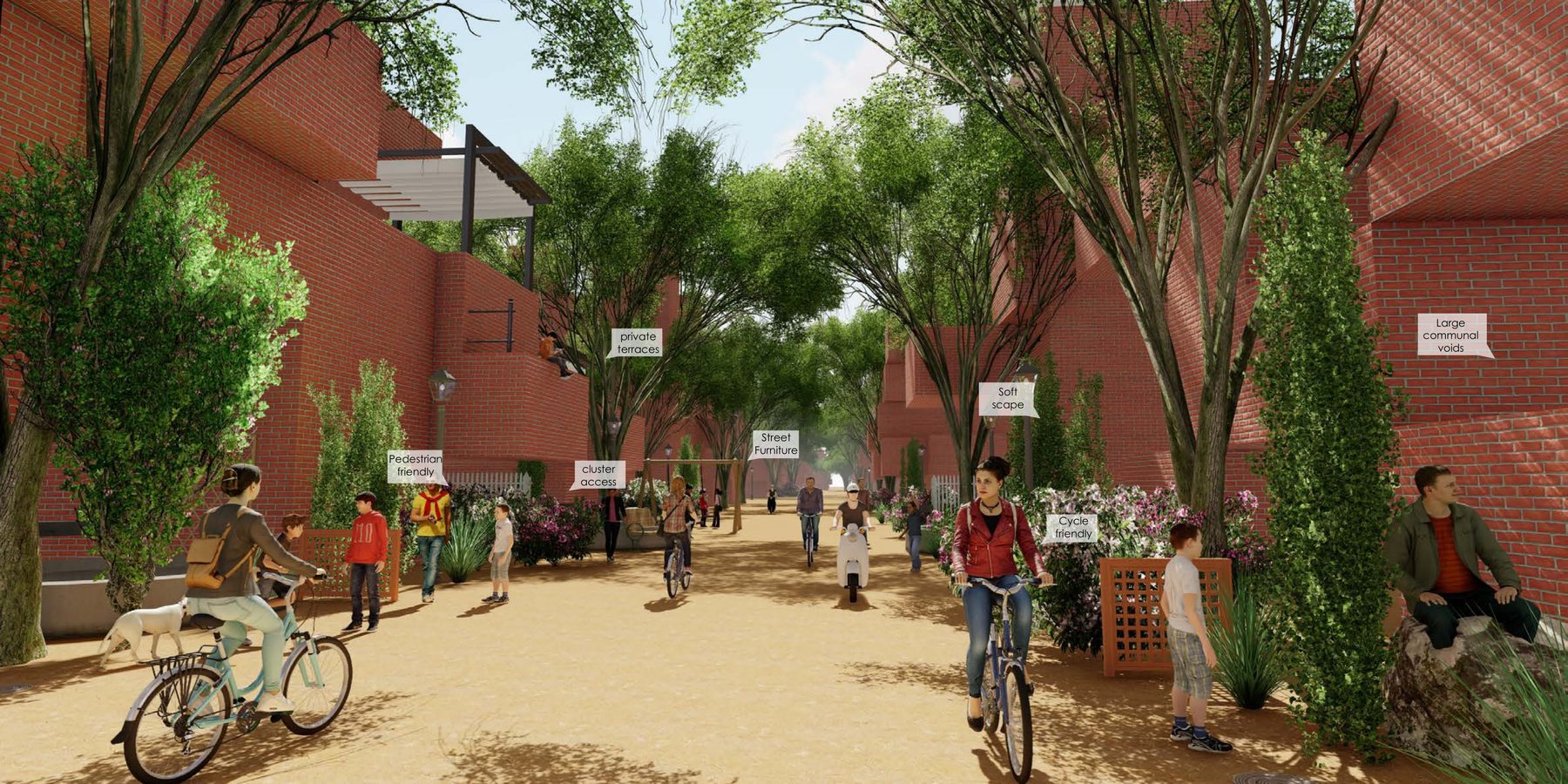
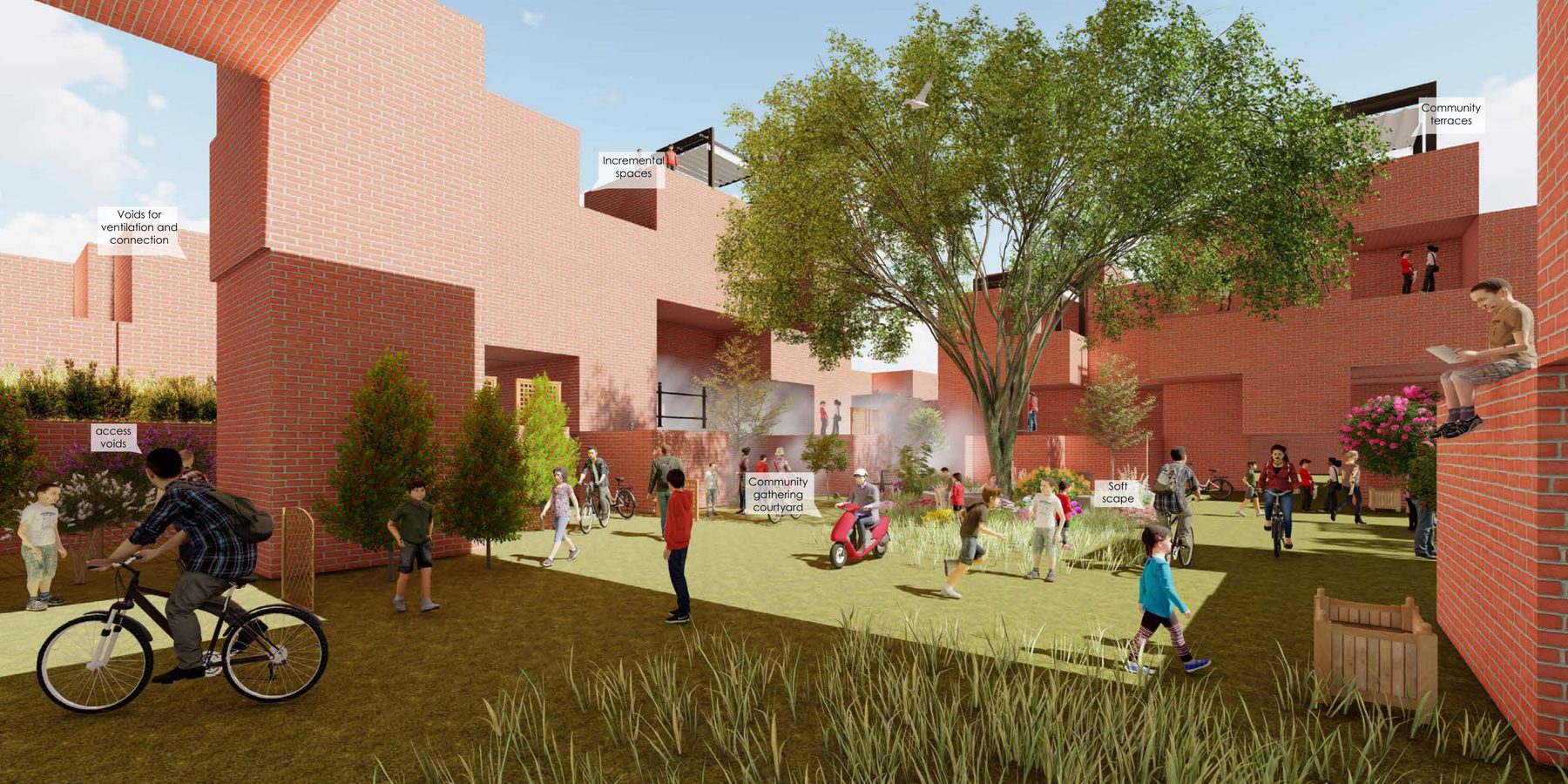
What the rules produce, at eye level, is a brick neighbourhood where the voids culled from the mass are the shaded streets and courts, and the staggered plates are the terraces that carry the open space the ground could not. It is the earliest project on this site where the thing designed is a system rather than a place.