र.
(← selected work) (research question)

how do you make a city policy that people will actually pick up?

Ahmedabad's Urban Green Policy 2030, a 90-page policy for AMC, designed so that a ward committee, a gardener and a commissioner can all read it.

Ahmedabad has about 60 square kilometres of tree cover, 12.5 per cent of the city, and 8.4 square metres of green per person against the WHO's nine. The climate action plan committed the corporation to closing that gap; the Urban Green Policy 2030 is the instrument. It covers what a greening policy usually covers, avenues, parks, private greens, heritage trees, pruning, penalties, a fund, and one thing most do not: who gets the green, ward by ward. Studio Commons designed the book for ICLEI South Asia and the Amdavad Municipal Corporation: the maps, the infographics, and an illustrated city that runs under every chapter so the policy reads as a place rather than a rulebook.

(role)
book design · illustration · maps and infographics, studio commons
(period)
2024–2025
(context)
amdavad municipal corporation · iclei south asia · studio commons
(status)
policy document · 2025
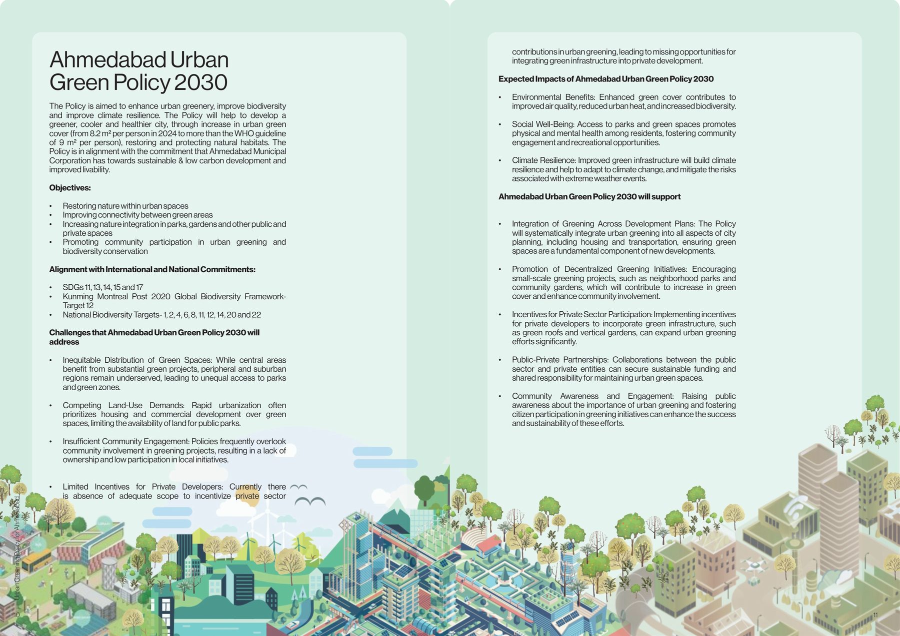
Urban Green Policy 2030. The objectives, the international and national commitments it aligns with, the challenges it names, and the illustrated city that carries the reader through the book.
fig.01Urban Green Policy 2030. The objectives, the international and national commitments it aligns with, the challenges it names, and the illustrated city that carries the reader through the book.
(00) the commitment

From 6.8 to 9 square metres a person

The Climate Resilient City Action Plan committed Ahmedabad to raising its green cover from 6.8 square metres per person to the WHO's nine. The Urban Green Policy 2030 is how. Its objectives are plain: restore nature within urban spaces, connect the green areas, bring nature into parks, gardens and private plots, and get the community to take part. It is written against the frameworks the corporation has signed up to: SDGs 11, 13, 14, 15 and 17, the Kunming–Montreal biodiversity targets, the national ones.

What sets it apart is the first challenge it names, inequitable distribution. The centre has the big green projects; the periphery does not.
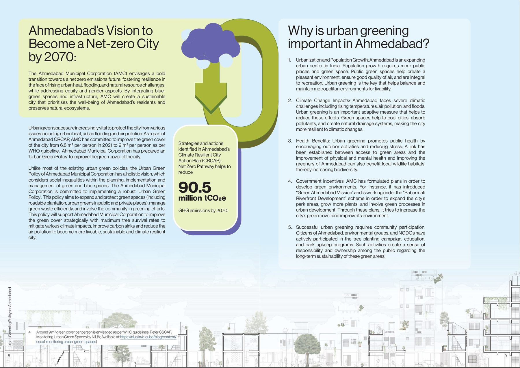
Ahmedabad's vision to become a net-zero city by 2070. And why greening is part of it: heat, flooding, air, and 90.5 million tCO₂e to bring down.
fig.02Ahmedabad's vision to become a net-zero city by 2070. And why greening is part of it: heat, flooding, air, and 90.5 million tCO₂e to bring down.
(01) baseline

Where the trees are, and where they went

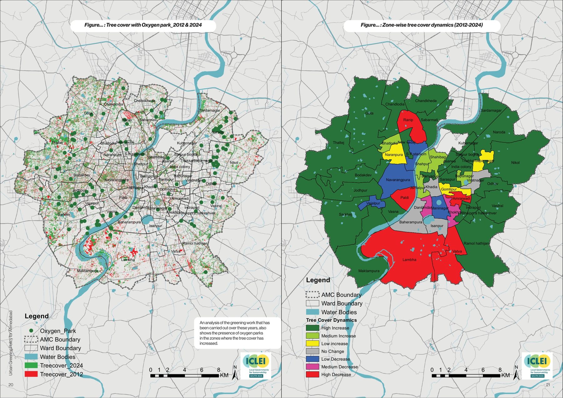
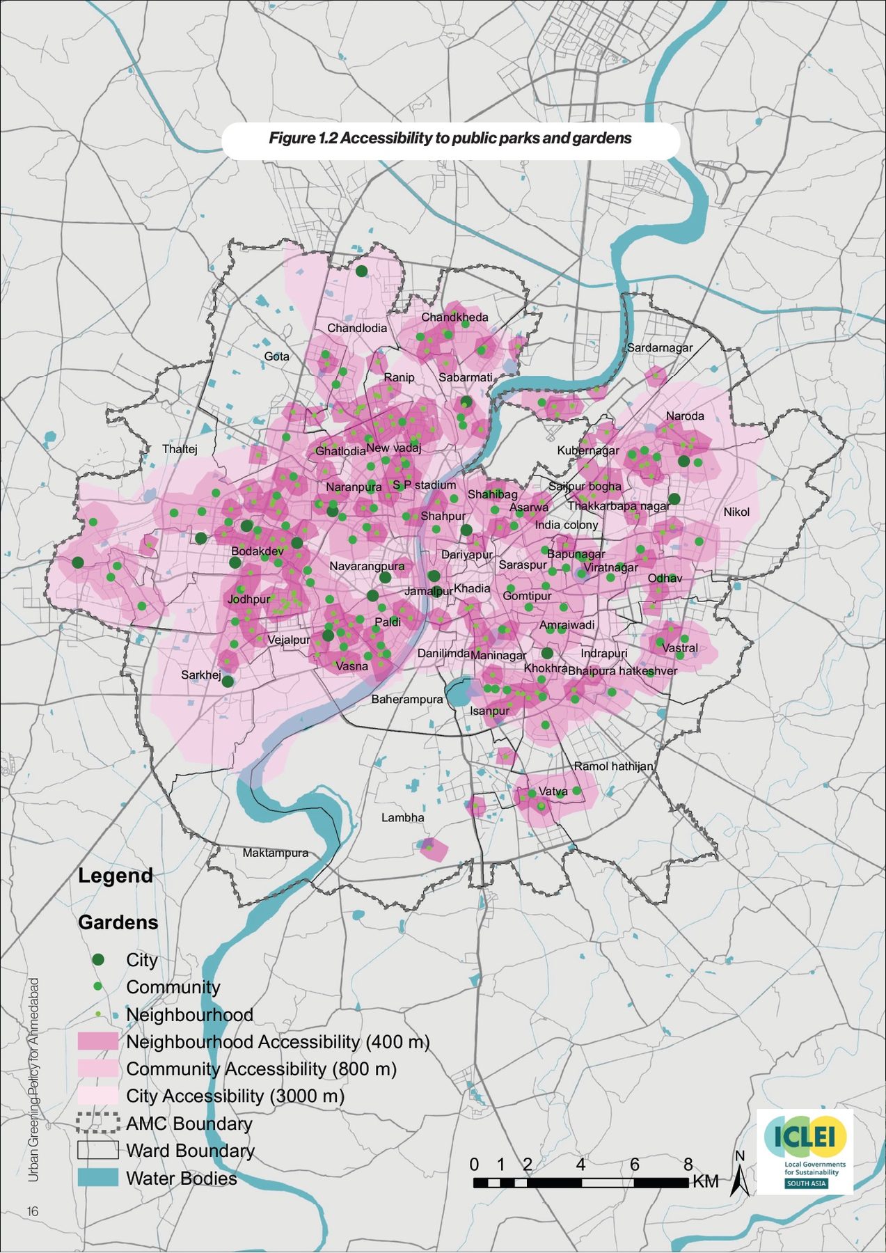
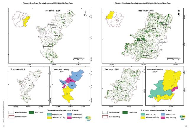
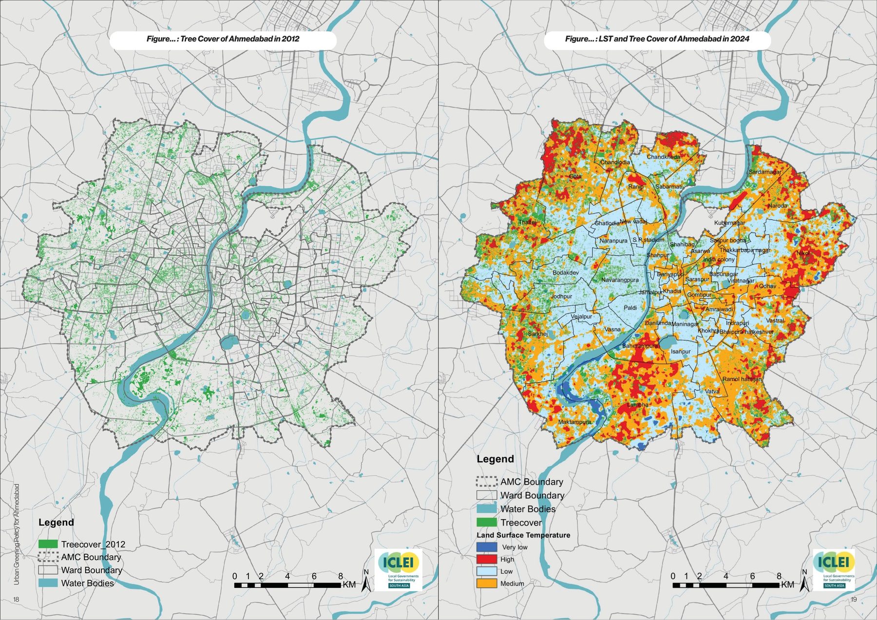
The baseline chapter is where the design earned its keep. Tree cover is about 60 square kilometres, 12.5 per cent of the city, and it moved between 2012 and 2024: up in Bhaipura Hatkeshwar, Indrapuri and Kubernagar, down in Vatva, Lambha and Amraiwadi. Land surface temperature drawn against tree cover shows the hottest ground is the barest. Park access at 400, 800 and 3,000 metres reaches 83.5 per cent of the city and misses Gota, Nikol, Vatva, Narol, Lambha and Sarkhej.

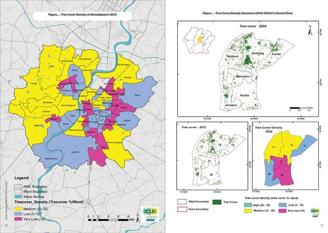
The book draws all of this ward by ward, because that is the scale the policy's committees will work at. A city-wide percentage hides a ward; the ward map does not.
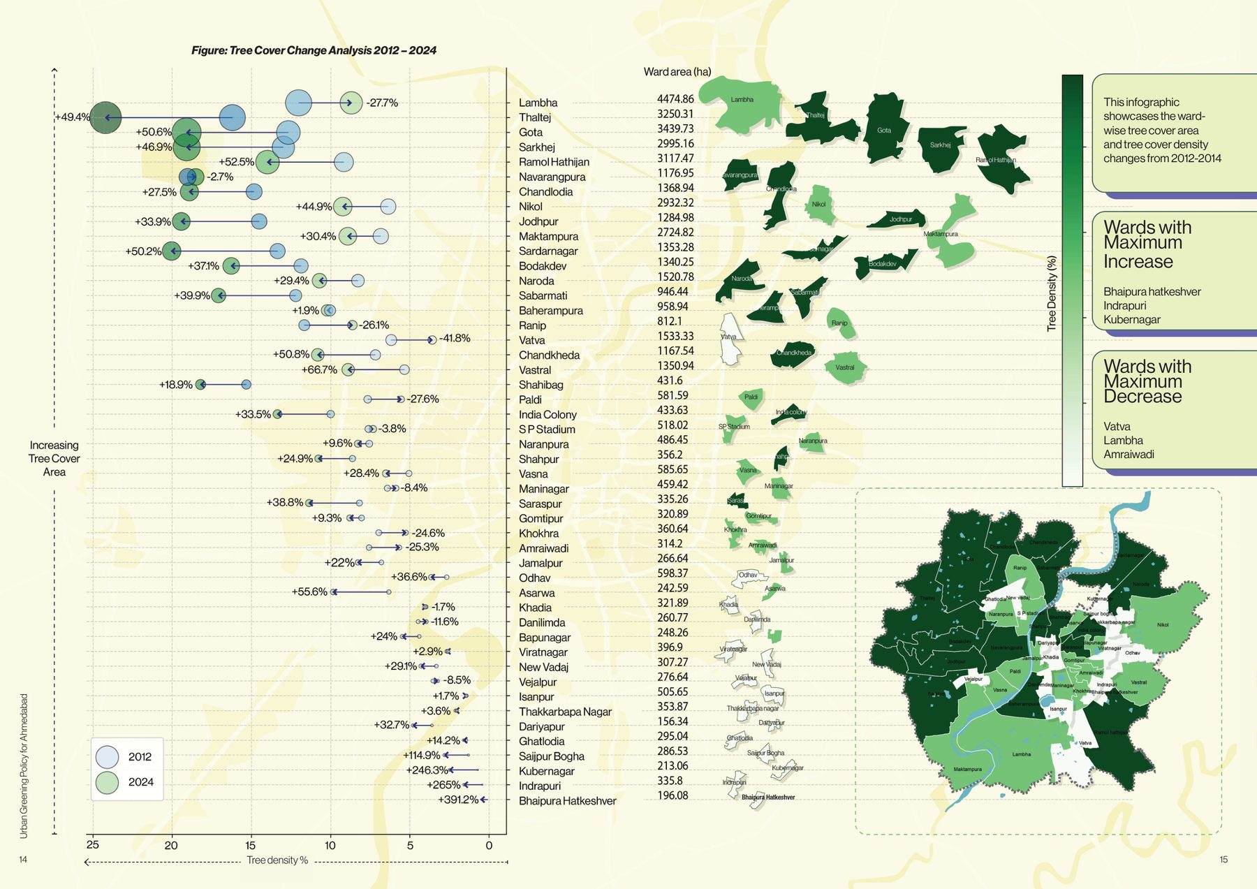
Tree cover change, 2012–2024, ward by ward. The wards that gained most (Bhaipura Hatkeshwar, Indrapuri, Kubernagar) and lost most (Vatva, Lambha, Amraiwadi), and the tree density of each.
fig.03Tree cover change, 2012–2024, ward by ward. The wards that gained most (Bhaipura Hatkeshwar, Indrapuri, Kubernagar) and lost most (Vatva, Lambha, Amraiwadi), and the tree density of each.
Tree cover in 2012, and land surface temperature against tree cover in 2024. The hottest ground is the barest.
Tree cover dynamics 2012–2024. High increase to high decrease, ward by ward, with the oxygen parks marked.
Accessibility to public parks and gardens. 83.5 per cent of the city within reach; Gota, Nikol, Vatva, Narol, Lambha and Sarkhej not.
fig.04–06Land surface temperature against tree cover, 2024; tree cover dynamics 2012–2024 with the oxygen parks; access to public parks at 400 m, 800 m and 3 km.
Tree cover density by ward, 2012 and 2024, and the central zone.
Tree cover density dynamics. East and north-west zones.
fig.07–08Tree cover density by ward, 2012 against 2024, and zone by zone. The same reading at the scale a ward committee works at.
(02) three greens

Avenues, public, private

The policy sorts the city's green into three kinds and gives each an owner: avenues, medians and junctions, under AMC, AUDA, the highways and public works; public greens (parks, gardens, forests, the riverfront) under the corporation; private greens, from institutional campuses to balconies, under whoever holds the plot. For the street, the rules are drawn to scale: the size of tree to the width of the verge, the section from building to carriageway, the criteria for choosing a native species over an ornamental one.
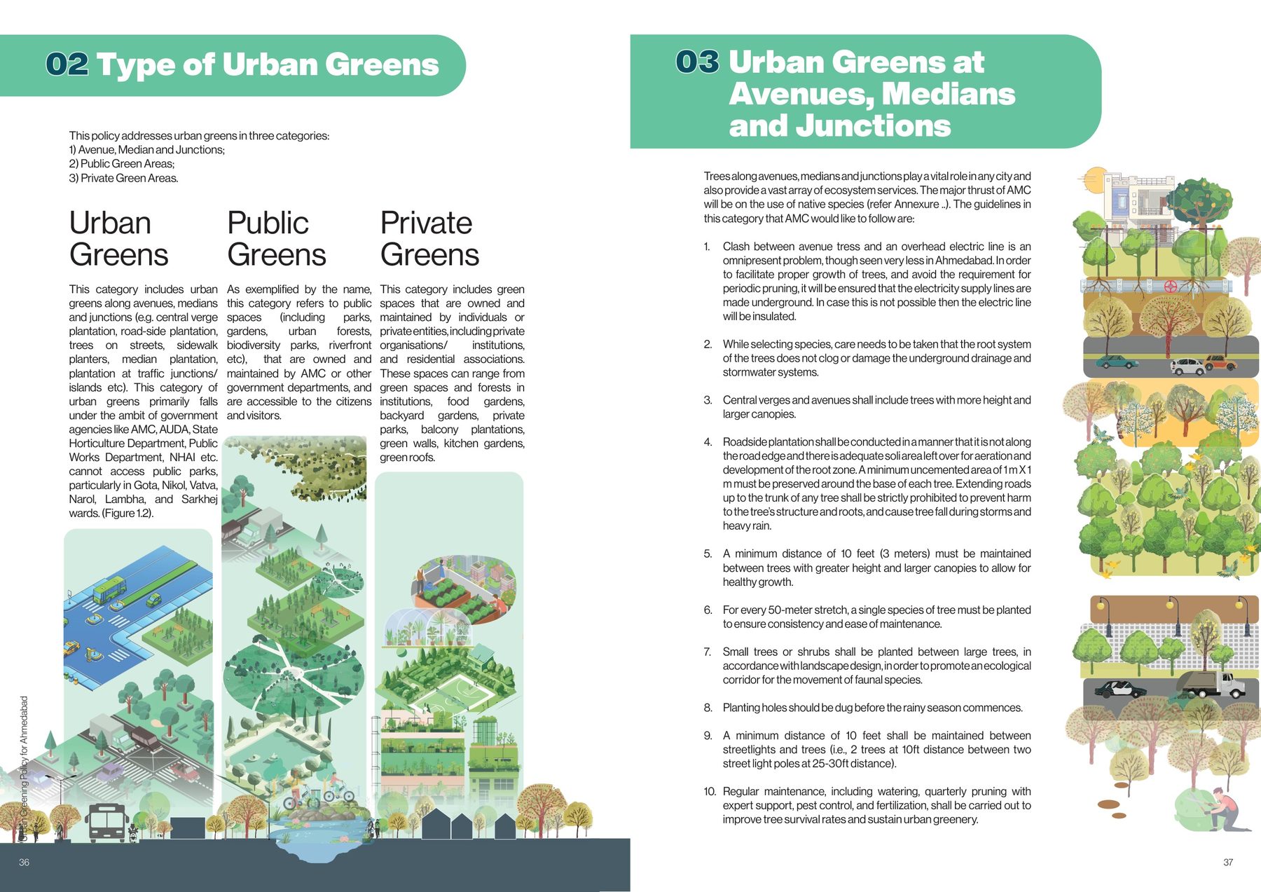
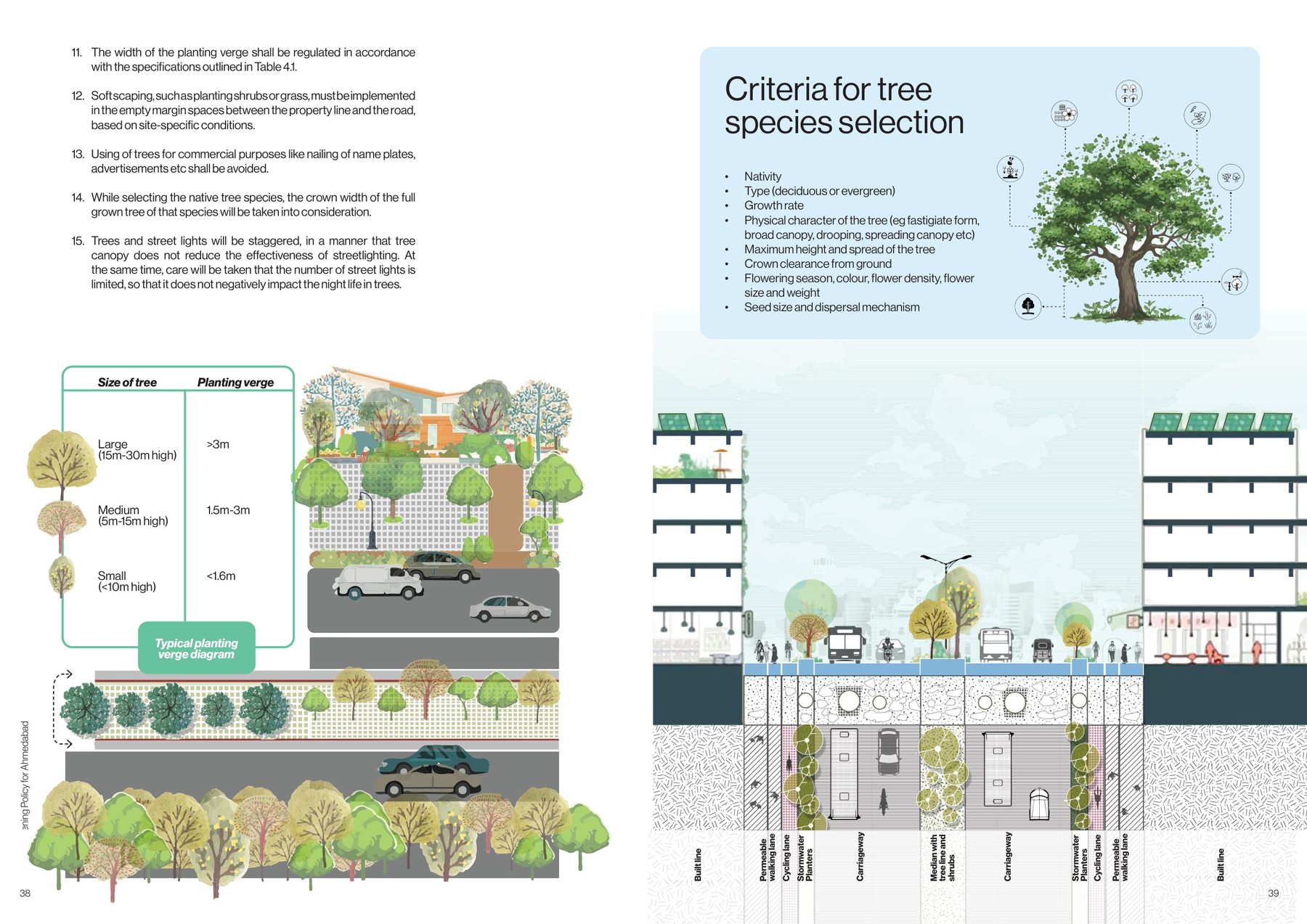
Types of urban greens. The policy addresses three: avenues, medians and junctions; public greens; private greens. Each drawn, each with its own agency.
fig.09Types of urban greens. The policy addresses three: avenues, medians and junctions; public greens; private greens. Each drawn, each with its own agency.
Urban greens at avenues, medians and junctions. The rules, and the size of tree to the width of verge.
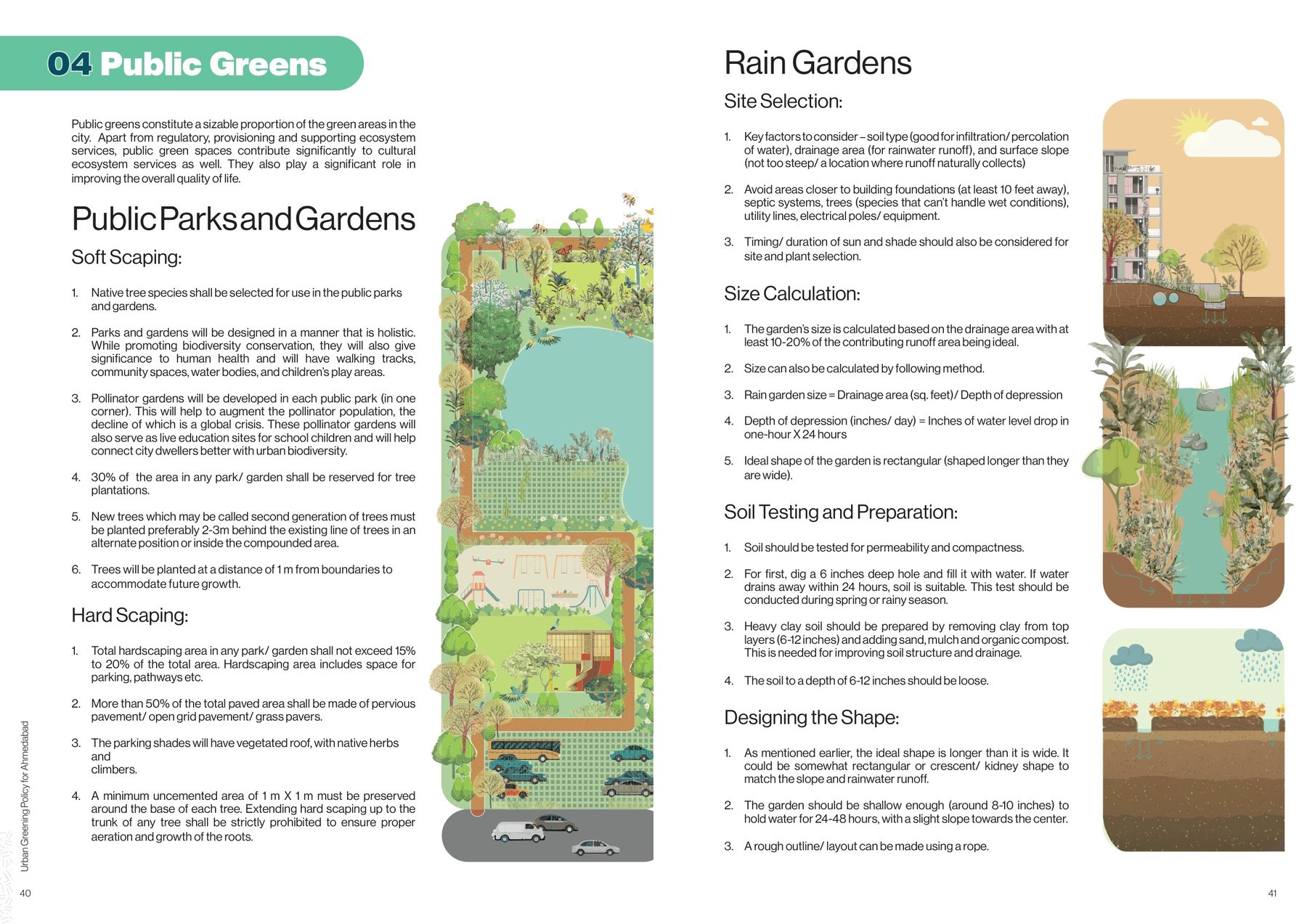
Criteria for tree species selection; the street in section; public parks and gardens; rain gardens.
fig.10–11Avenues, medians and junctions. Planting verges by tree size; the street section, and the criteria for choosing a species.
(03) catalogue

A green for every kind of ground

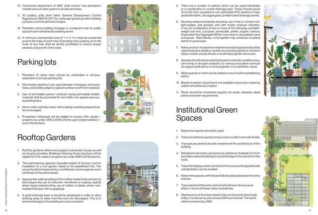
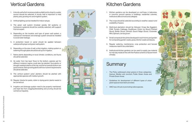
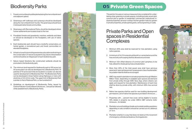
Then the catalogue: urban forests and Miyawaki plantations, riverfront and open-space planting, biodiversity parks, the open spaces inside residential complexes, parking lots, rooftops, institutional grounds, vertical gardens, kitchen gardens. Each gets its guidelines and its illustration on the same spread, so that the rule and the picture of the rule are never on different pages.
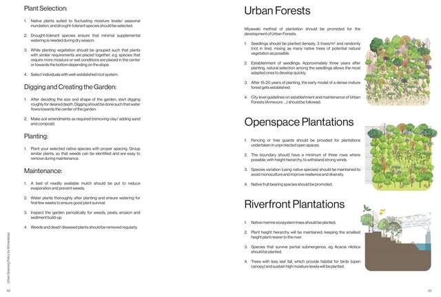
Urban forests, open-space plantations, riverfront plantations.
Biodiversity parks; private green spaces. Parks and open spaces in residential complexes.
Parking lots, rooftop gardens, institutional green spaces.
Vertical gardens, kitchen gardens. And the summary of the chapter.
fig.12–15The catalogue. Urban forests, open-space and riverfront plantations; biodiversity parks and private complexes; parking lots and rooftop gardens; vertical and kitchen gardens. Each with its guidelines and its drawing.
(04) care

Heritage trees, pruning, a health card

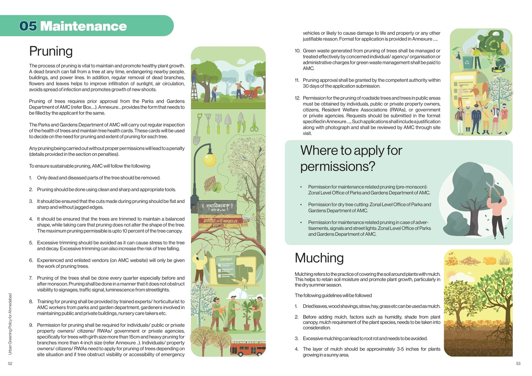
A heritage tree is a tree with a story: age, size, form, a rare species, a festival held under it. The policy sets out how one is recognised and protected. The maintenance chapter is practical: how to prune, where to apply for permission, how to mulch, how to manage pests with neem and lime rather than chemicals, and how to keep a tree health card (identification, inspection, growth, soil, records) for every tree the corporation plants.
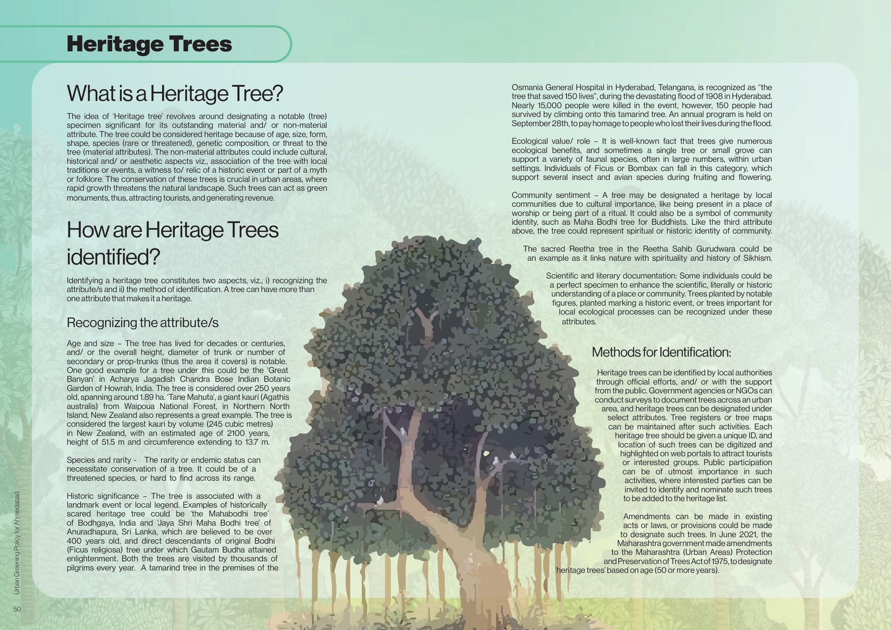
Heritage trees. What makes a tree heritage (age, size, form, species, story), how one is identified, and the banyan drawn to carry the chapter.
fig.16Heritage trees. What makes a tree heritage (age, size, form, species, story), how one is identified, and the banyan drawn to carry the chapter.
Maintenance. Pruning rules, permissions, mulching.
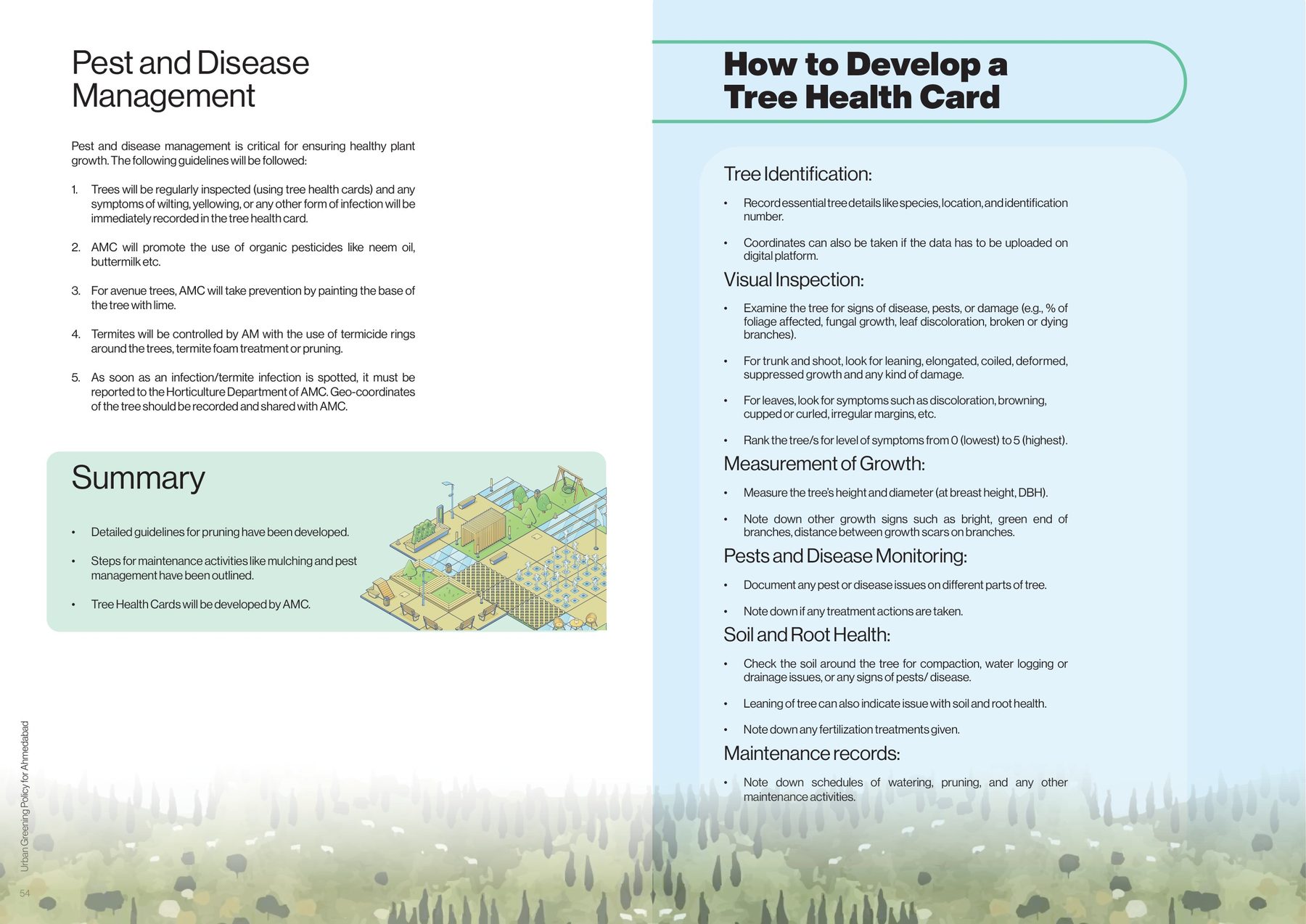
Pest and disease management, and the tree health card: identification, inspection, growth, soil and roots, records.
fig.17–18Maintenance. Pruning, where to apply for permission, mulching; pest and disease management, and how to develop a tree health card.
(05) people and money

Ward committees, a fund, and a fee for felling

The existing garden ward committees become Ward-level Urban Green Committees, with residents, experts, youth and women on them, planning their ward's greening and keeping the health cards. An Urban Green Fund takes public and private money and every penalty. Felling needs permission, is never permitted for red-listed or reserved species or for trees under seven years old, and costs a fee per tree that goes to the fund. Green waste gets a helpline, composting centres and a monthly training target. The chapter closes with what Mumbai, Salem, Bengaluru and Bhubaneswar already do.
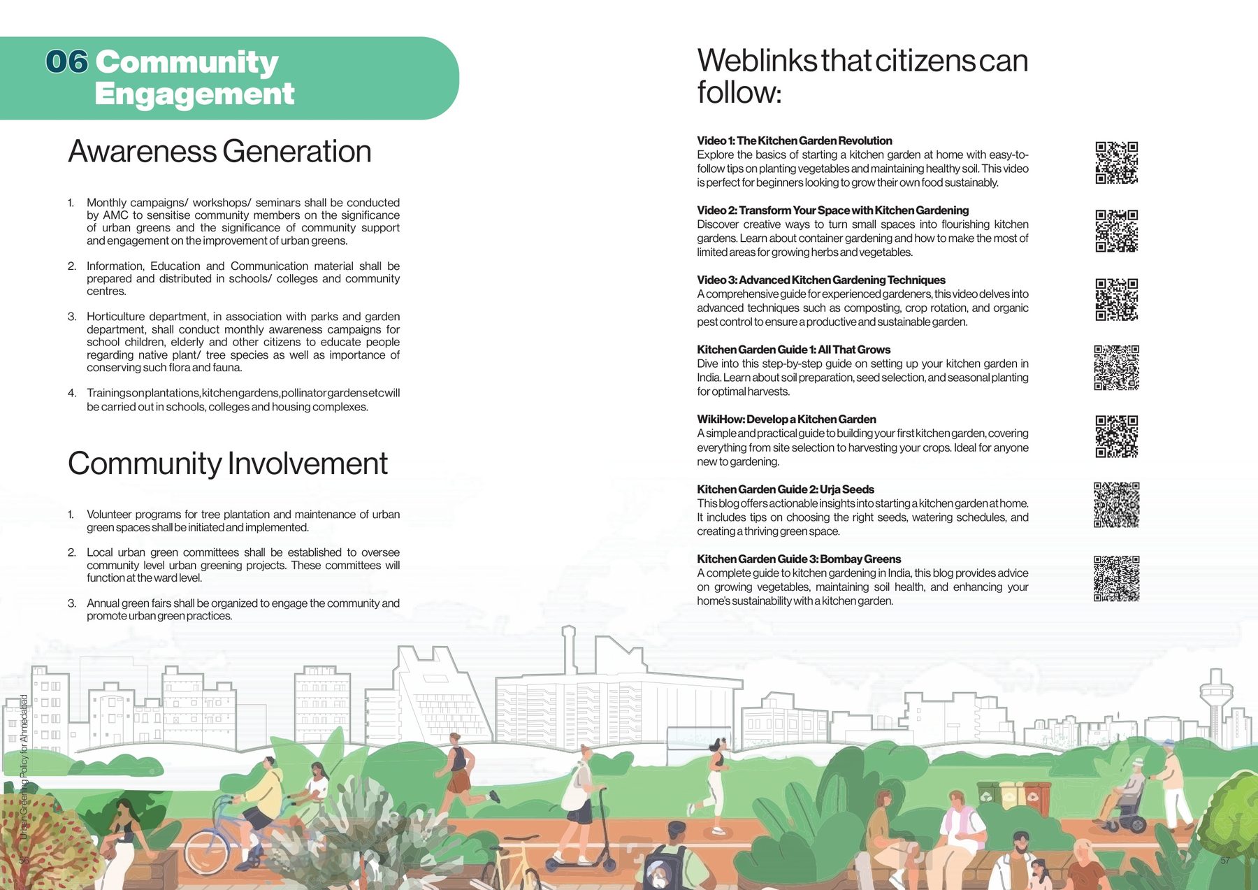
Community engagement. Monthly campaigns, training in schools and housing complexes, volunteer programmes, and the weblinks a citizen can follow to start a kitchen garden.
fig.19Community engagement. Monthly campaigns, training in schools and housing complexes, volunteer programmes, and the weblinks a citizen can follow to start a kitchen garden.
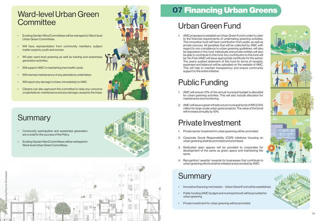
Ward-level Urban Green Committees; financing urban greens. The Urban Green Fund, public funding, private investment.
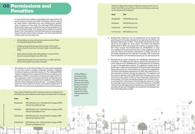
Permissions and penalties. No felling under seven years, nothing on the IUCN Red List, and a fee per tree that goes to the fund.
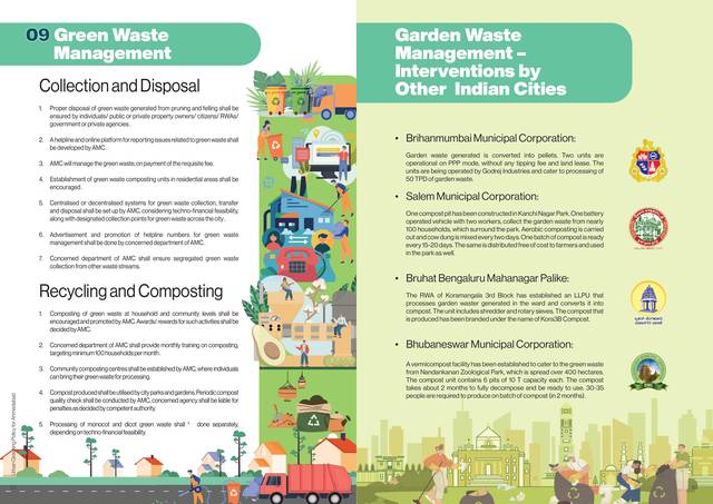
Green waste management. Collection, composting, and the interventions of Mumbai, Salem, Bengaluru and Bhubaneswar.
fig.20–22Ward-level urban green committees and the Urban Green Fund; permissions, penalties and the felling fee; green waste management, with what other Indian cities do.
(06) the greens

What the city already has

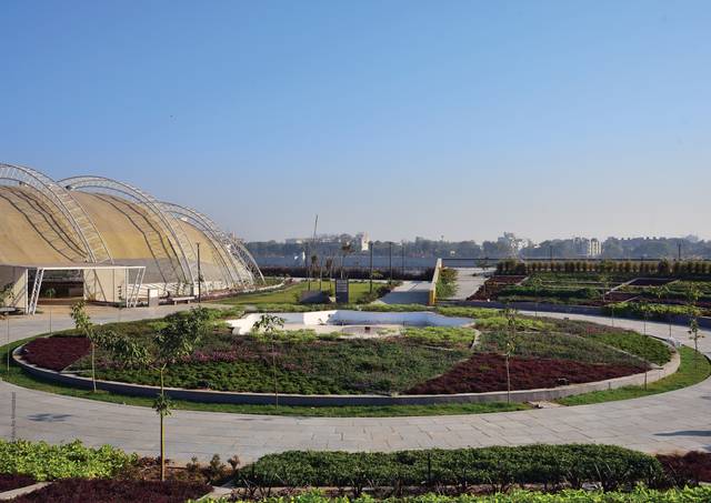
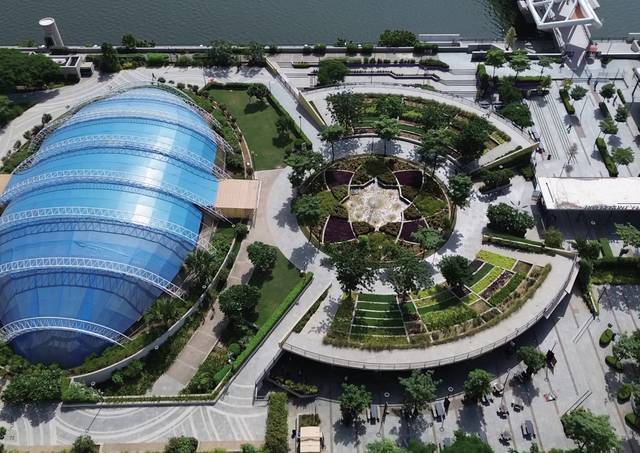
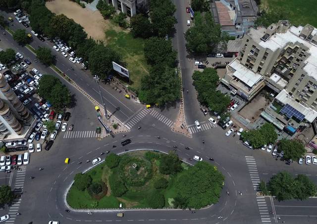
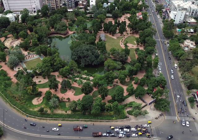
Between the chapters, the city's own gardens from above: the riverfront terraces, the oxygen parks, the domed garden, the planted junctions. They are there to remind the reader that the policy is not starting from nothing: 275 urban forests and oxygen parks in five years, three million trees planted in 2024, and a survival rate of sixty per cent that the policy exists to raise.
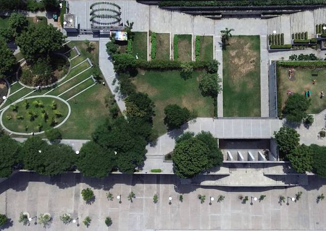
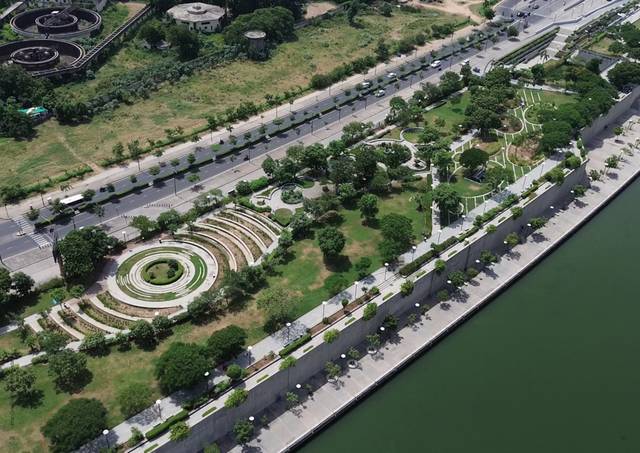
A riverfront garden from above.
The riverfront promenade and its terraced garden.
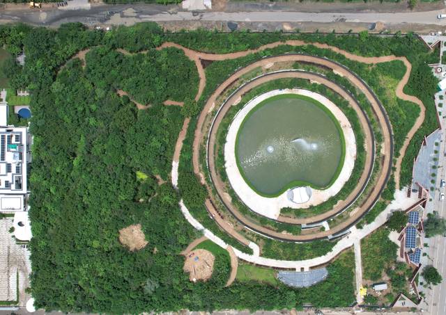
An oxygen park. The spiral path and the pond at its centre.
A garden under a canopy.
The domed garden from above.
A junction green. The traffic island planted.
A neighbourhood park inside the block.
fig.23–29Ahmedabad's parks and gardens from above. The riverfront gardens, the oxygen park, the domed garden, the junction greens. Photographs by AMC and ICLEI South Asia; the plates that close the chapters.
(07) annexures

The species list and the form

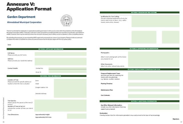
The annexures are the working end: a native species list with vernacular, scientific and IUCN status, so a committee plants what belongs; and the application form itself, designed rather than photocopied, because the form is the policy's most-used page.
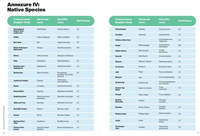
Native species. The list a ward committee plants from.
Application format. The form for permission to cut, prune or plant.
fig.30–31Annexure IV, native species. Common, vernacular and scientific names with IUCN status; Annexure V, the application format for the Garden Department.
(outcome)
Urban Greening Policy, Ahmedabad. Towards a Sustainable and Resilient Future: the Urban Green Policy 2030 for the Amdavad Municipal Corporation, prepared by ICLEI South Asia, designed by Studio Commons. Nine chapters, five annexures, ward-level maps and an illustrated catalogue of every kind of urban green.
(what I'd do next)
The ward maps are the part that should be live. A public map of tree cover and park access by ward, updated as the Mission Million Trees numbers come in, would make the policy checkable by the committees it creates.
(next) State of Cities · fifteen cities, one instrument →