can a centuries-old irrigation system plan a city better than its masterplan?
Eco-Lab Rajgir, an eight-square-kilometre plan drawn in the water's order, on south Bihar's aahar-pyne system.
Rajgir was the first capital of Magadha: a valley ringed by five hills, walled in cyclopean stone, where the Buddha preached and Mahavira taught, and where the hot springs still draw pilgrims. Today it is a small town in Nalanda district under heavy development pressure: a new Nalanda University, a sports stadium, a highway, and a floodplain between the hills and the railway that floods every monsoon and dries every summer. The studio's premise was Ian McHarg's, water and the city as one constructed ecosystem, and the site had a precedent already in the ground: the aahar-pyne, south Bihar's centuries-old network of channels and catchment basins. This plan reverses the usual order. The water is drawn first; streets, food and built fabric are negotiated around it.
- (role)
- urban design studio · gis analysis · masterplan
- (period)
- 2021 · one semester
- (context)
- rajgir · nalanda · bihar · cept L3 studio
- (status)
- studio
A valley that has been a city for 2,500 years
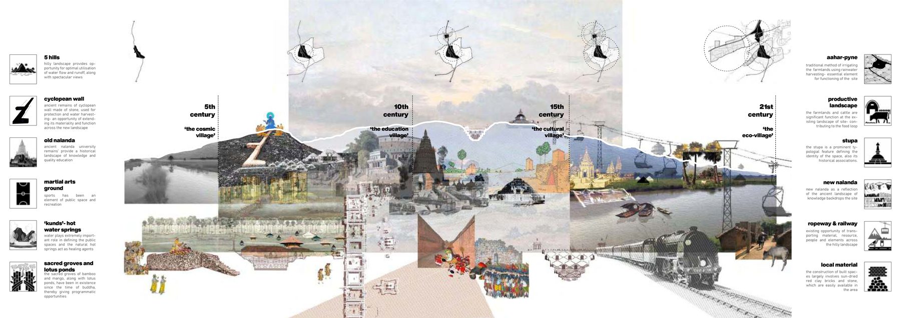
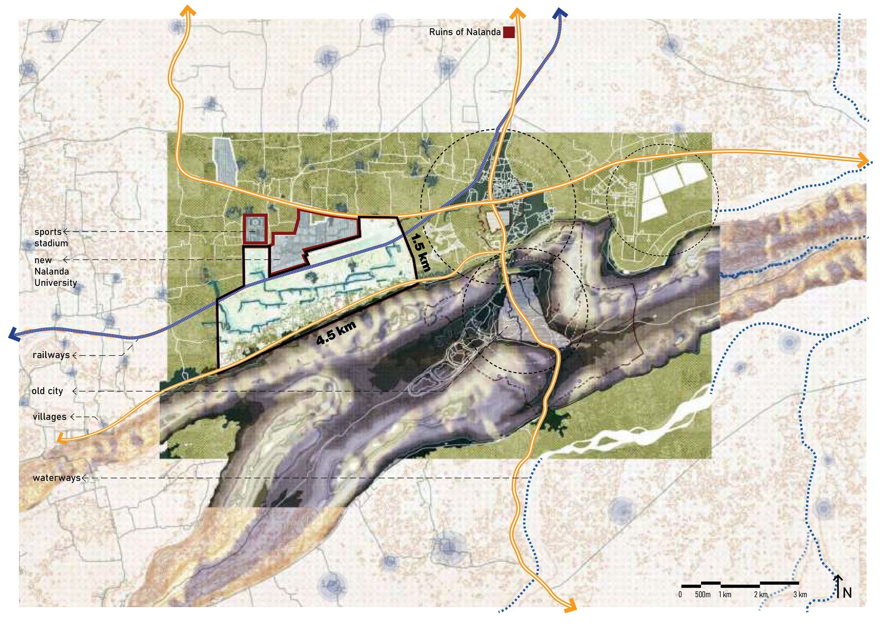
Rajgir has been a city longer than almost anywhere in India. It was Rajagriha, the first capital of Magadha, a valley closed by five hills and walled in cyclopean stone; the Buddha preached on Griddhakuta and Mahavira taught here; the hot springs have drawn pilgrims for two and a half millennia. It is now a small town in Nalanda district, and everything around it is moving: the new Nalanda University campus and the ruins of the old one to the north, a sports stadium, the highway, and between the hills and the railway an eight-square-kilometre floodplain of villages and fields that floods every monsoon and dries out by summer. That floodplain was the site: the ground the water already uses, about to be built on.
Reading the site in layers
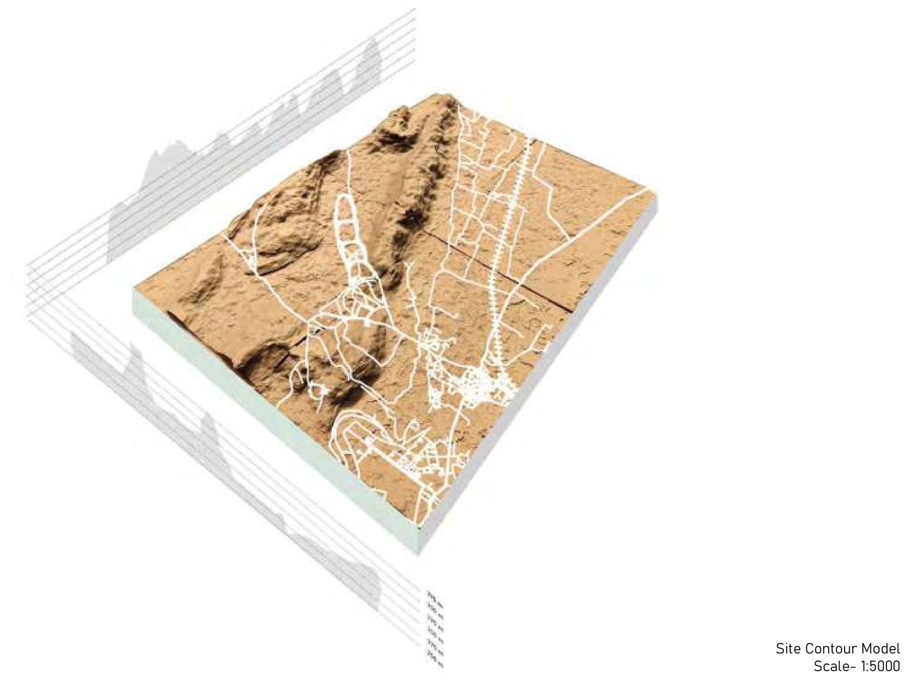
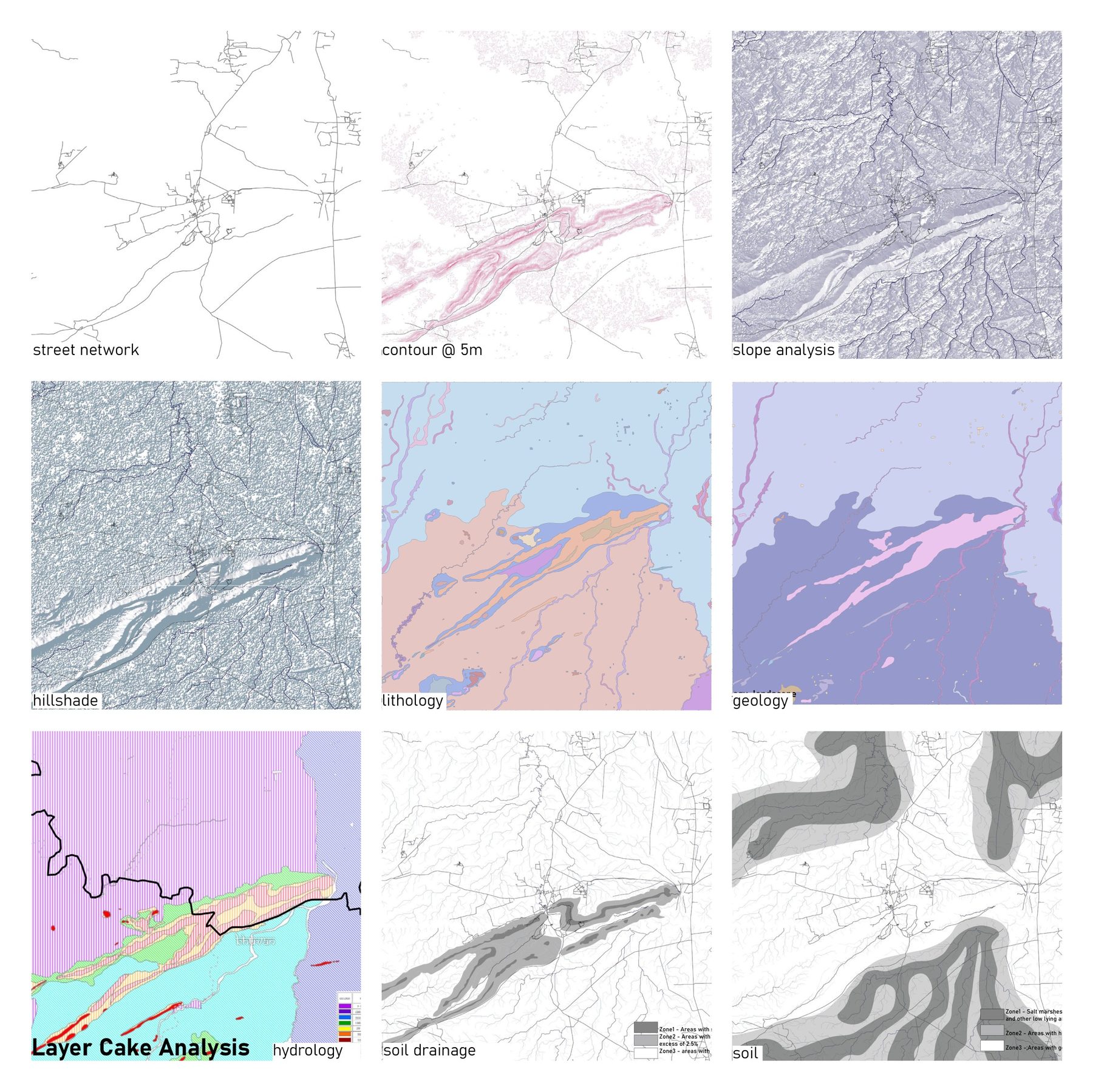
The analysis began in GIS, the way McHarg's Design with Nature layers a site: contours, slope, hillshade, hydrology, lithology, geology, soil drainage, the street network, read together for which ground is buildable and which ground is doing the site's hydrological work. A contour model at 1:5000 made the ridges and the low ground physical. Two problems came out of it, and they are the same problem: flooding during the monsoon, drought during the summer.
The aahar-pyne, read as a plan
South Bihar has had an answer to that problem for centuries. The aahar-pyne is a network in two parts: pynes, the channels that carry runoff off the hills across the plain, and aahars, the embanked basins that catch and hold it for irrigation through the dry months. It is infrastructure that stores the flood to survive the drought.
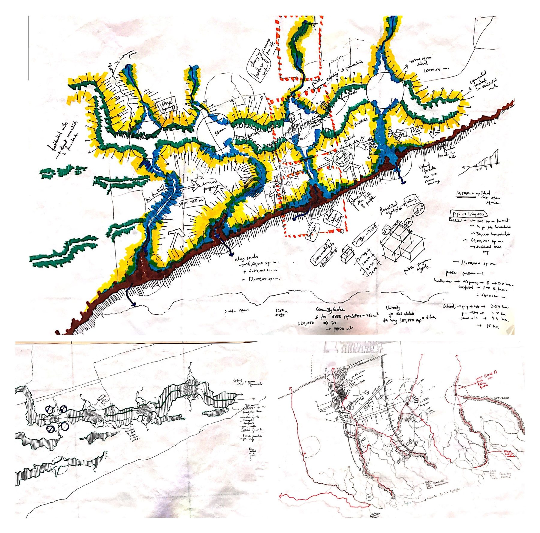
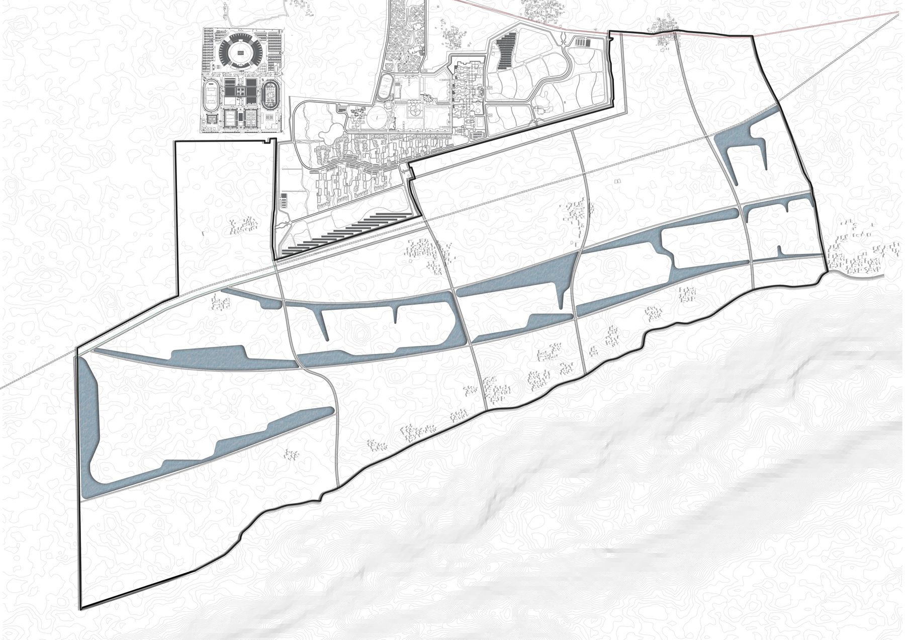
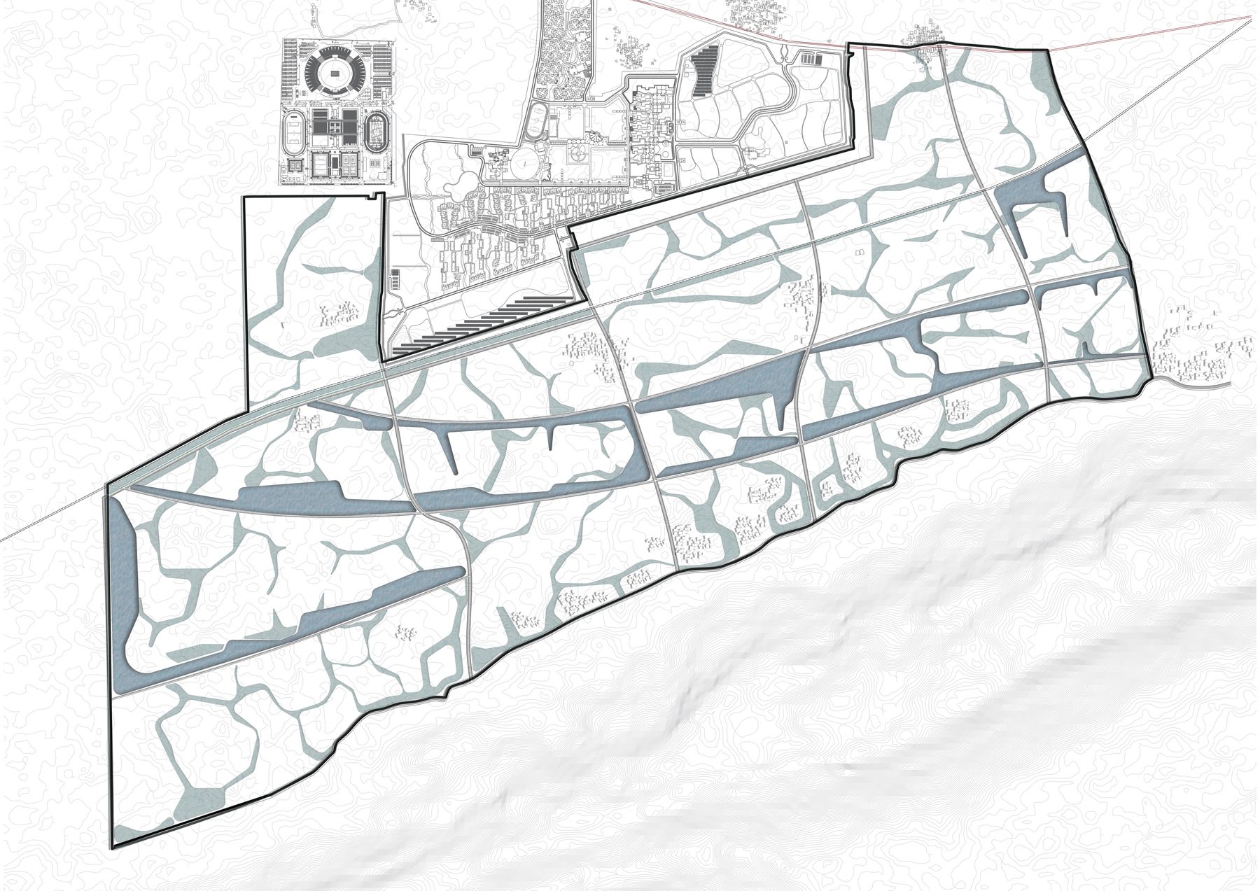
The studio's move was to treat this as a plan rather than as heritage. Once the ridges on the site are traced, the network of low ground between them falls out on its own, and that network is the wetland system, the bio-retention zones, the aahars' natural places. The water is drawn first, in the position the terrain already gives it.
The plan, drawn in the water's order
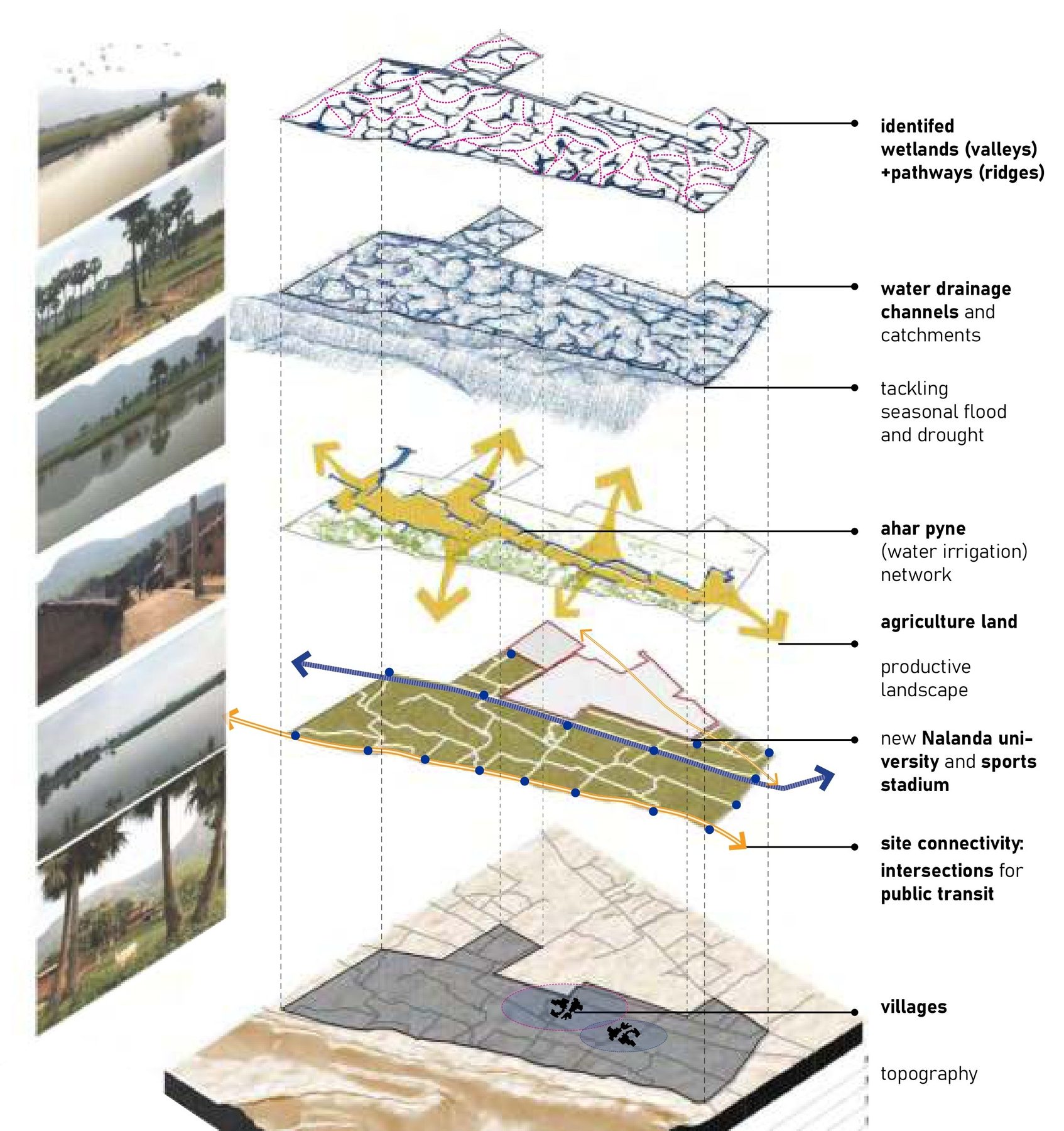
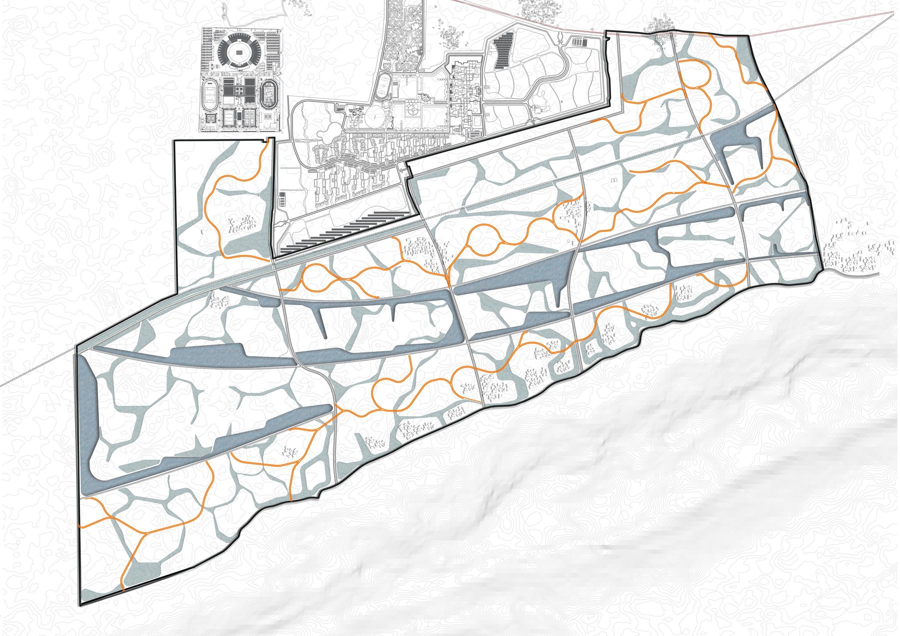
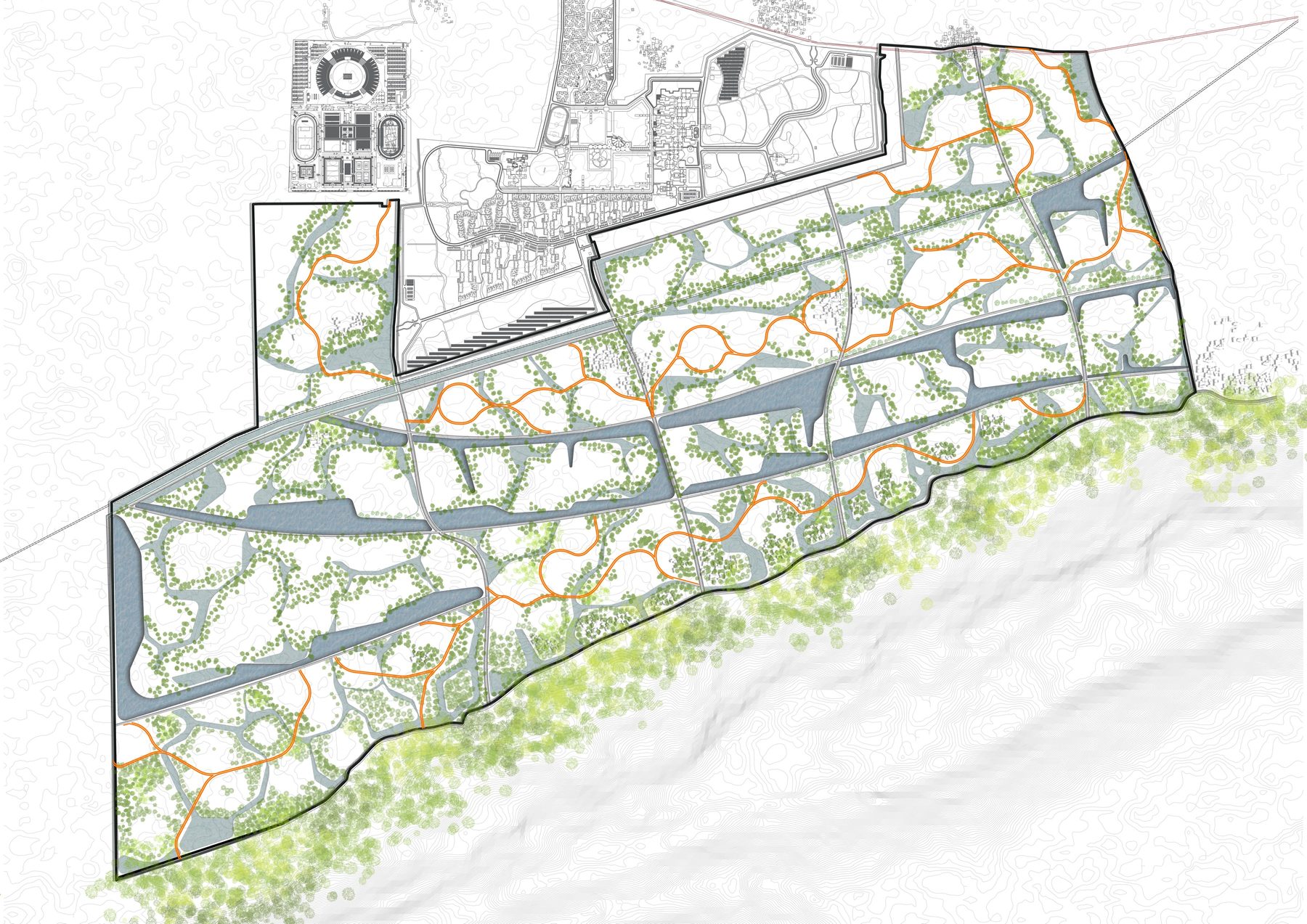
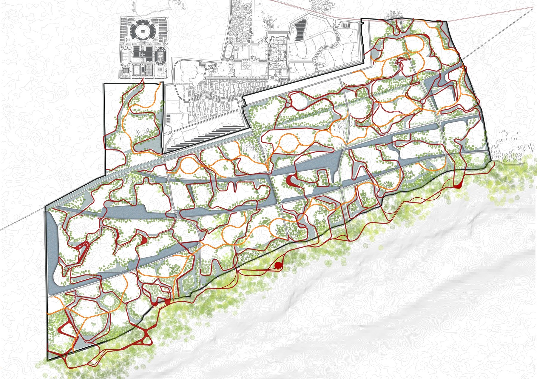
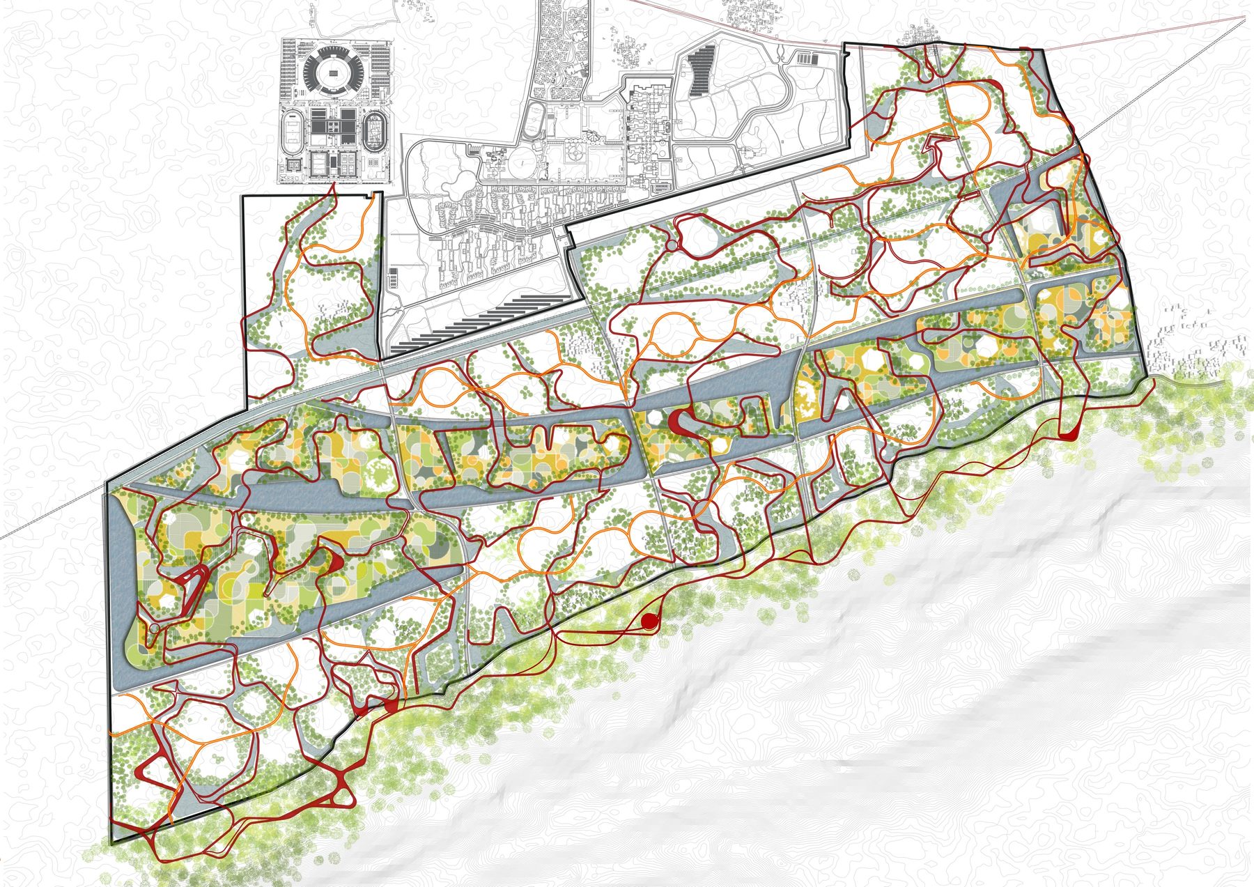
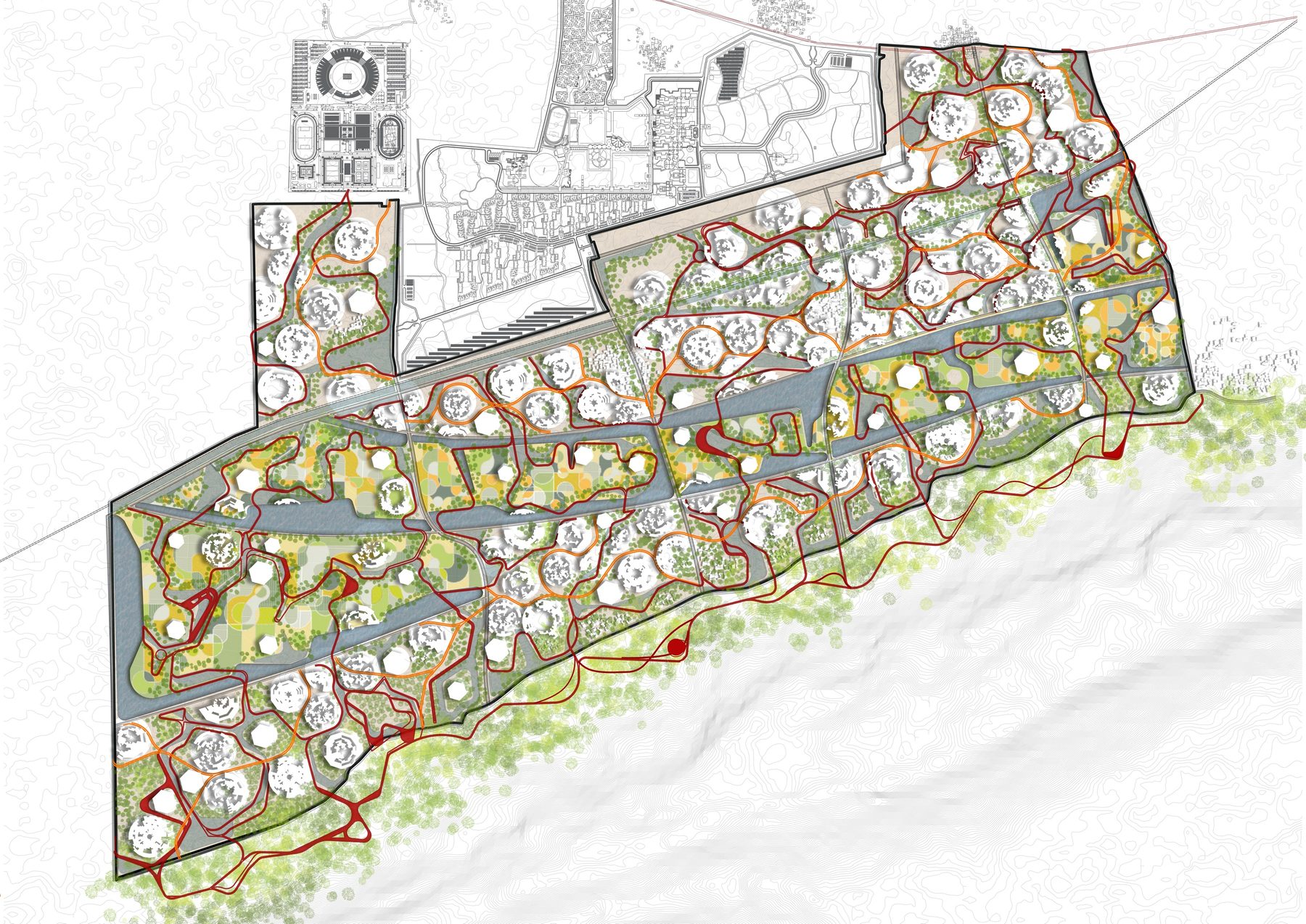
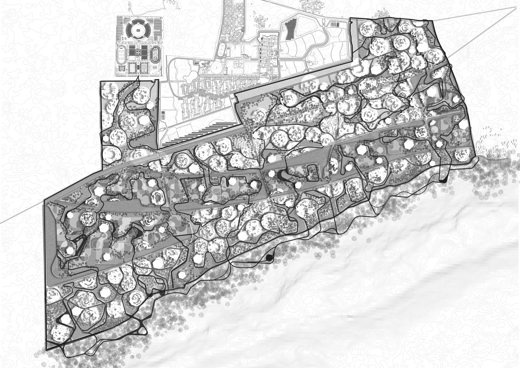
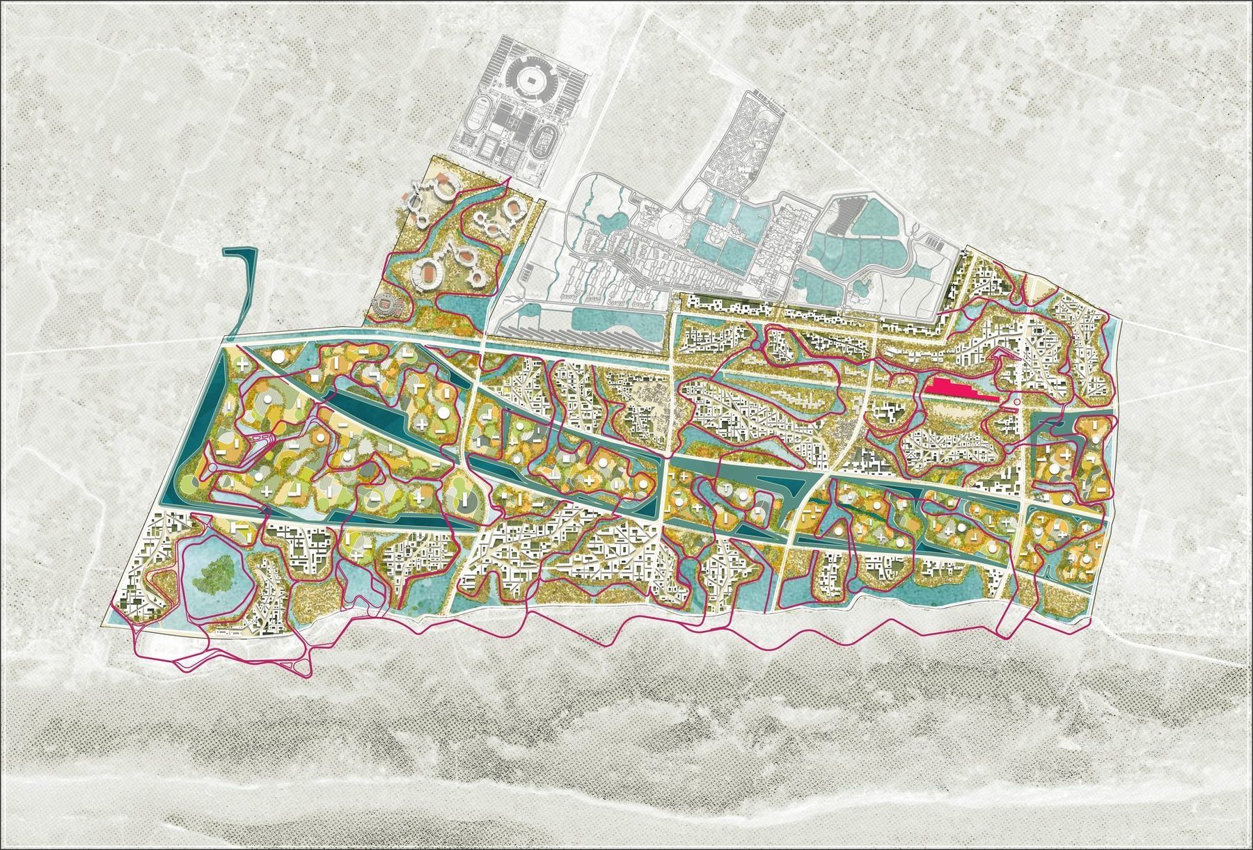
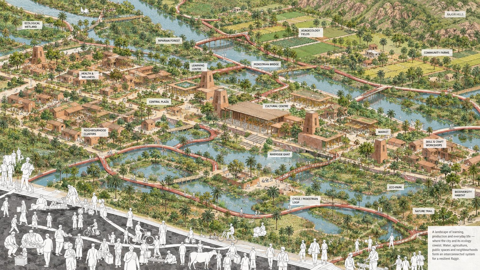
Everything else is negotiated around that first drawing, in order. The exploded diagram shows the stack: topography and villages at the bottom; the site's connectivity and the intersections that become transit stops; the university and the stadium as the fixed neighbours; agriculture kept as productive landscape; the aahar-pyne network; the drainage channels and catchments that tackle the seasonal flood and drought; and on top, the wetlands in the valleys and the pathways on the ridges. The eco-trail, the primary cycle and pedestrian network, follows the pynes, because that is where the shade and the water are. Only then the street network: the existing portals of entry set the primary connections, and the railway station becomes a multimodal hub where the street turns north to the highway, closing a transit loop.
The sequence matters more than any one layer: at every stage the city works, and at no stage does it work against the water.
Water, food, waste, energy
The site is planned for 1,20,000 people, and the program was sized from that number through four loops of ecology, water, food, waste, energy, each checked for viability against the projected population. The food loop takes the aahar-pyne as its reference: farms on the traditional irrigation network, an inventory of how much food, water, solid and liquid waste a cluster of a given size produces, and what the wetland has to filter.
The idea was that these loops are also programs of learning: an Eco-Lab, where villages, students, academics and visitors exchange knowledge and resources at the city scale, and the landscape itself is the laboratory.
The cluster and the living machine
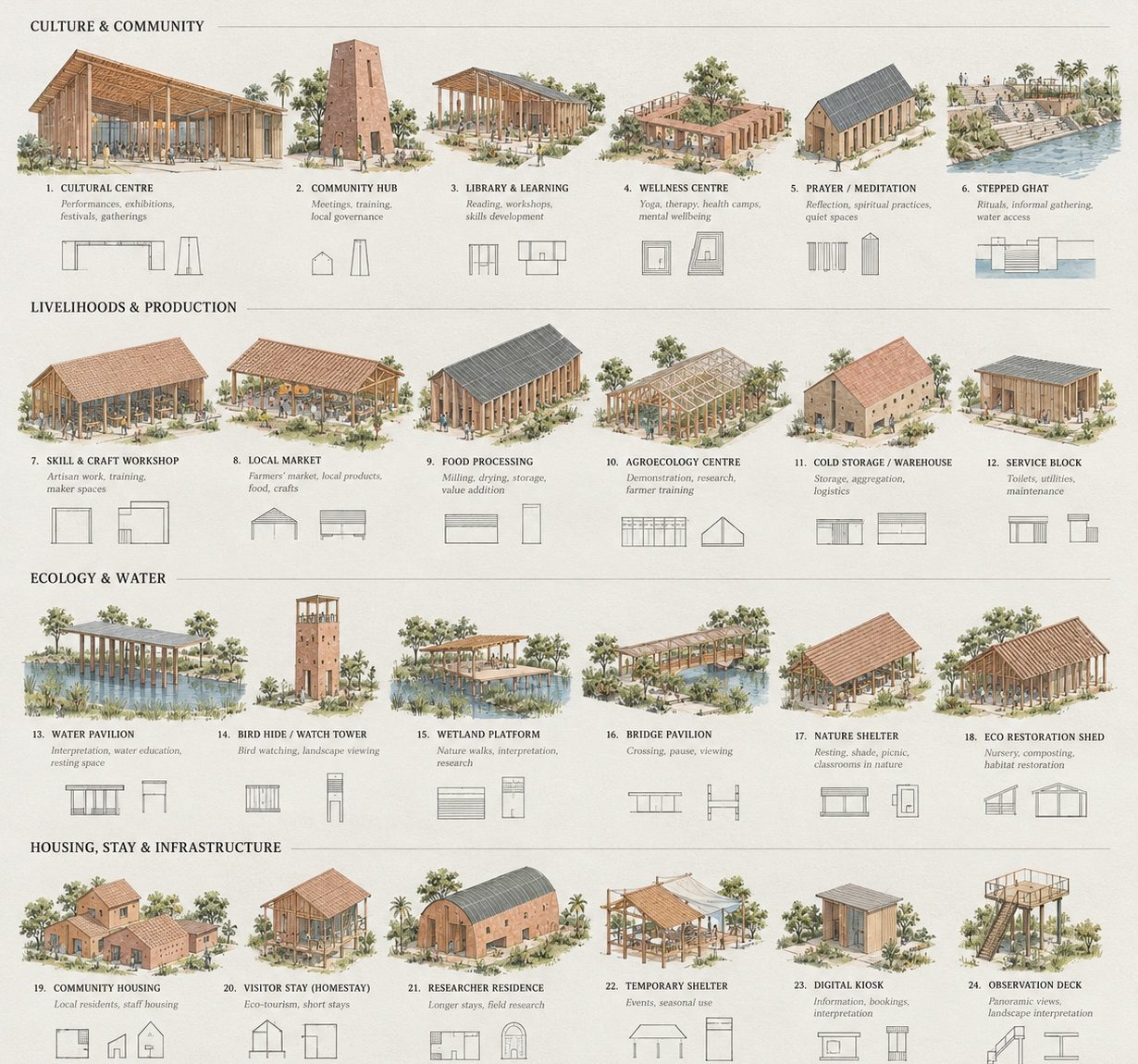
At the neighbourhood scale the loops become a cluster. A catalogue of the existing villages, their organisation, activities, materials (red clay brick, thatch, bamboo, timber) and forms, set the parameters: a grid, a shared central court, rainwater harvesting in every unit, kitchens and social amenities on the ring, staggered heights. From those parameters a generative process derived clusters of self-sustaining eco-villages, 160 to 200 metres across, tuned to the ridge they sit on.
At the centre of each is a living machine, where the neighbourhood's solid and liquid waste, its food and its water arrive and are treated through a series of tanks, wetland biofiltration and aquaponic greenhouses, and where those processes are made public, as places of learning and exchange.
Living with the water, not beside it
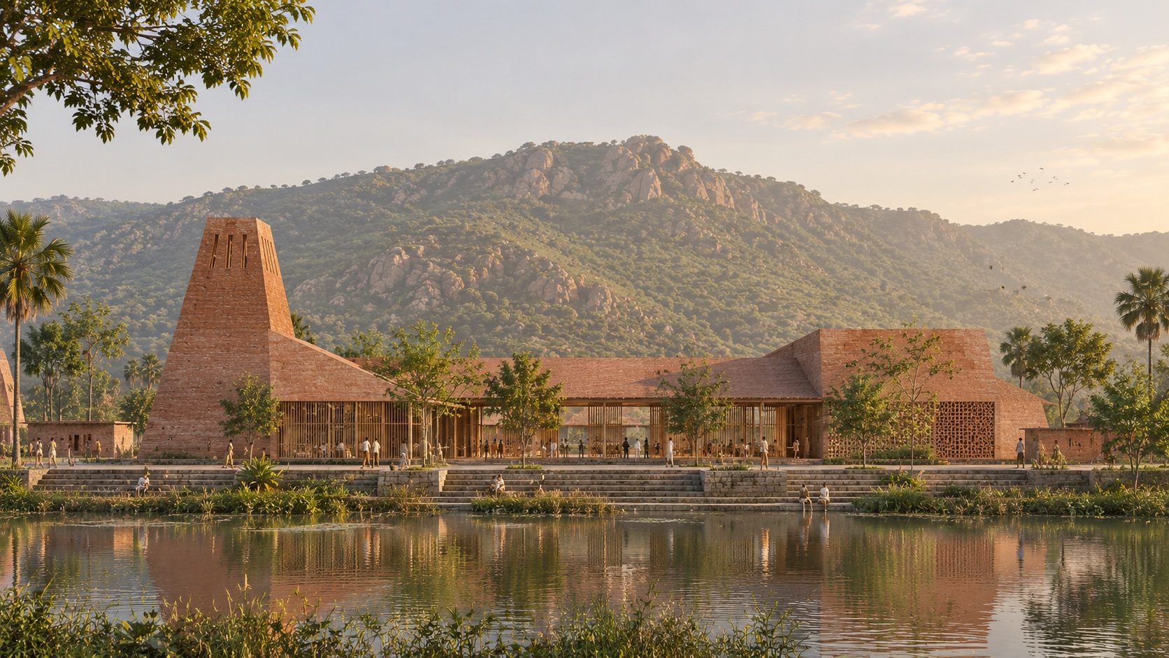
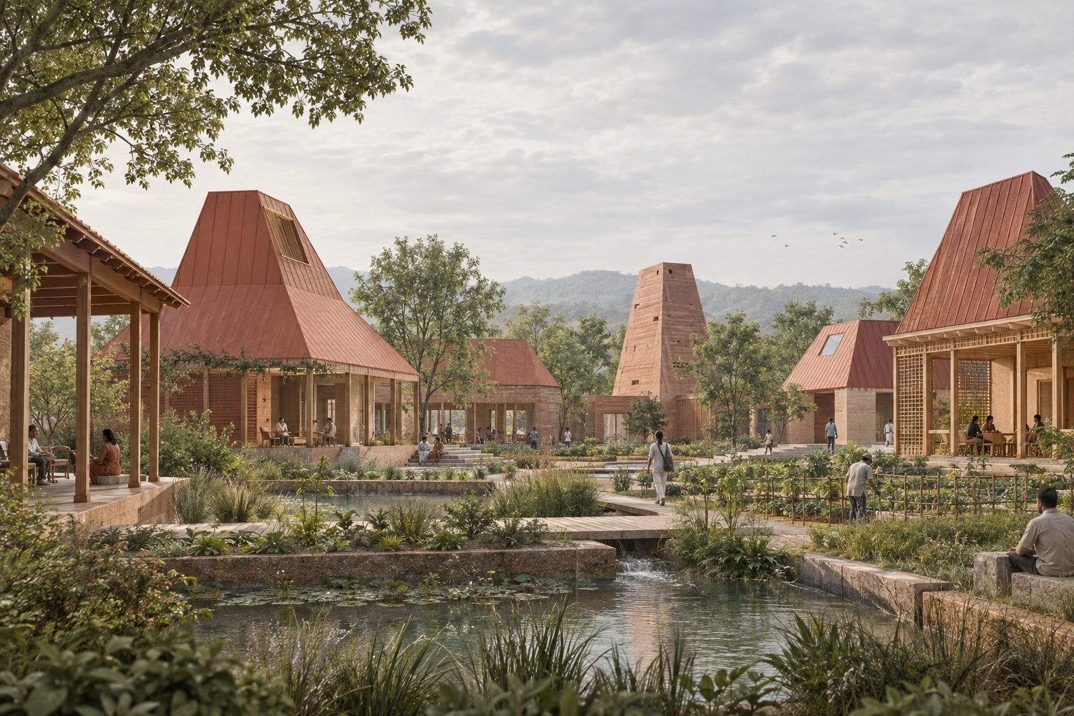
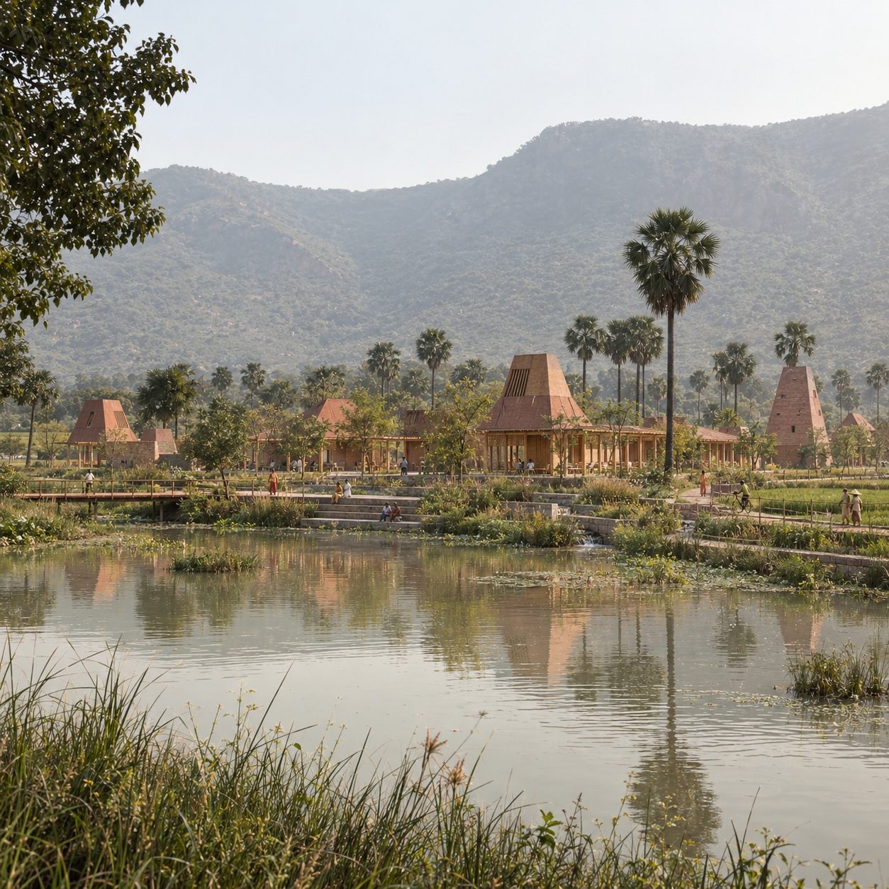
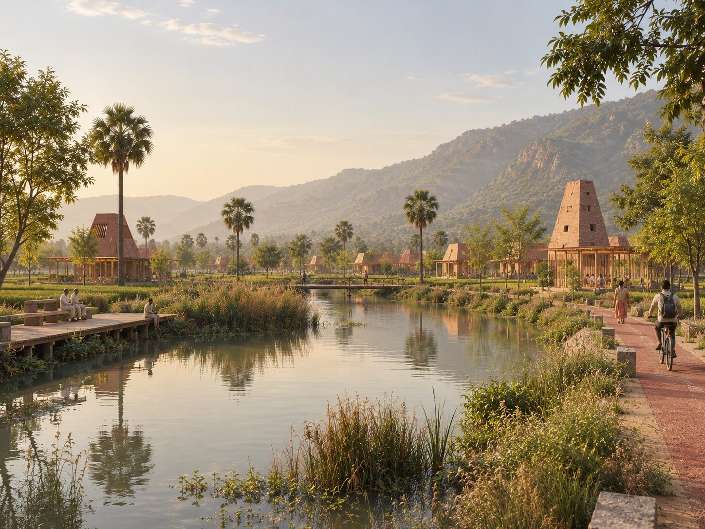
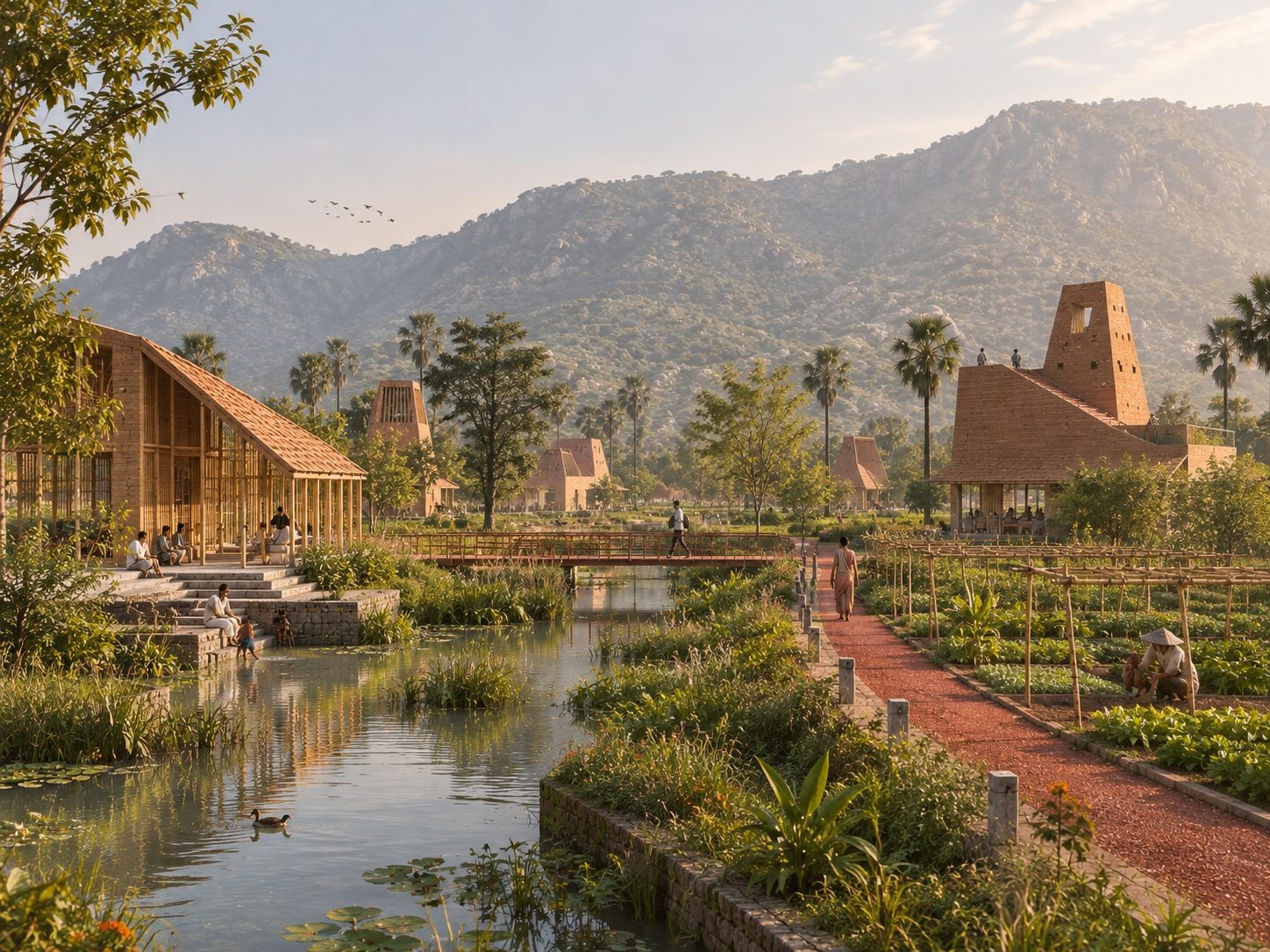
At eye level the plan is a brick village on the water. The living machine is a tower and a shaded hall at the aahar's edge, the hills behind it; the houses ring their courts with a rill running through; the wetland cells sit between the clusters with reeds and palms; a boardwalk and a bridge cross the aahar to the trail on its far bank, and the trail runs on past the farms. It is a masterplan in the ordinary sense, land use, built-open, phasing, but its structure is hydrological before it is anything else. The city arrives last, and lives with its water rather than beside it.