Reverse Effekt
what can a city learn from the community it keeps trying to remove?
- (role)
- directed research · fieldwork · cartography · strategy
- (period)
- 2022 · spring semester
- (context)
- worli koliwada · mumbai · cept undergraduate thesis
- (status)
- thesis
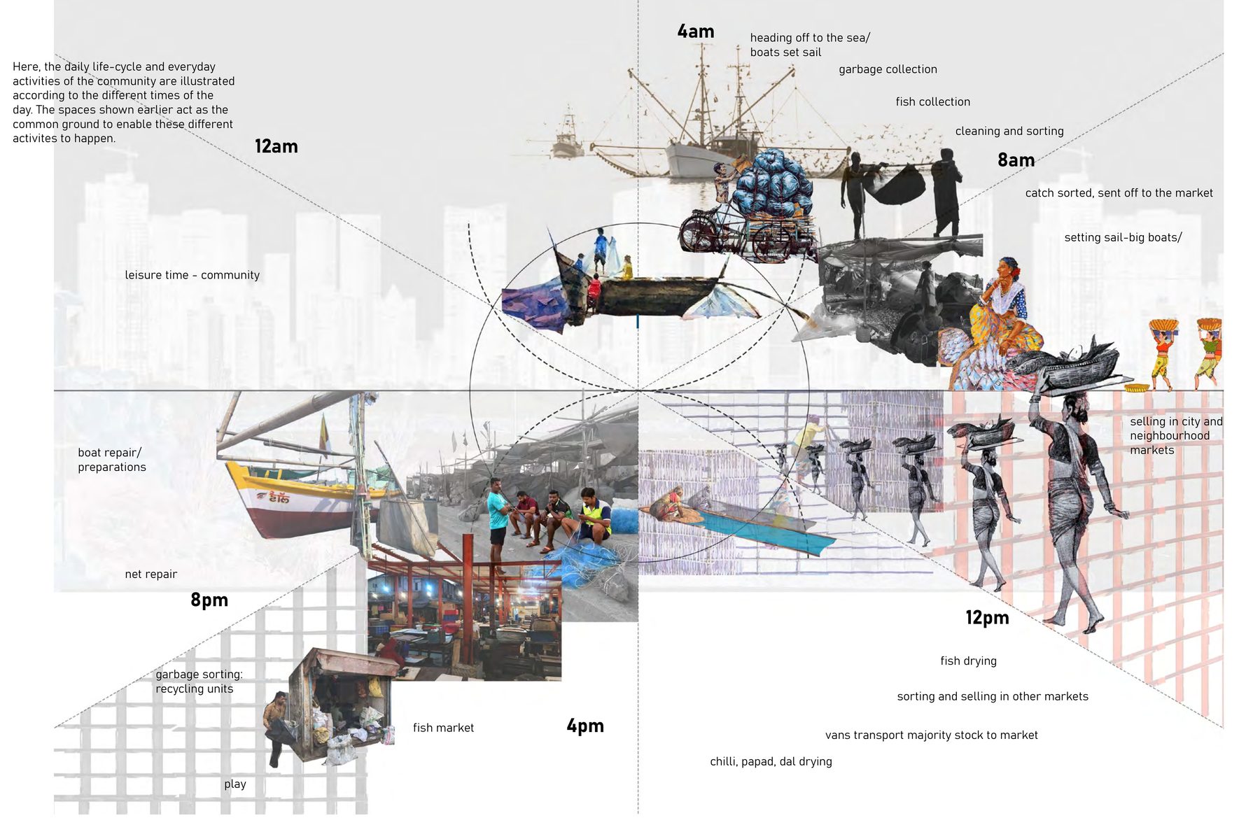 fig.01
4 am, the boats go out
(drag me)One open space, twenty hours of use.
At four in the morning the boats leave the Worli tip. Through the day the same ground is for sorting, cleaning, drying and selling fish; then net repair, the market, play, and the boats back by evening. No one designed any of it. The thesis asks what a city could learn from that.
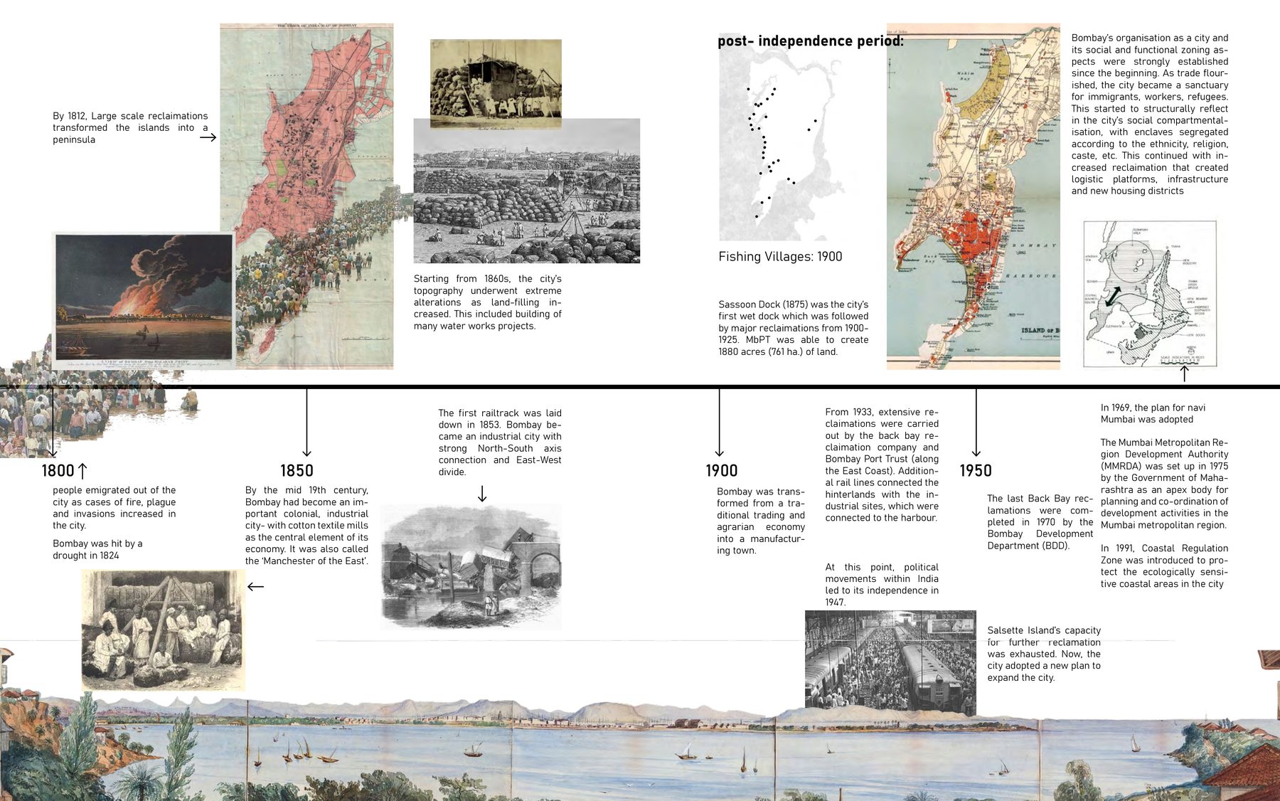 fig.02
on the 1930 map, still on the 2022 one
(drag me)Seven islands, made one by filling.
Mumbai became one city by filling the sea between its islands, hills quarried and levelled to do it. The fishing villages were there before the filling started and are still there after it. The intertidal ground the Kolis worked was recategorised as wasteland, so that it could be reclaimed.
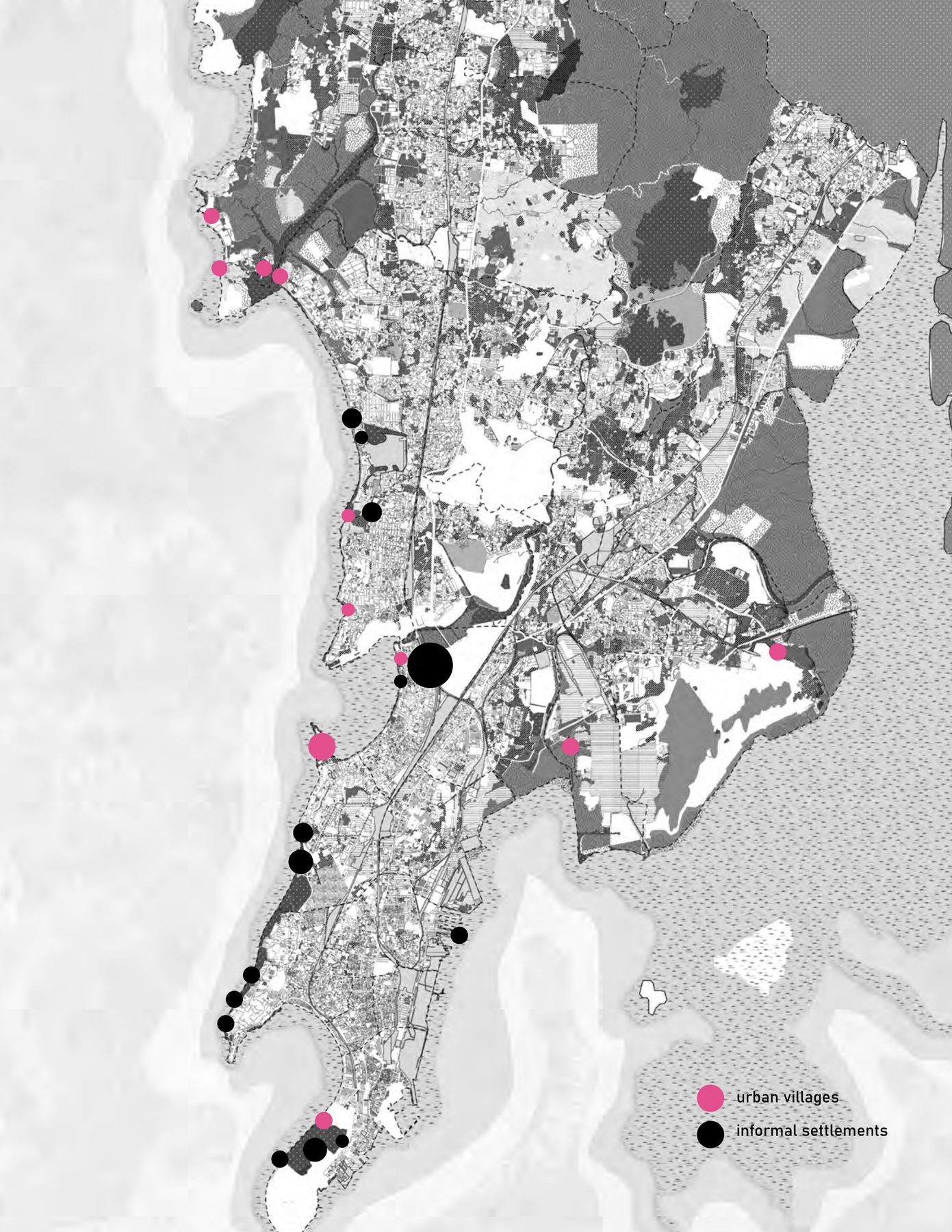 fig.04
The people who were here first.
The Kolis are artisanal fishers and the city's first inhabitants, five hundred years on this shore. A koliwada is a dense gaothan of houses and the commons around it: drying grounds, the creek, mangroves, intertidal flats. A highly productive landscape that the city's maps read as empty.
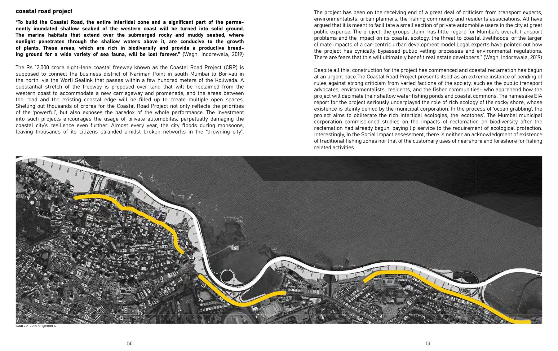 fig.07
consulted after the fact
(drag me)A road, a plan, a rulebook.
The Coastal Road reclaims 10.5 km of the western shore through the waters the villages fish. The coastal-zone rules treat the shore as a hazard, not a workplace. The development plan reads the koliwadas as slum. The first job was to lay these documents out plainly, and draw what they do to a village's access to the sea.
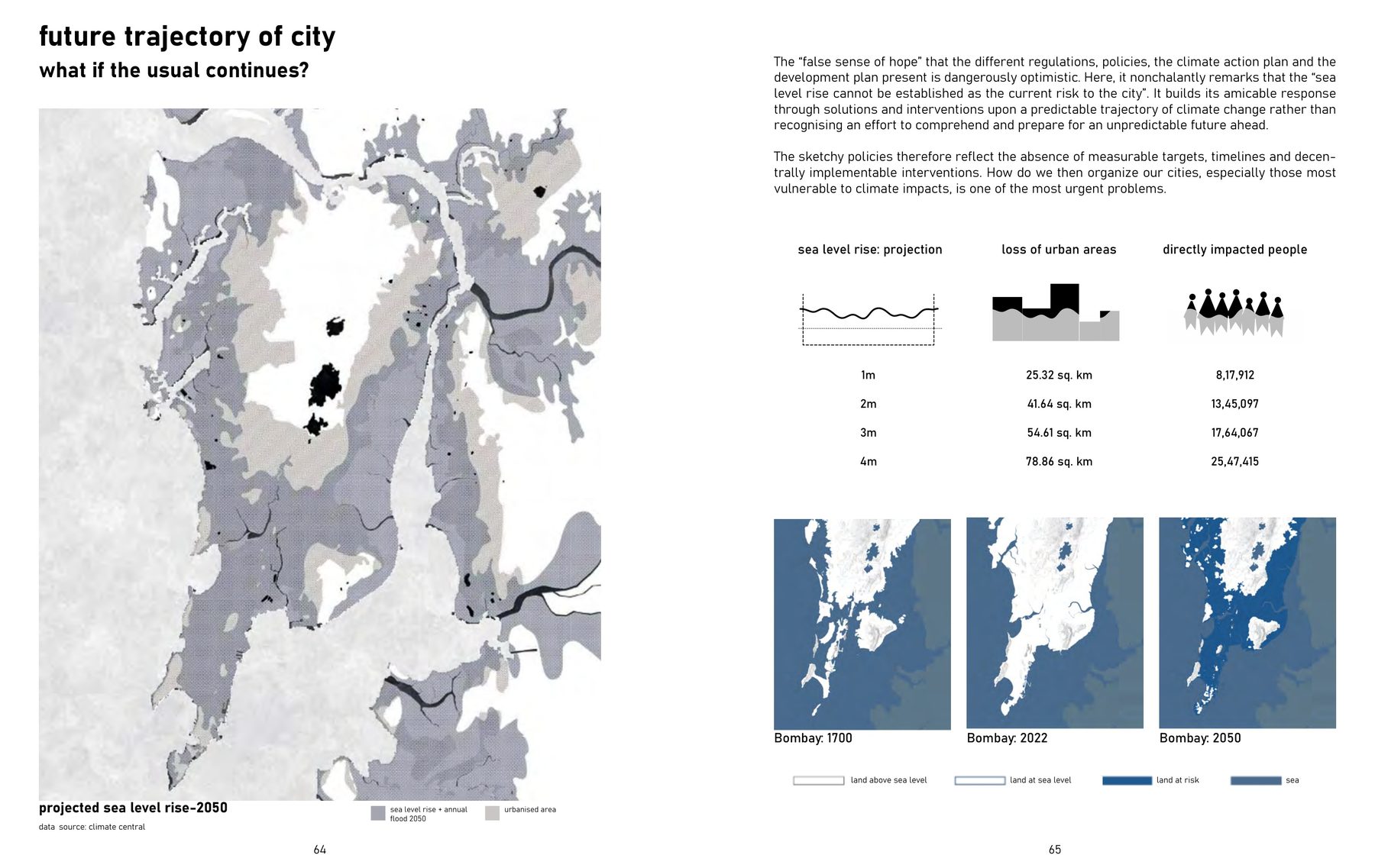 fig.09
If the usual continues, it ends underwater.
The projection to 2050 puts a metre or more of sea on the reclaimed ground, and the first people it displaces are the ones on the shore. The collage is blunt because the numbers are.
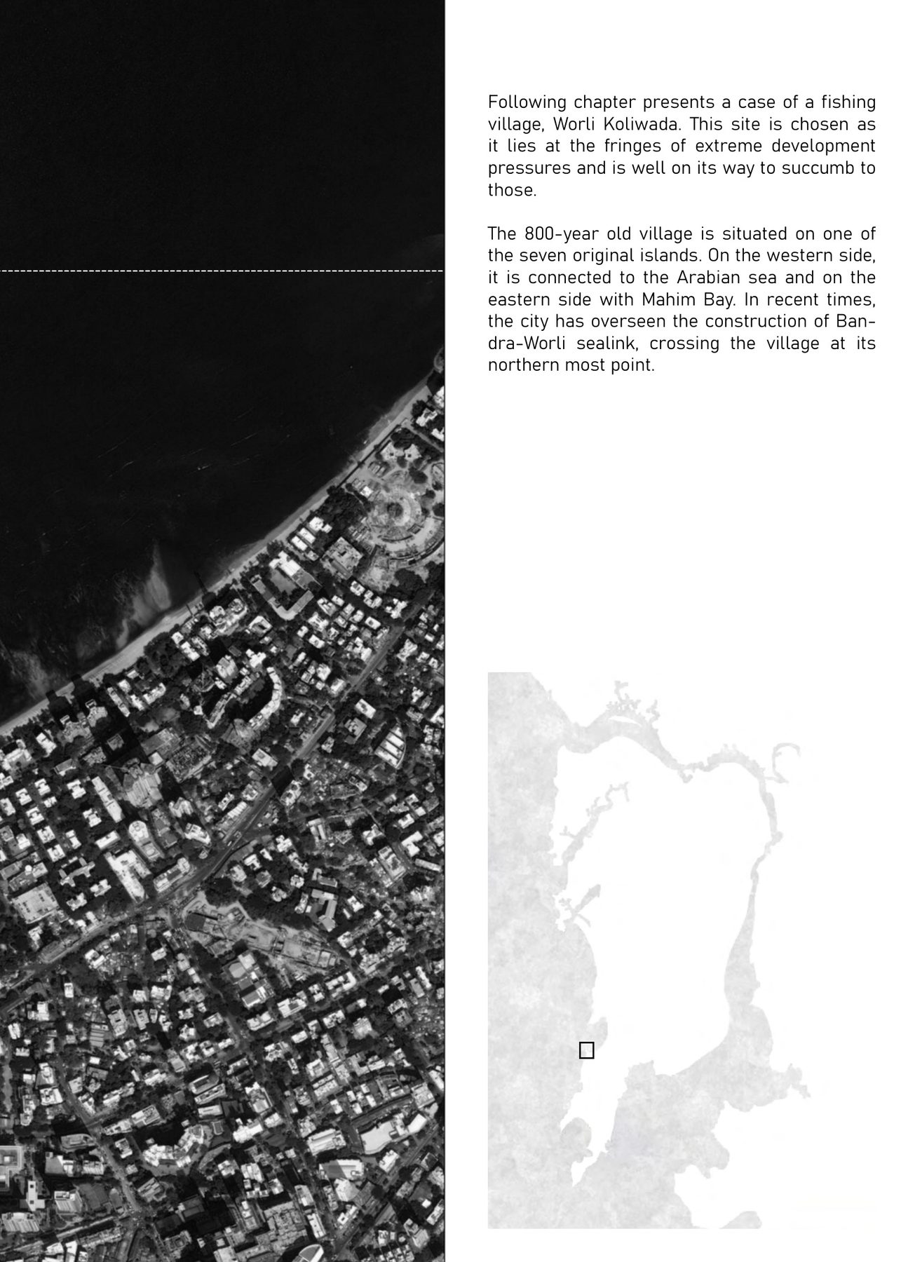 fig.11
Eight hundred years at the foot of a bridge.
Worli Koliwada sits on one of the seven original islands, with the sea link landing at its tip. It is at the fringe of extreme development pressure and well on its way to giving in to it. Read closely, it is an open repository of exchange: of fish, of nets, of festivals, of knowledge.
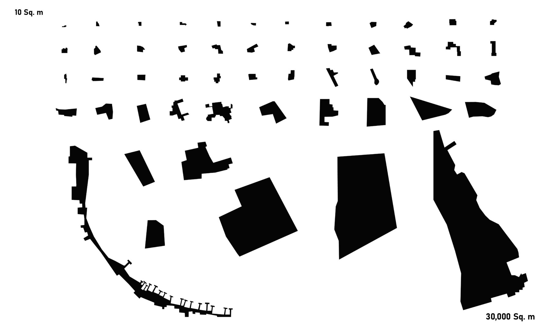 fig.14
From ten square metres to thirty thousand.
Before proposing anything, find what a place already has. Every common space in the village was drawn to scale, from a shrine court to the tip, and four were studied in the round: the Worli tip, the east jetty, the maidan, and the linkage to the city.
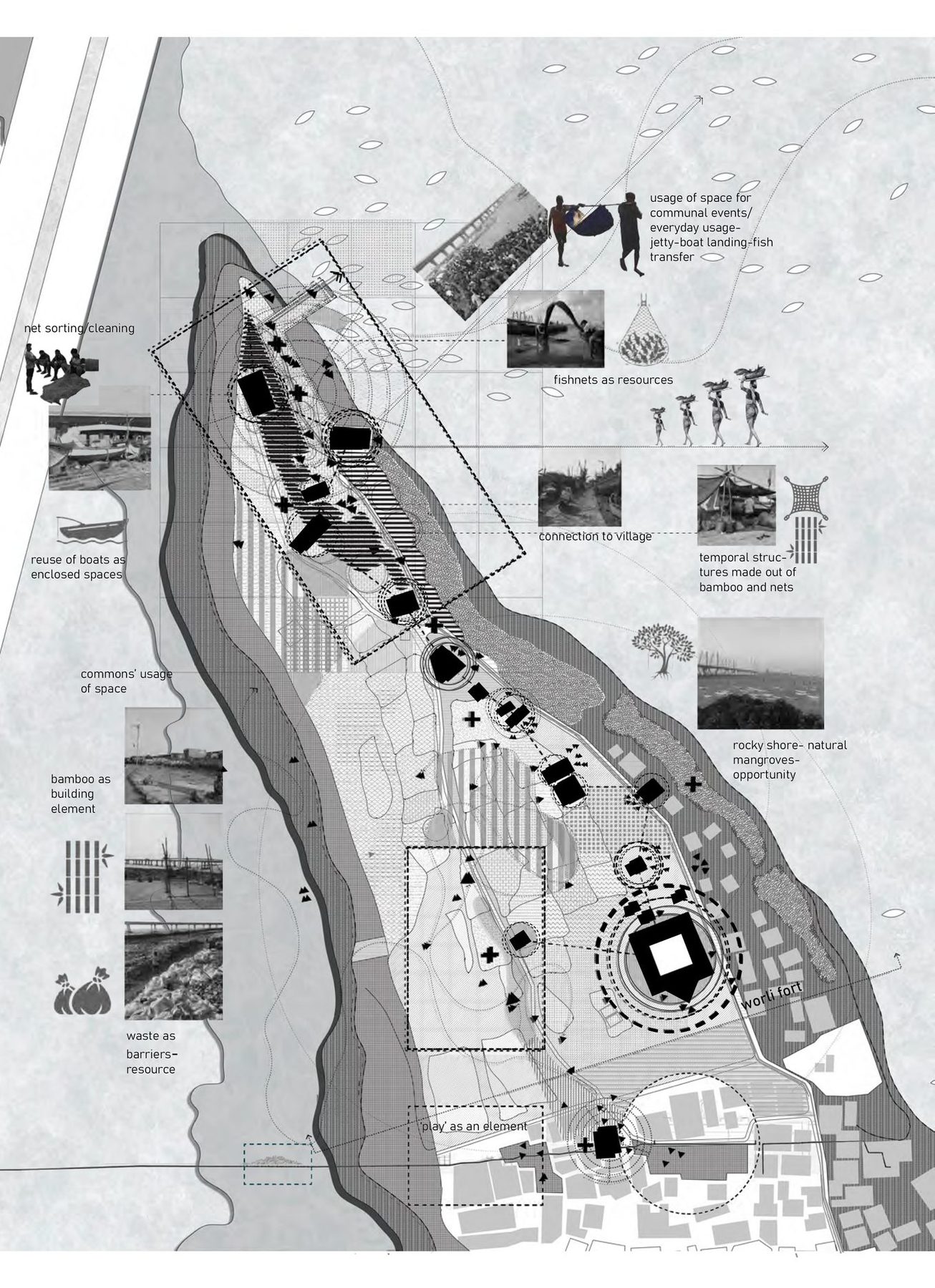 fig.15
no one designed this
(drag me)The shore as a working floor.
Through the day the open ground is fish sorting, drying, and selling to the fisher women who carry it to the city. On Narali Poornima, Holi and Ganesh Chaturthi it is the stage. All of it happens without anyone having designed it, and that is what the drawing is for.
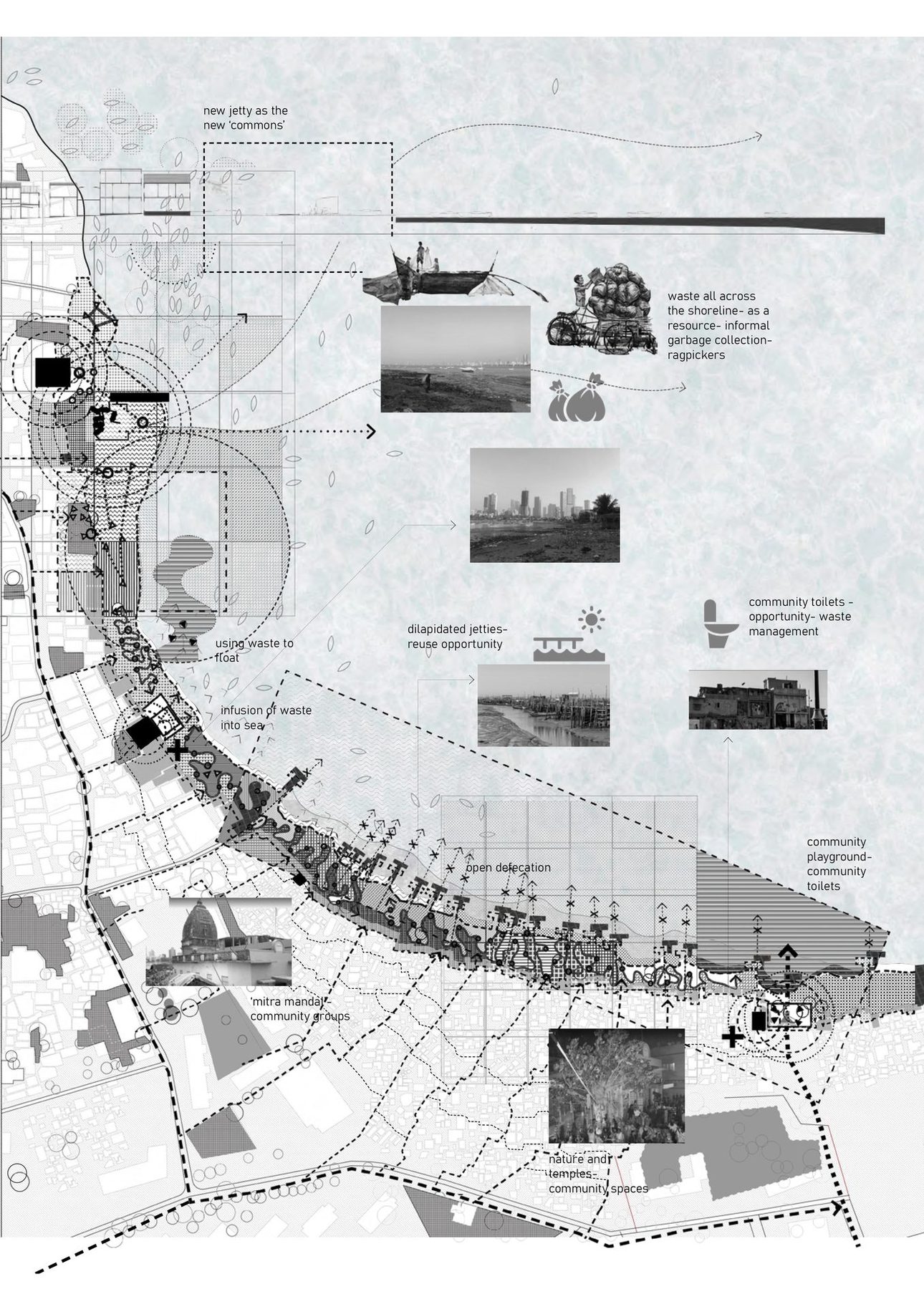 fig.17
waste bags against the tide
(drag me)Waste as a breakwater.
On the bay side, the edge where the village's waste enters the sea is also where the village stacks that waste in compact bags against the high tide. Ragpickers work the edge, children play at the water, bamboo structures come and go.
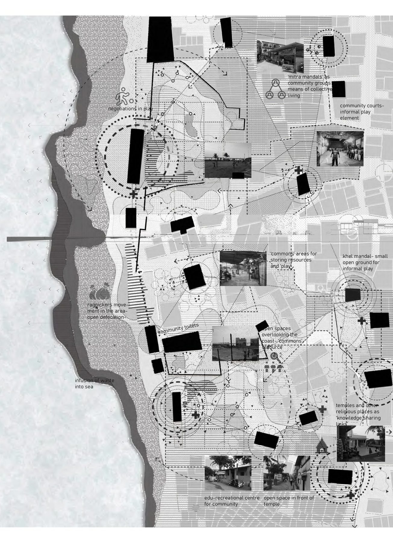 fig.19
Play as a knowledge-sharing link.
Inside the village, a chain of open spaces of every scale: the maidan over the coast, the mitra mandals of each sub-community, temple courtyards, small education and sport centres. Play is how different people negotiate the same ground. These are the spaces through which the village teaches itself.
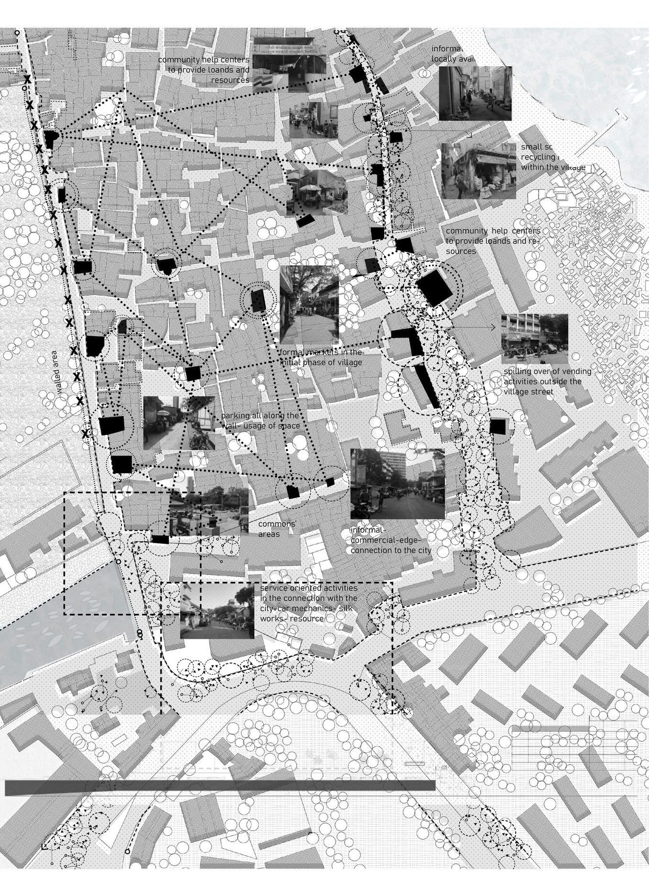 fig.21
Where the village becomes the city.
Where the village street meets the city, the livelihoods change. The canal that was once the way to the island is an open drain. As fishing declines, the village works in the high-rises as guards and drivers. The thesis wants the flow to run the other way too: the village's capacities into the city, not only its labour.
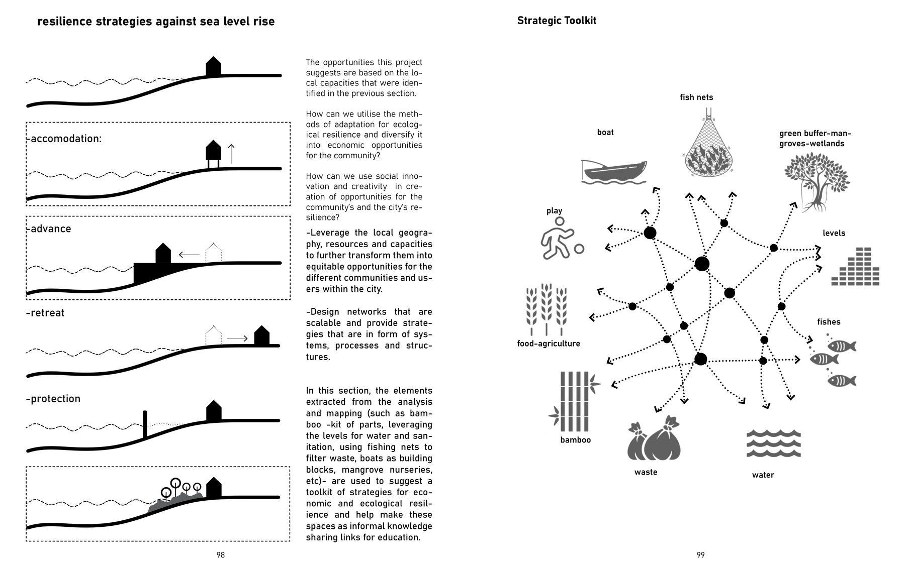 fig.23
Eco-punctures, and a toolkit.
Initiations, not answers. At the village scale, a toolkit drawn from what is already there (boats, nets, mangroves, bamboo, waste, water, fish, the levels of the shore), set against accommodate, advance, retreat, protect. At the city scale, the urban villages as eco-punctures, linked into a knowledge landscape rather than cleared for one.
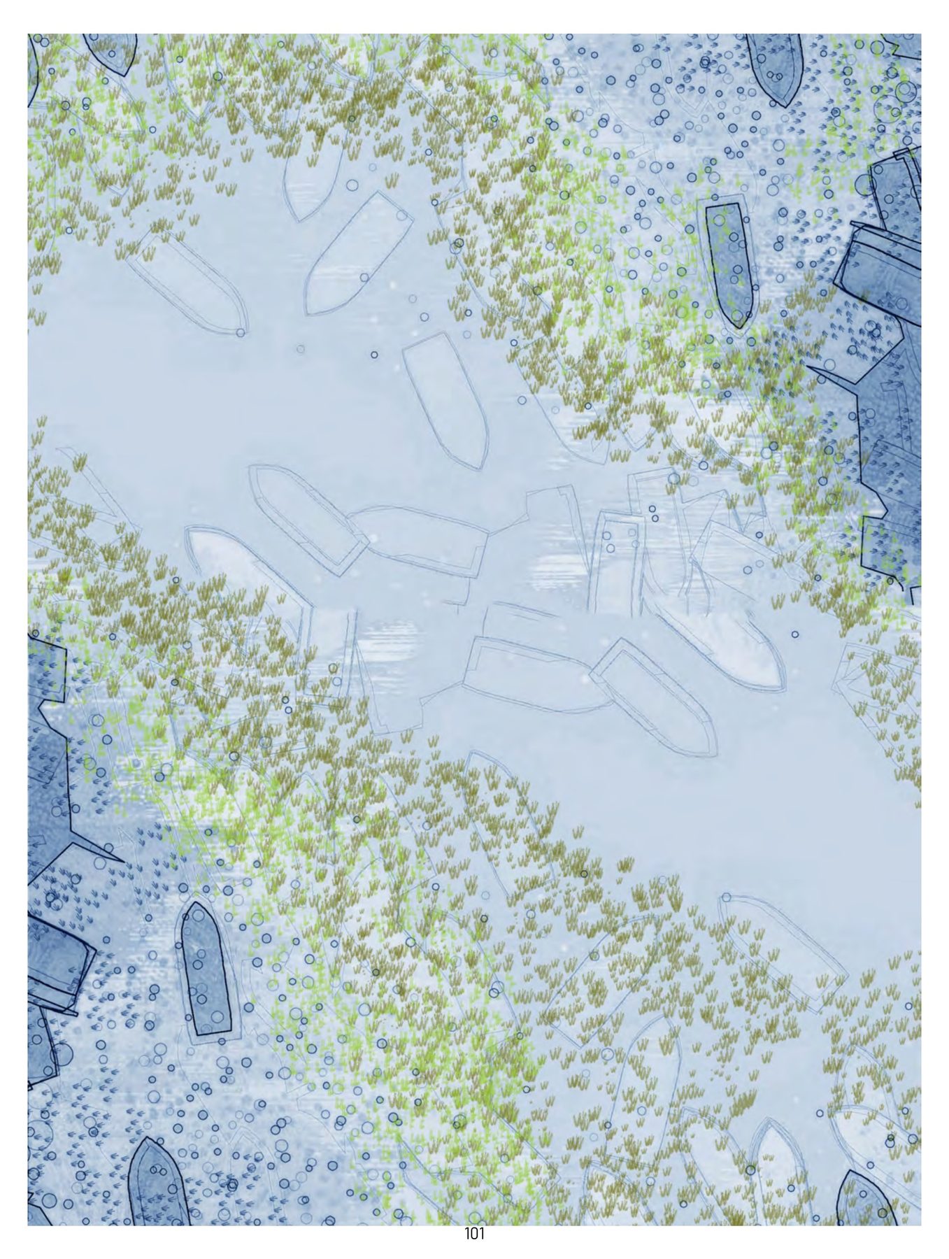 fig.25
The city as a ground of open opportunities.
The manual was written about the village. The next step is to hand it over: the cartographies and the toolkit as things the mitra mandals hold and edit themselves.